Will AI Replace GIS Jobs? What It Automates Today
Published
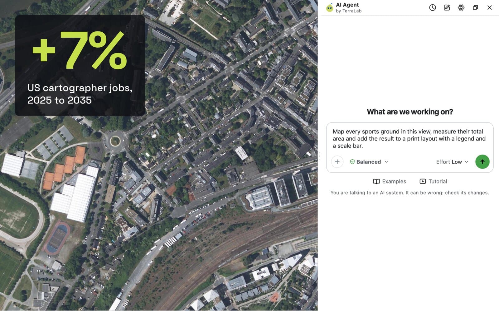
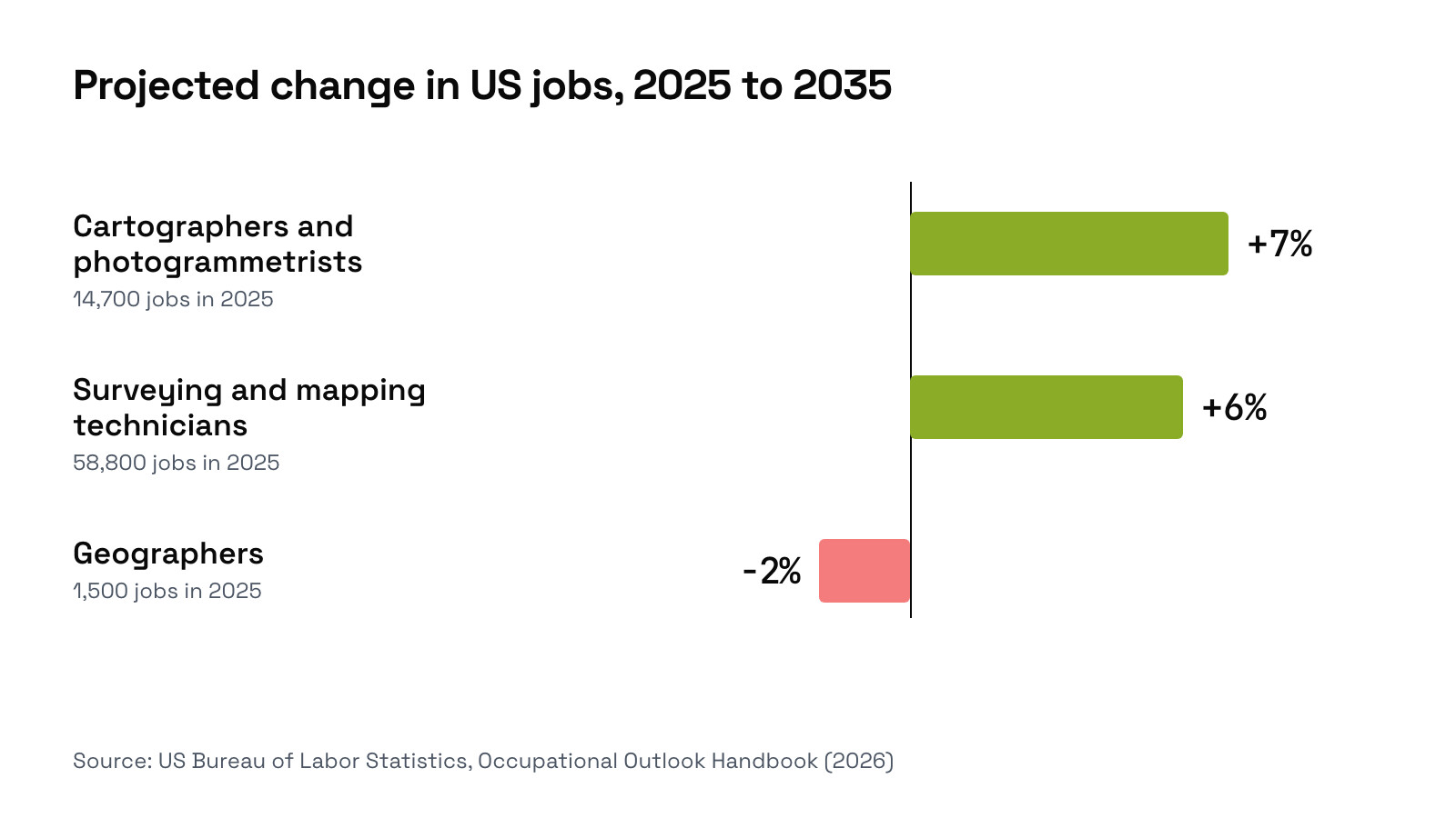
No. AI is taking over the clicks in GIS work, not the jobs. It now digitizes buildings from photos, writes PyQGIS scripts and runs whole tasks inside QGIS with plugins like AI Agent. Yet the US Bureau of Labor Statistics still projects cartographer and photogrammetrist jobs to grow 7% from 2025 to 2035, much faster than the average job. What changes is the work itself: less drawing and clicking, more checking, choosing data and answering the real question.
 with plugins like
 What the job numbers say
The US Bureau of Labor Statistics updated its outlook in August 2026, with projections to 2035. Two of the three mapping jobs grow.
| Job | Jobs in 2025 | Projected change to 2035 | Openings a year | Median pay, May 2025 |
|---|---|---|---|---|
| Cartographers and photogrammetrists | 14,700 | +7% | About 900 | $81,390 |
| Surveying and mapping technicians | 58,800 | +6% | About 6,900 | $54,240 |
| Geographers | 1,500 | -2% | About 100 | $102,040 |
These are US figures, and a projection is not a promise. But they were made with AI tools already on the market, and they do not show mapping work drying up.
What AI already does in GIS
Four kinds of work have moved the most. Each comes with a number we measured ourselves.
1. Digitizing objects from imagery
Tracing roofs, pools or fields by hand used to fill whole days. Now a segmentation model outlines every object in a zone at once. In our own plugin, AI Segmentation, people outside our team ran 7,133 building runs in two months, and the model found 5.2 million candidates.
They kept 36.5% of them. In 18.2% of runs, they also fixed at least one outline by hand. The machine does the drawing, and a person still decides what counts as a building. Our guide to GIS digitizing in QGIS compares this with digitizing by hand.
2. Writing PyQGIS and processing scripts
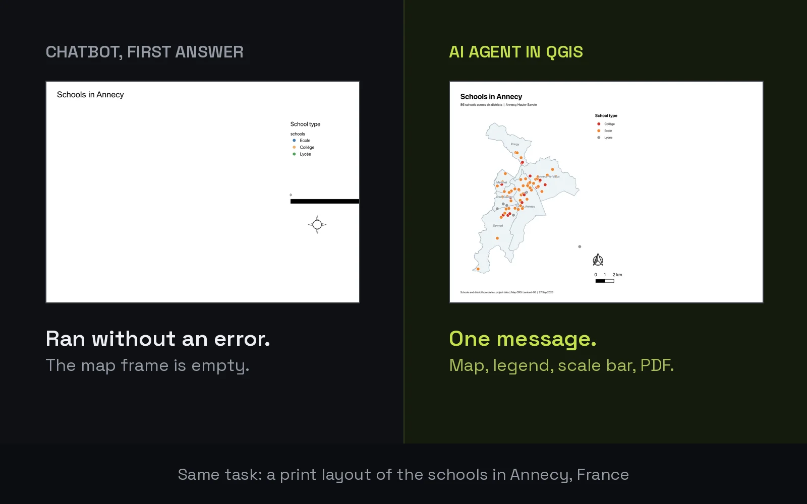
A chatbot writes working Python for QGIS in seconds. We tested ChatGPT on three real tasks. Two scripts were right on the first answer. The third ran without an error and exported an empty map, and only a person who looked at the PDF noticed. The full test is in ChatGPT for QGIS.
3. Running whole tasks inside QGIS
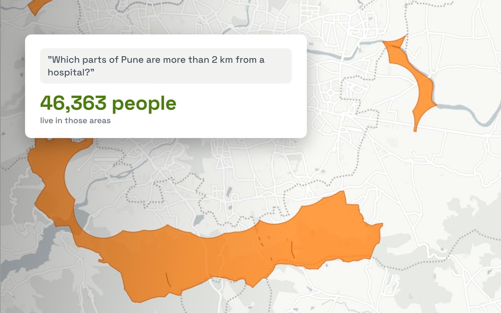
An AI agent goes one step further: it reads your project, runs the QGIS tools and checks the result. With AI Agent, buffering 86 schools and measuring the merged area took 20 seconds, and a print layout with legend and scale bar took 51 seconds, both right on the first message.
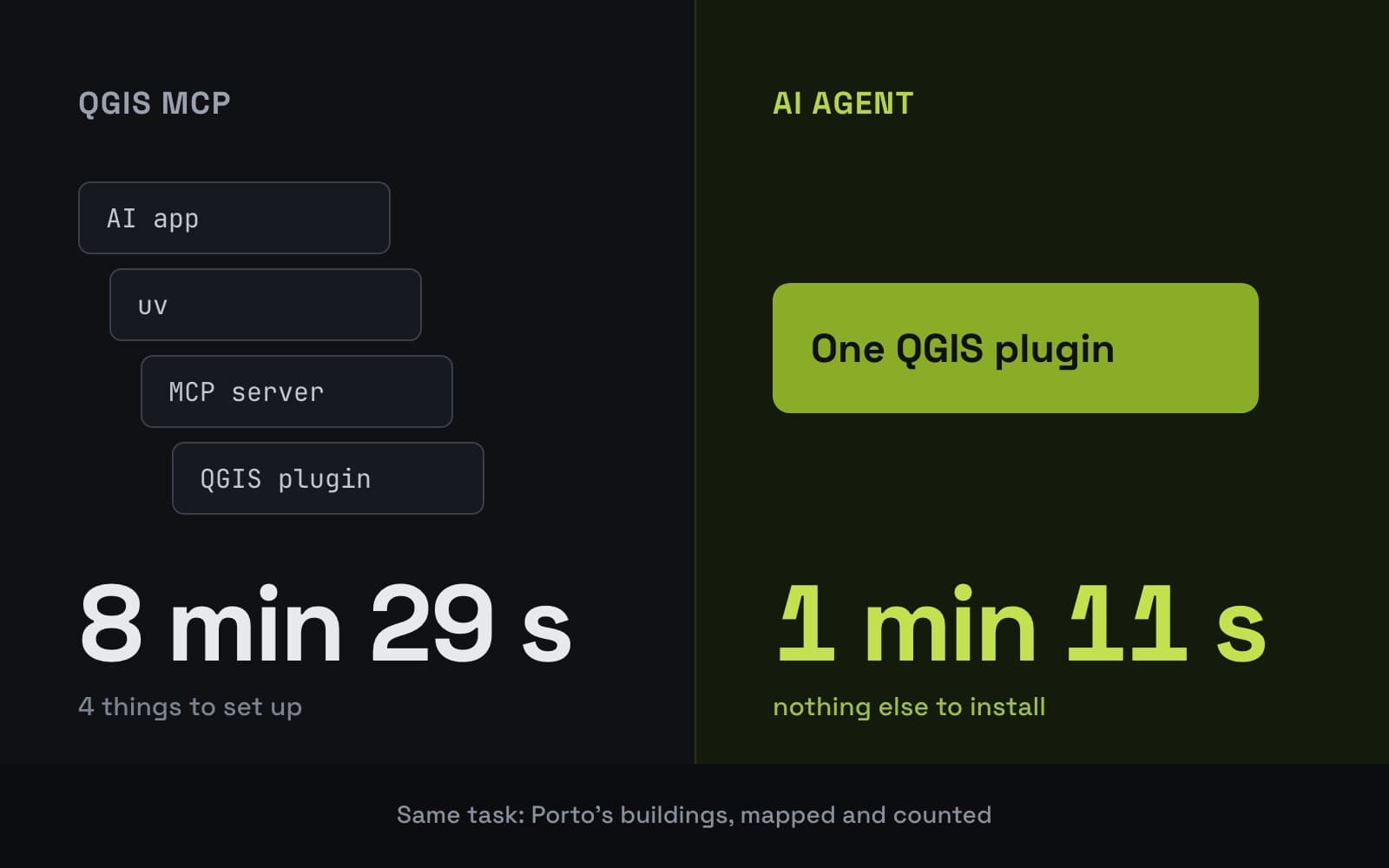
The catch is judgment. We asked two AI tools to count the buildings of Porto's historic centre. One drew its own rectangle and counted 4,445. The other used the official boundary and counted 1,914. Both counts were correct for the area each one chose. Knowing which area the client meant is still the GIS analyst's job. The test is in our QGIS MCP article.
4. Making visuals from imagery
Turning an aerial photo into a coloured site plan or a redesigned street used to take hours in a drawing program. AI Edit does it from the photo in QGIS, as in our colored site plan example. You still choose the style and check that nothing was invented.
What AI does not do
- Pick the question. A client asks for "the buildings in the centre". Which centre, which buildings, as of when? The Porto test above shows two right answers to two different questions.
- Vouch for the data. A model does not know that a dataset is out of date, has the wrong licence, or was drawn from a different photo than yours.
- Check its own result. Every number above came with a person checking it. The empty map in the ChatGPT test had no error message.
- Sign off. Licensed surveyors, planners and engineers carry the legal responsibility for a plan. Software cannot.
- Go outside. Field surveys, ground truth and talking to the people who live there stay human.
Which GIS tasks change, task by task
| Task | Before | With AI today | What stays with you |
|---|---|---|---|
| Digitizing buildings, pools, trees | Click every corner | Outlined in one run | Filtering and fixing |
| Scripting and processing chains | Write the Python yourself | Drafted in seconds | Testing it on real data |
| Routine analysis and map layouts | A dozen menus | One request to an agent | Checking area, data and result |
| Finding open data | Search portals by hand | The agent loads it | Licence and freshness |
| Client questions and decisions | Human | Human | All of it |
What to learn now
- Checking results. Compare counts with a second source, look at the map, open the attribute table. This is the skill AI makes more valuable, not less.
- Writing a clear request. Name the area, the data, the output and the CRS. A precise request to an AI agent in QGIS gets a precise result.
- Data sources and licences. Know where OpenStreetMap, national mapping agencies and satellite programmes publish, and what you may do with each.
- Enough Python to read a script. You do not need to write it from scratch any more, but you need to see when it is wrong. Our PyQGIS introduction is a start.
- Your field. Forestry, urban planning, utilities or agriculture: knowing the domain is what turns a map into an answer.
What to remember
US mapping jobs are projected to grow to 2035, according to the Bureau of Labor Statistics.
AI takes over the repetitive parts: digitizing, scripting and routine map production.
Every AI result still needs a person to check it, and to know which question was asked.
The fastest way to see where the line sits is to try it on your own project. AI Agent is free to start and runs inside QGIS.
Questions people ask
Will AI replace GIS analysts?
Not on current evidence. AI tools now digitize, write scripts and run routine QGIS tasks, but they still need a person to choose the data, frame the question and check the result. The US Bureau of Labor Statistics projects cartographer and photogrammetrist jobs to grow 7% from 2025 to 2035.
Is GIS still a good career?
In the US, two of the three mapping jobs the Bureau of Labor Statistics tracks are projected to grow faster than average to 2035, with about 900 openings a year for cartographers and photogrammetrists and about 6,900 for surveying and mapping technicians. The job is shifting toward checking, data judgment and domain knowledge, so those are the skills to build.
How is AI used in GIS today?
Mostly in four places: outlining objects from aerial and satellite imagery, writing Python for processing, running whole tasks inside GIS software, and editing imagery for plans and visuals. In QGIS, AI Agent runs tasks from a plain request and AI Segmentation outlines objects in a zone you draw.
Can ChatGPT do GIS work?
It can write PyQGIS code and explain GIS concepts, but it cannot see or touch your project. In our test, one of three scripts ran without an error and still produced an empty map. An agent that works inside QGIS reads your layers and checks its own output.