

QGIS plugins with AI: describe the job, get the layers
AI Agent runs the task you describe in the project you have open: it finds the data, runs the tools and styles the map. Two more plugins read your imagery into polygons and redraw it on request. All three run on a laptop with no GPU.
QGIS 3.28 or later. Windows, macOS, Linux. No GPU, no Python setup, no card.
- installs from the QGIS plugin repository
- 116,000+
- QGIS tools it can run
- 227
- open datasets ready to load
- 2,830
- needed: the models run on our servers
- No GPU
The short answer
AI in QGIS does three jobs today.
AI Agent carries out a task in the project you have open, from finding the data to the print layout, and every task undoes in one click. AI Segmentation reads imagery and returns the objects in it as polygons. AI Edit redraws the imagery itself from a written instruction. None of the three replaces a field survey.
- Runs in
- QGIS 3.22 and later
- Starts at
- Free, no card
QGIS plugins
Three QGIS plugins with AI, one account
Each one installs on its own from the QGIS plugin manager, and one sign-in works for all three. Use one, or let AI Agent drive the other two.
AI Agent
Runs the GIS task you describe in your open project: finds open data, runs Processing tools, styles the layers and builds the print layout.
- Name in the plugin manager
- AI Agent by TerraLab
Output: layers, styles and a layout
See AI AgentAI Segmentation
Detects objects in satellite, aerial or drone imagery and returns them as an editable polygon layer. Click one object, or name a class for a whole area.
- Name in the plugin manager
- AI Segmentation by TerraLab
Output: a polygon layer
See AI SegmentationAI Edit
Changes the imagery from a written instruction: remove clouds or cars, switch the season, preview a project. The result comes back georeferenced.
- Name in the plugin manager
- AI Edit by TerraLab
Output: a georeferenced raster
See AI Edit

AI Agent does the GIS task you describe
Ask for the job in plain words and it does it where you work: finds the open data, runs the Processing algorithms, styles the layers, builds the print layout. It asks before anything destructive, and one click undoes the task.
The message
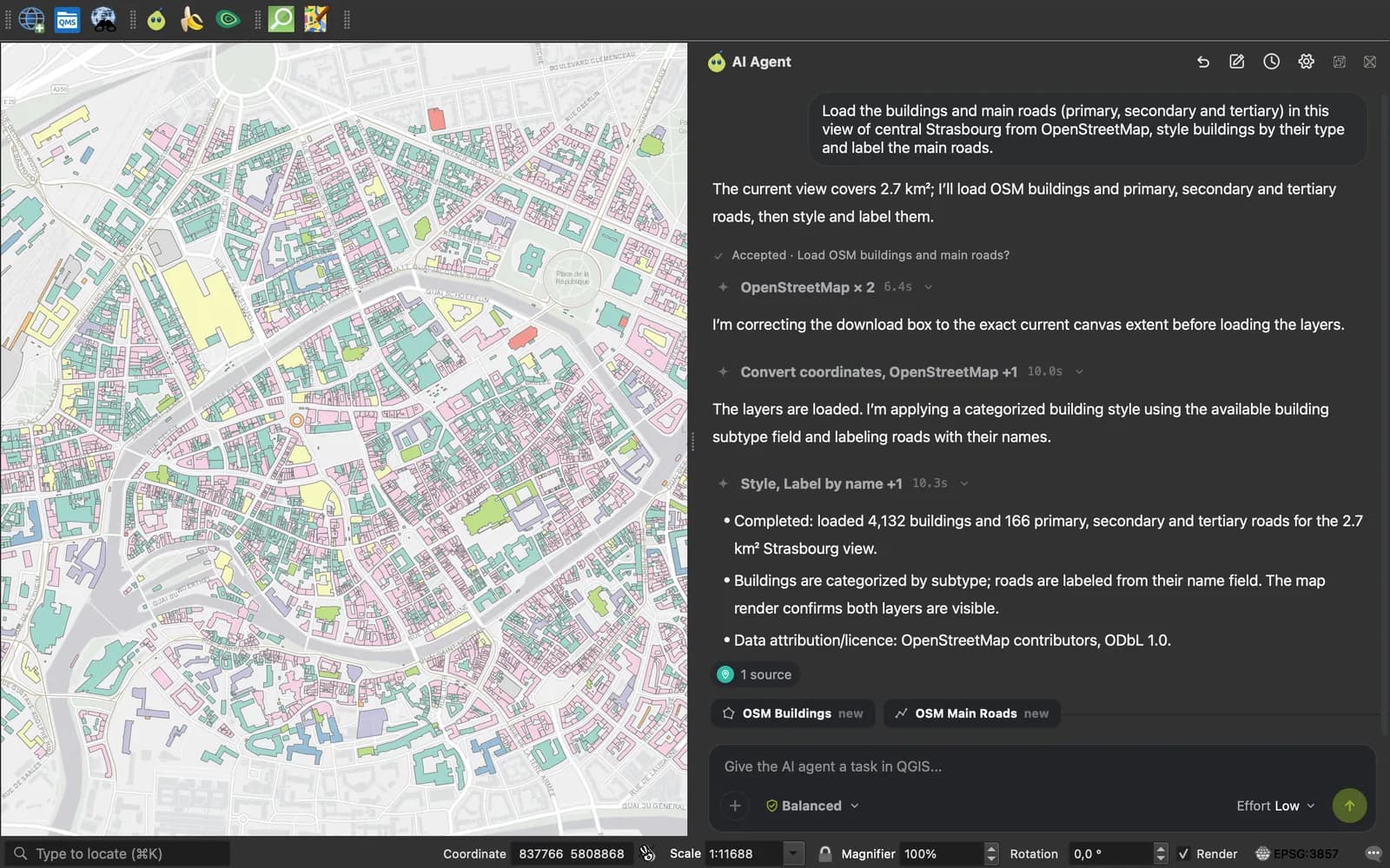
Load the buildings and main roads (primary, secondary and tertiary) in this view of central Strasbourg from OpenStreetMap, style buildings by their type and label the main roads.
- 4,132 buildings and 166 main roads loaded for 2.7 km²
- Buildings styled by type
- Main roads labelled
Data: OpenStreetMap
The message
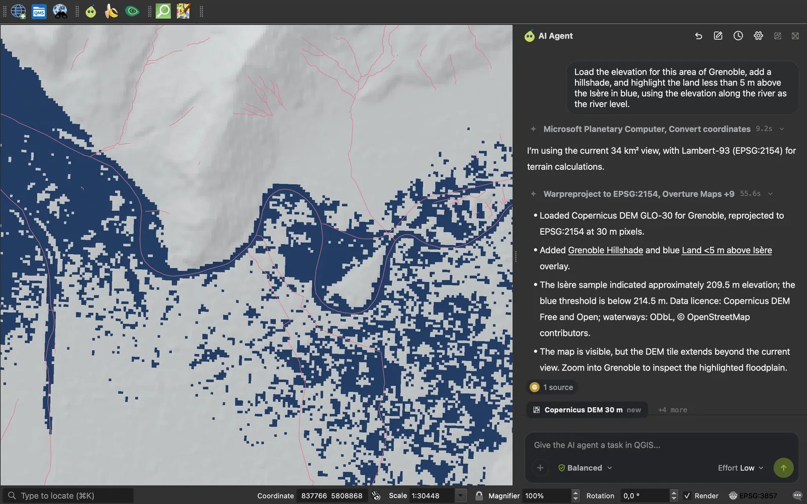
Load the elevation for this area of Grenoble, add a hillshade, and highlight the land less than 5 m above the Isère in blue, using the elevation along the river as the river level.
- 30 m elevation loaded for the 34 km² view
- Hillshade added in Lambert-93
- River read at 209.5 m, land below 214.5 m in blue
Data: Copernicus DEM, OpenStreetMap
The message
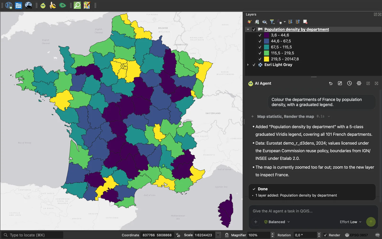
Colour the departments of France by population density, with a graduated legend.
- Density found for all 101 departments
- Joined to the official boundaries
- 5-class graduated legend
Data: Eurostat 2024, IGN
Other jobs people hand it
- Find and load open data for an area without hunting for the source
- Run a chain of Processing algorithms from one sentence
- Style and label a layer to match a spec
- Answer a question about the layers already in the project
- Build a print layout with a legend, a scale bar and a north arrow
For the imagery itself
Two plugins that read and redraw your imagery
Use them on their own, or let AI Agent drive them for you.

Every object, as a polygon
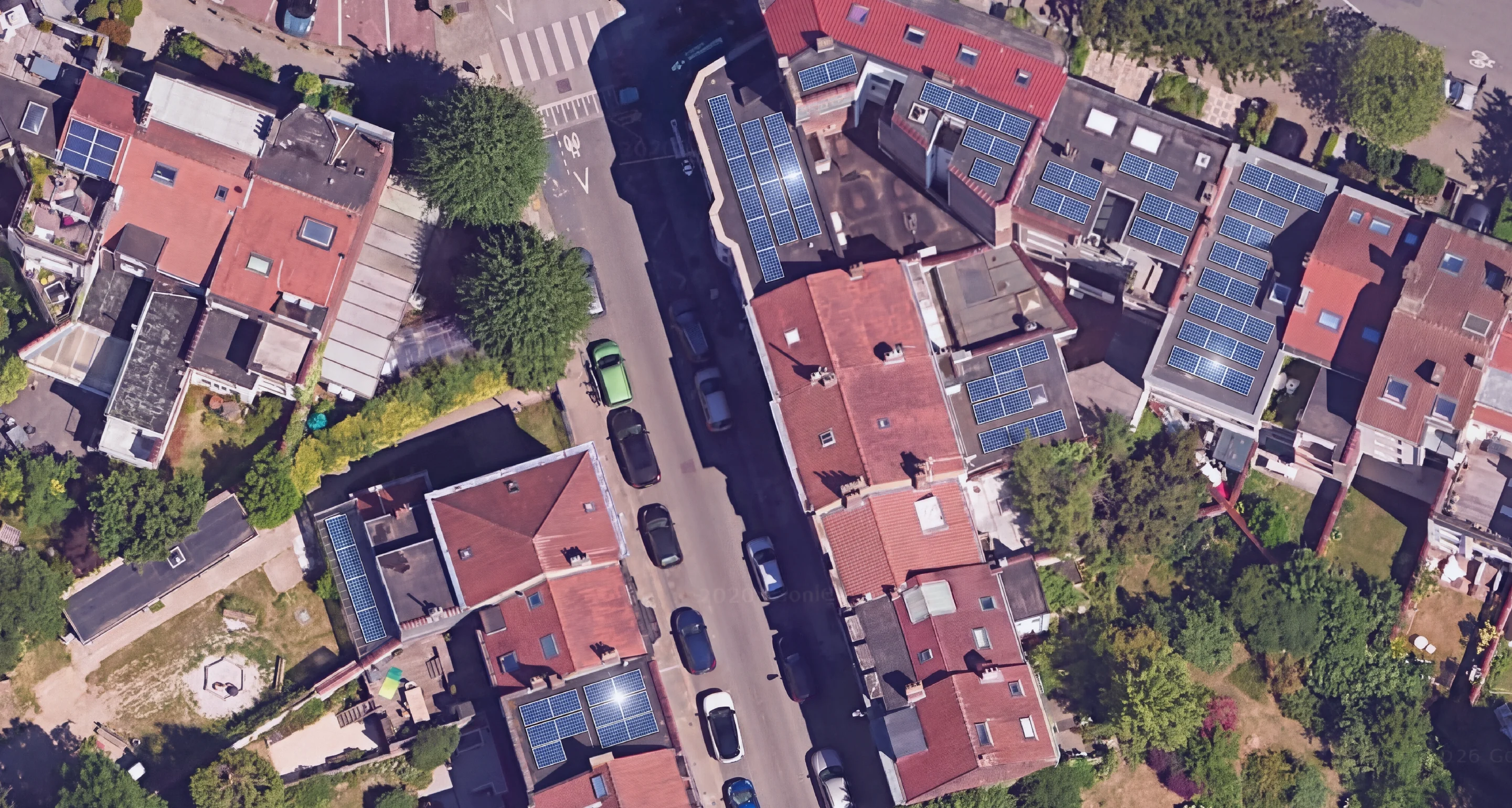
Click an object and get its outline. Or name what you want ("buildings", "solar panels", "trees") and get every match across an area, as an editable layer in your project CRS.
- Get building footprints as polygons
- Extract a road network from aerial imagery
- Map individual tree crowns
- Count solar panels across a district
- Digitize water bodies or field boundaries
- Trace one awkward object without clicking every corner
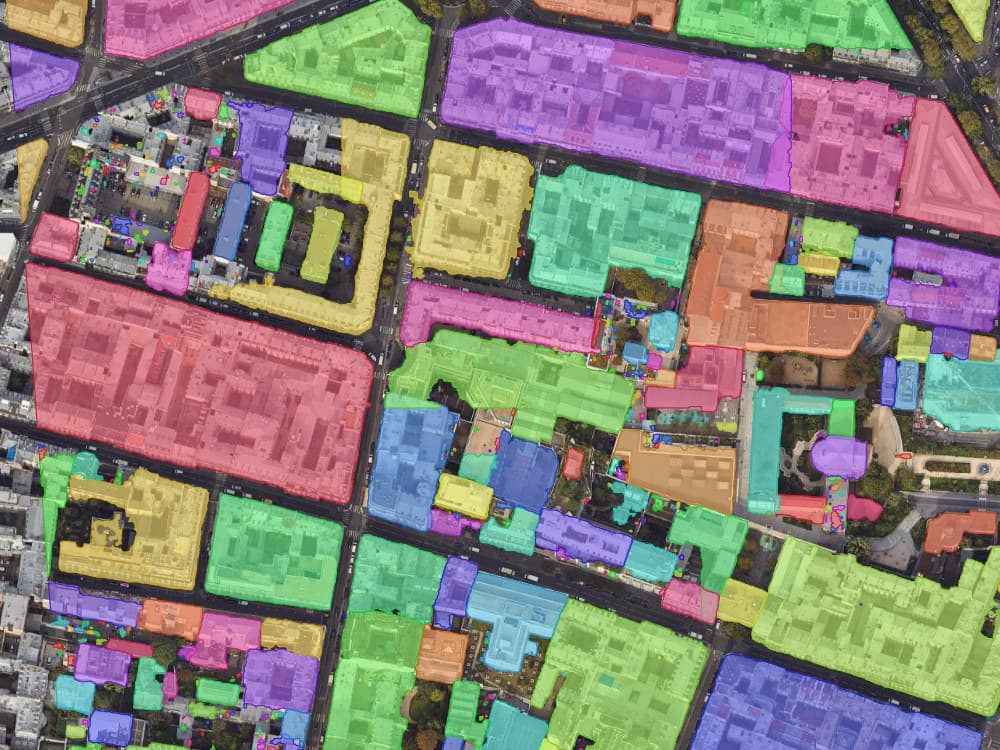
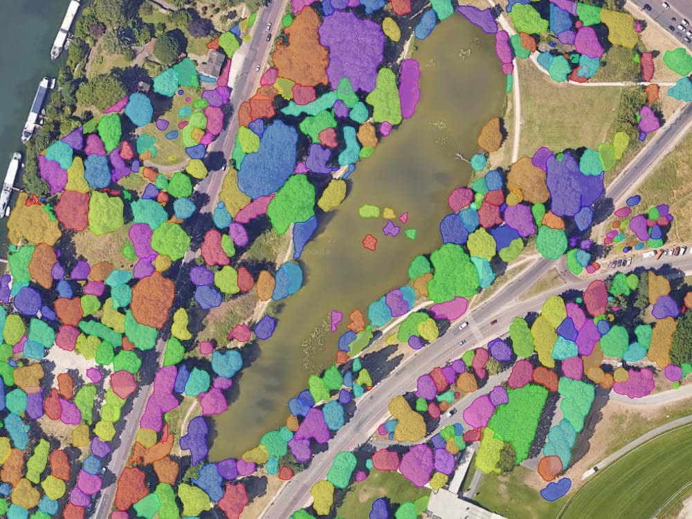
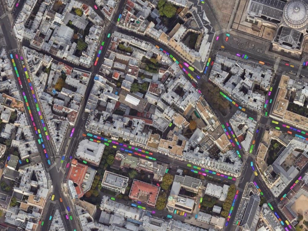
Detection results as they land in the project. Every object gets its own colour, which is how the layer looks before you export it.

A new raster, same coordinates
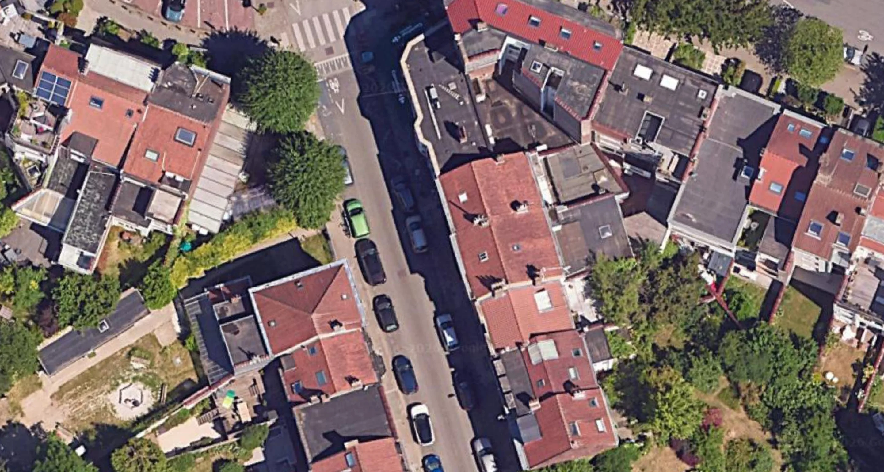
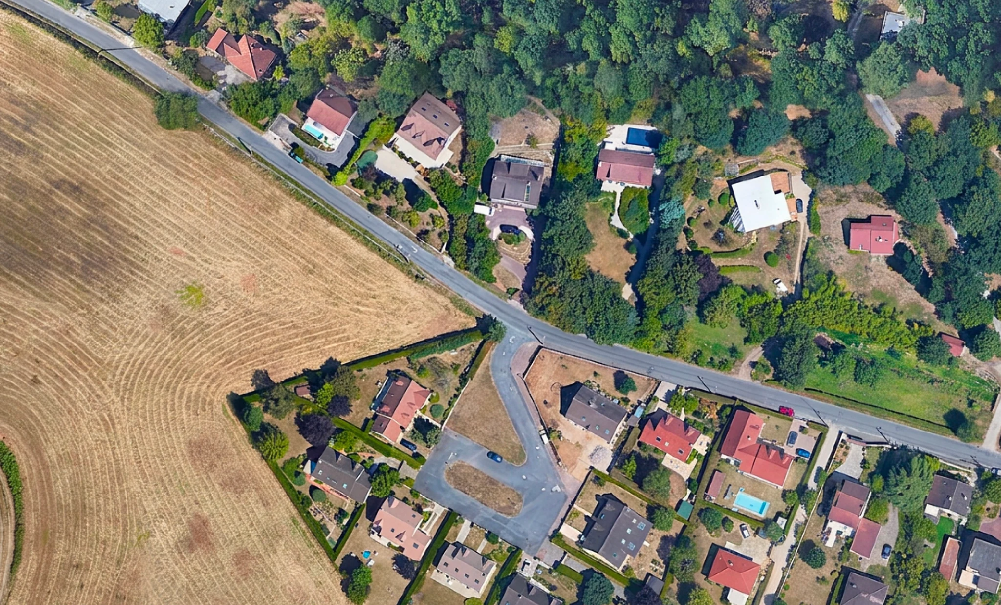
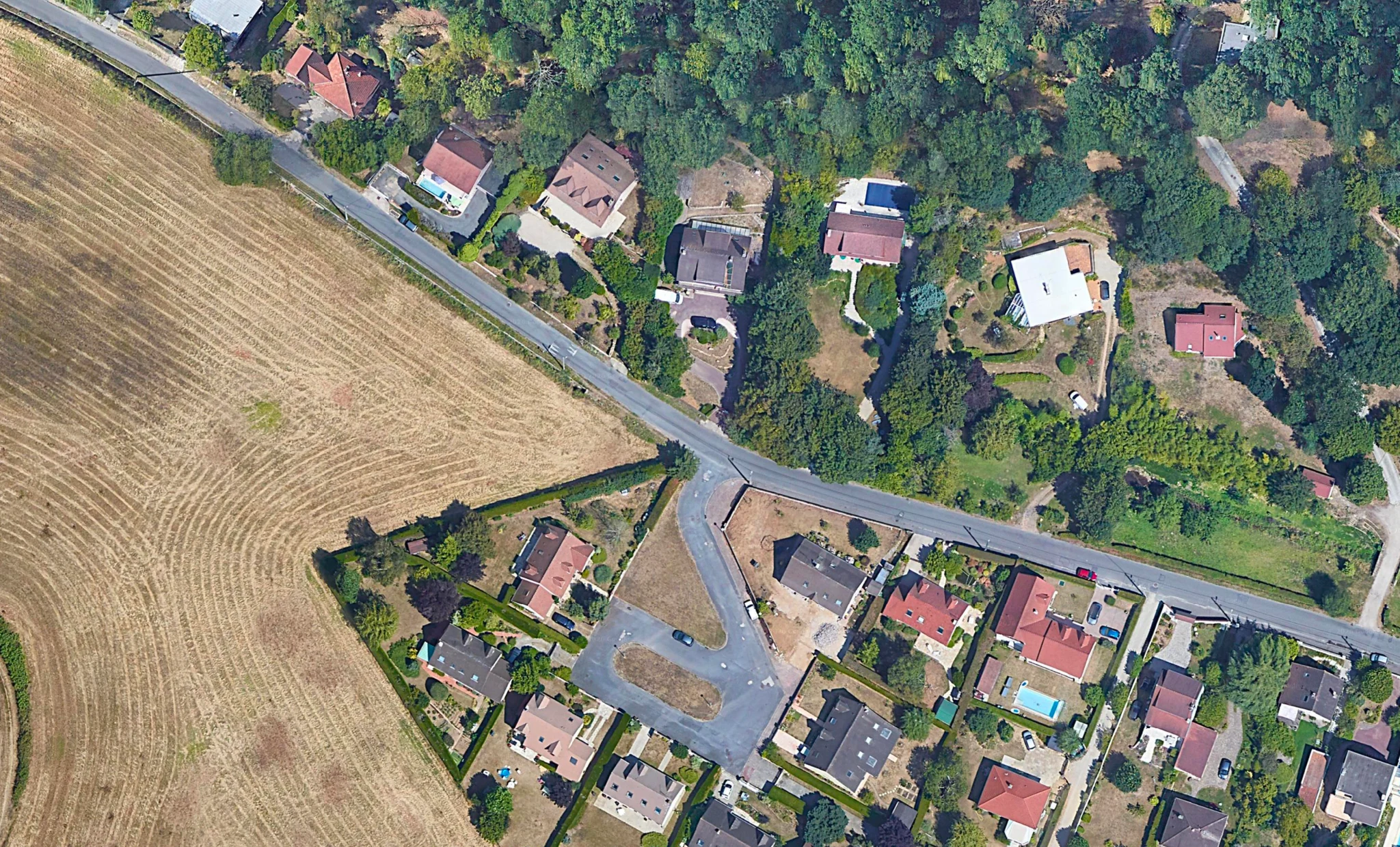
Select an area, describe the change in plain words, and get imagery back that no longer shows the clouds, the cars or the winter. It lands aligned to the same extent and CRS.
- Remove clouds from a scene you need to present
- Clear the cars off a car park to see the surface
- Show a site in summer when your orthophoto is from January
- Preview a development or a flood extent on real ground
- Sharpen a low-resolution tile for print
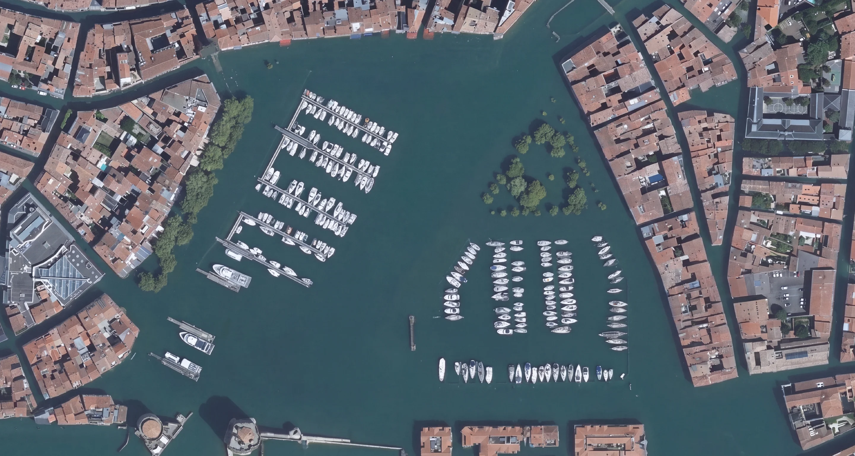
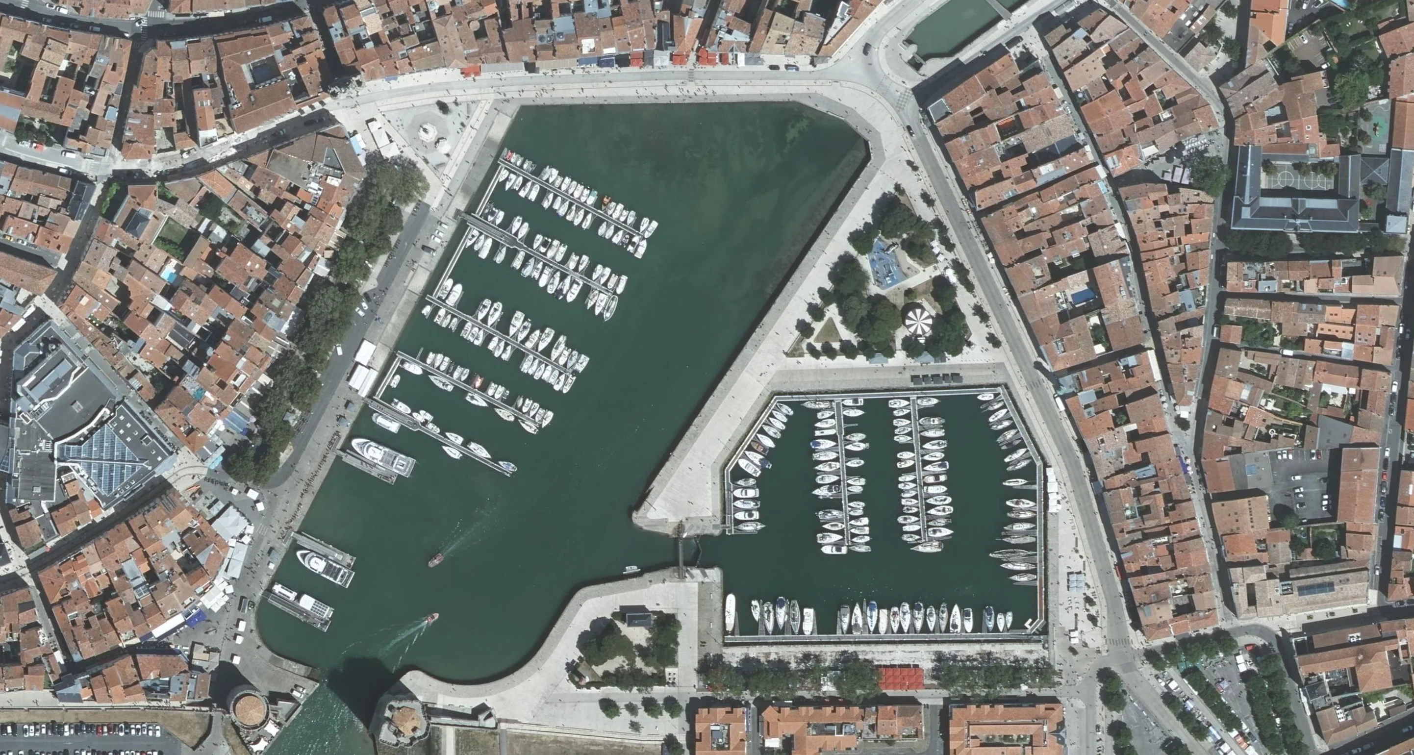
Imagery edits, one prompt each. Drag the handle to compare. Every result comes back on the extent and CRS of the tile that went in.


Need more than one? The Pack covers AI Agent, AI Segmentation and AI Edit on one subscription.
Getting started
How to install a QGIS plugin
 1
1Install from the plugin manager
In QGIS, open Plugins, then Manage and Install Plugins. On the All tab, type the plugin name, select it and click Install Plugin. No admin rights needed.
 2
2Sign in once
Open the panel and sign in with your email. No card. The free tier starts immediately and your account works on every machine you use.
 3
3Ask for the job
Type the task in the AI Agent panel. For AI Segmentation and AI Edit, load any raster first: a GeoTIFF on disk, an XYZ basemap or a WMS layer.
Plugin not in the list? AI Agent needs QGIS 3.28 or later, the other two 3.22. On a locked-down network, download the ZIP from plugins.qgis.org and use Install from ZIP in the same dialog.
Questions people ask before installing
- Yes. TerraLab ships three QGIS plugins. AI Agent runs tasks in the project you have open from a plain-language request: it loads open data, runs Processing tools and builds layouts. AI Segmentation detects objects in imagery and returns them as vector polygons. AI Edit changes what the imagery shows from a written instruction. Geo-SAM, GeoOSAM, SamGIS, Bunting Labs and Mapflow are other options, and three of them are free.
- Open the Plugins menu and choose Manage and Install Plugins. On the All tab, search the plugin by name, select it and click Install Plugin. It appears in the Plugins menu and on a toolbar. If your network blocks the repository, download the ZIP from plugins.qgis.org and use Install from ZIP.
- Yes. AI Agent, AI Segmentation and AI Edit are published on plugins.qgis.org, the official repository that the QGIS plugin manager reads. You install them from inside QGIS like any other plugin, and new versions show up on the Upgradeable tab of the same dialog.
- There is a free tier with no card. Clicking an object and getting its outline costs nothing when the model runs on your own machine, with no counter. Automatic detection across an area, the same click answered by our best model, and imagery edits use a monthly allowance that resets. Paid plans start when that allowance runs short. Try Pro free for 7 days: add a card, cancel before the end and nothing is charged. For scale, a paid plan costs about twenty minutes of billable consulting time a month, or roughly one percent of a commercial GIS seat.
- No. The heavy models run on our servers, so a standard work laptop is enough. The click-to-segment model also runs on a plain CPU when you keep it on your own machine. This matters more than it sounds: the newest Segment Anything release needs a graphics card with CUDA and has no CPU path, which rules out every Mac and every machine on integrated graphics.
- Yes. Anything QGIS can load as a raster works: satellite scenes, aerial orthophotos, drone flights, scanned maps, XYZ basemaps and WMS layers. Detection quality tracks ground resolution more than the source, so a sharp drone orthophoto usually gives the best results.
- GeoAI is the use of machine learning on geographic data: satellite and aerial imagery, point clouds, vector layers. In practice it means models that read a map the way an analyst would, finding objects and patterns. Running it inside QGIS is what turns it from a research topic into a working tool.
- It is stored on our servers in Europe, and AI Segmentation runs its detection there too. AI Edit sends what you select to an AI provider that may process it outside the European Union. We do not train any model on it and we do not share it. If you prefer, click-to-segment runs on your own machine, and then nothing leaves your computer. You can ask us to delete everything at any time.
- No plugin can give you one honest number, because it moves with your imagery and with what you extract. Expect a first pass you review, not a finished layer. Our plugin opens every run in a review step where you filter by confidence, add what was missed and delete what is wrong. Test it on your own imagery before you trust anyone's figure.
Go deeper
The full guides
AI Agent: the complete guide
What to ask for, what it reaches, and how the undo checkpoint works.
AI SegmentationAI Segmentation: the complete guide
Every mode and setting, from a single click to hundreds of objects across an area.
AI EditAI Edit: the complete guide
How to write a prompt that works, which resolution to pick, and what the model will not do.
AI SegmentationDetect building footprints in QGIS
Open data, hand-tracing and automatic detection compared, plus the filtering step that decides whether the layer is usable.
AI SegmentationSegment Anything (SAM) in QGIS
Which objects come back clean, what the licence stops you doing, and which of the seven plugins fits the machine you own.
Try it on your own project
Install AI Agent from the QGIS plugin manager, sign in with your email and ask for the first job. The free plan needs no card.
QGIS 3.28 or later. Windows, macOS, Linux. No GPU, no Python setup, no card.