Mapflow Alternatives for QGIS: 5 Free and Paid
Published Updated
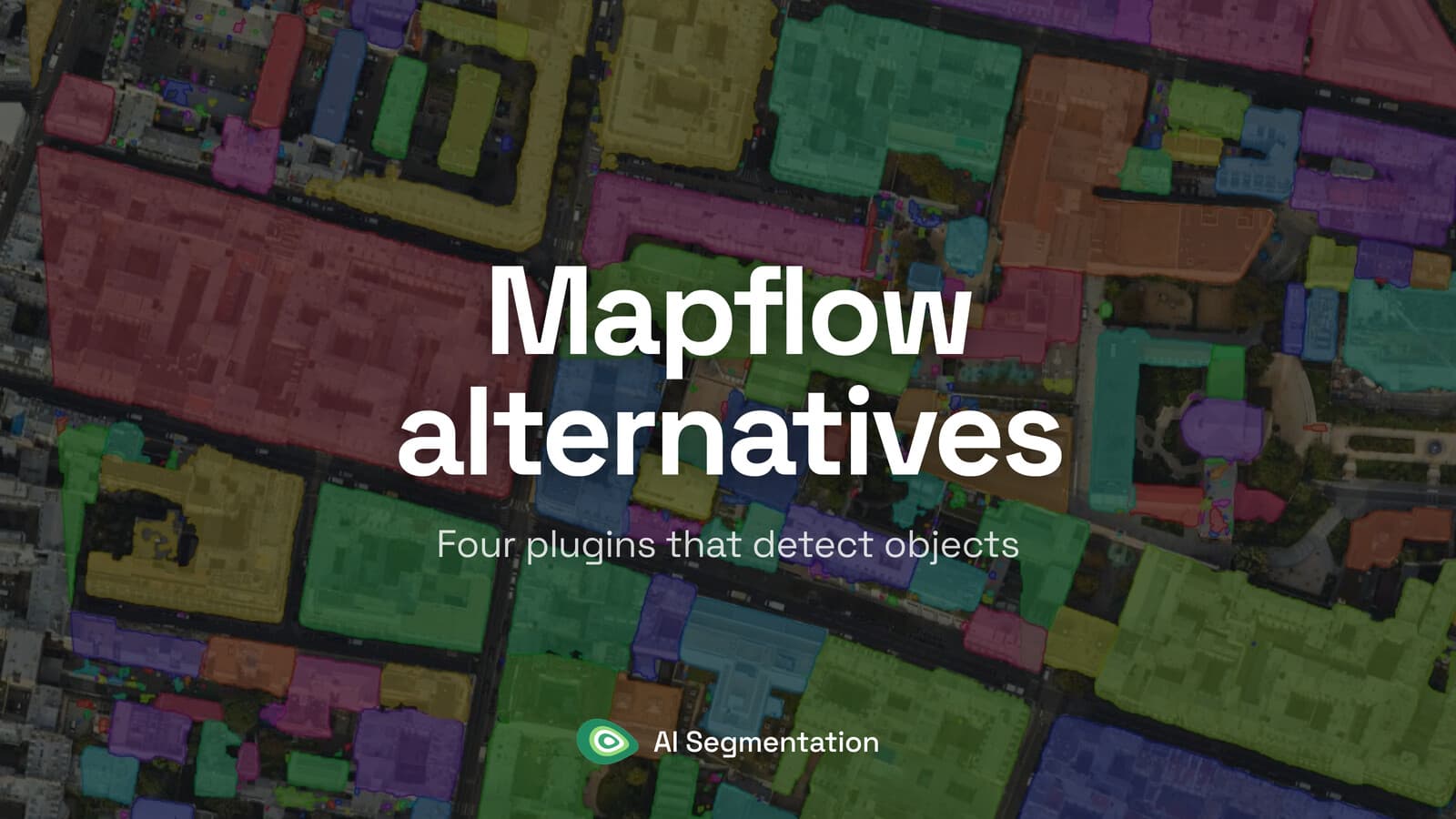
Mapflow is a QGIS plugin that connects to the Mapflow platform: you send an area and get buildings, roads or forest back as vector layers. If you are looking at other options, it is usually for one of three practical reasons: a flat monthly price rather than a per-km² one, a free tool that runs on your own machine, or a class you want to name yourself rather than pick from a list.
 plugin that connects to the Mapflow platform: you send an area and get buildings, roads or forest back as vector layers. If you are looking at other options, it is usually for one of three practical reasons: a flat monthly price rather than a per-km² one, a free tool that runs on your own machine, or a class you want to name yourself rather than pick from a list.
My default pick is AI Segmentation, ours. You draw a zone, type a word, and every match inside the zone comes back as its own polygon, with no graphics card and no Python environment to build. If the imagery may not leave your desk, skip straight to Deepness, which is free and runs on a plain CPU.
Compared at a glance
| Tool | Best for | Price | Runs on | Free plan |
|---|---|---|---|---|
| AI Segmentation (ours) | Every instance of one class inside a zone | €39 a month | Our servers, Europe | 1.5 km² and 20 object detections a month |
| Mapflow | Buildings, roads and forest from one panel | About $1.30 per km² of buildings | Their cloud; on-premise for enterprise | 250 credits, 25 km² per job |
| Deepness | An ONNX model you already have | Free, Apache 2.0 | Your machine | The whole plugin |
| GeoAI | Tree crowns, water masks, training your own | Free, MIT | Your machine | The whole plugin |
| Geo-SAM | One object per click | Free, MIT | Your machine | The whole plugin |
1. AI Segmentation
AI Segmentation is ours, so weigh this entry accordingly. It is a QGIS plugin for one job: draw a zone, type a word, get every match as its own polygon in a dated layer. Automatic mode sweeps the whole zone, and Semi-Auto works from your clicks on your own machine.
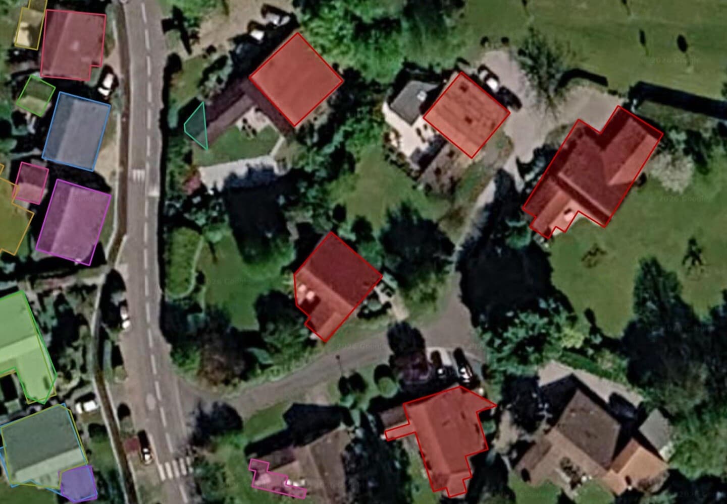
- Best for: someone on an office laptop who needs one class over a whole area today.
- Not for: imagery that may not leave the building, since the two cloud modes run on our servers.
- Price: free covers 1.5 km² of automatic detection and 20 object detections a month, with an email and no card. Pro is €39 a month for 100 km² and 500 object detections.
- Runs on: our servers in Europe for the two cloud modes. The Semi-Auto model runs on your own machine and has no counter.
- Install: plugin manager, QGIS 3.22 and up. No Python stack, no weights to fetch.
Where it wins
- No graphics card and no environment to build, which is the whole reason the free tier is testable over a coffee.
- Filtering sits on two sliders in the panel rather than in the attribute table. On one Paris run that took 635 polygons down to 82, and those 82 still held 84% of the built area.
- The local Semi-Auto model keeps working when the network does not.
Where it falls short
- We publish no accuracy benchmark by named area, so run the free tier over your own imagery before you plan a campaign on it.
AI Segmentation · Plugin listing
Try it free in QGIS, no card needed
2. Mapflow
The QGIS client of the Mapflow platform, which is also available on the web and through an API: draw an area, pick a model, watch vector tiles stream in, then export a GeoPackage or GeoJSON. Default models are open to every account. Some specialised models are available on request, and custom models can be added.
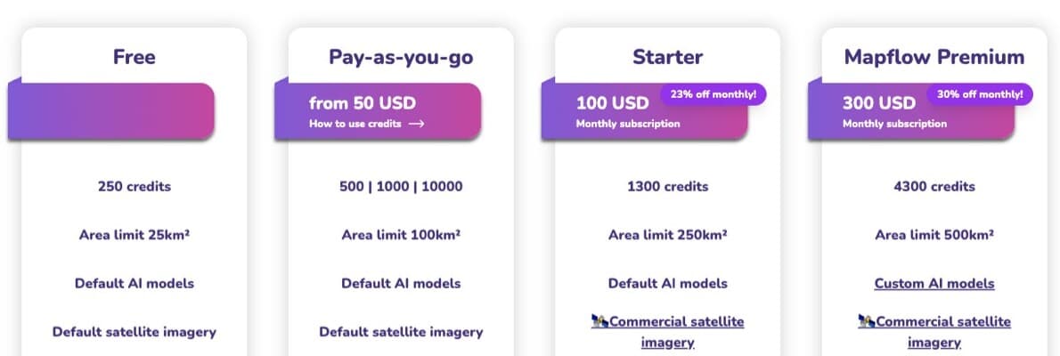
- Best for: a team that wants buildings, roads and forest from one panel on ordinary laptops and can live with a metered bill.
- Not for: a team that wants a flat monthly price rather than a per-km² bill.
- Price: one credit is 10 cents. Buildings cost 10 credits per km² and a Mapbox or ArcGIS basemap at zoom 18 adds 3, so about $1.30 per km². Roads cost 5, forest 8, all three together 23. Your own GeoTIFF drops the imagery half to zero. Anything under 1 km² is billed as 1 km².
- Runs on: their cloud for the public service and the free accounts. Enterprise customers can get separate AWS instances or an on-premise deployment for restricted data.
- Install: plugin manager, then an account.
Where it wins
- Nothing to set up beyond the account, and the same panel gives you three classes.
- They publish a benchmark over 14 named zones, with an IoU and an F1 for each one, which nobody else here does.
- The academic licence is public and has four tiers, starting free at 2,000 credits. If you work in a university, read it before the pricing page.
Where it falls short
- The bill is metered per km², so a large area needs a quote before the run rather than a fixed monthly cost.
- On the public service the imagery goes to their cloud. Keeping it in-house means their enterprise deployment, which is a separate conversation.
mapflow.ai · QGIS plugin docs · Source
3. Deepness
A QGIS plugin that runs an ONNX model you supply over any raster in your project, tile by tile. There is no model picker and no download button: the model zoo is a documentation page of links you fetch by hand.
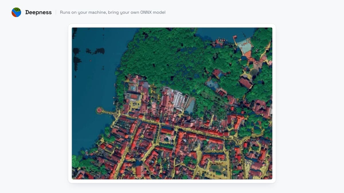
- Best for: anyone who already has a model file, or will take one from that page, and wants detection with no account and no bill.
- Not for: a colleague who wants a class list to pick from, because there is none.
- Price: free, Apache 2.0, peer reviewed in SoftwareX if you have to cite it.
- Runs on: your machine, start to finish. Every URL in the source sits inside a comment, so nothing goes out at inference.
- Install: the plugin, then it pip-installs OpenCV and ONNX Runtime. About twenty minutes, for me.
Where it wins
- The imagery never moves, which settles the question a client contract usually asks first.
- A plain CPU works. On one 5,000 pixel tile at 20 cm the run took 80 minutes on CPU against 61 seconds on a GPU, so call it slow rather than impossible.
Where it falls short
- The version you install is 0.6.5, from December 2024, while the documentation builds from an unreleased branch, so the model list you read is longer than the one you get.
- On 23 August 2026, its GitHub tracker had open issues about macOS installs (#209) and about numpy 2.0 on QGIS 3.44 (#235).
4. GeoAI
The deepest free toolbox in the registry, from Qiusheng Wu: SAM, DeepForest for tree crowns, OmniWaterMask, Mask R-CNN, and a trainer for a model of your own.
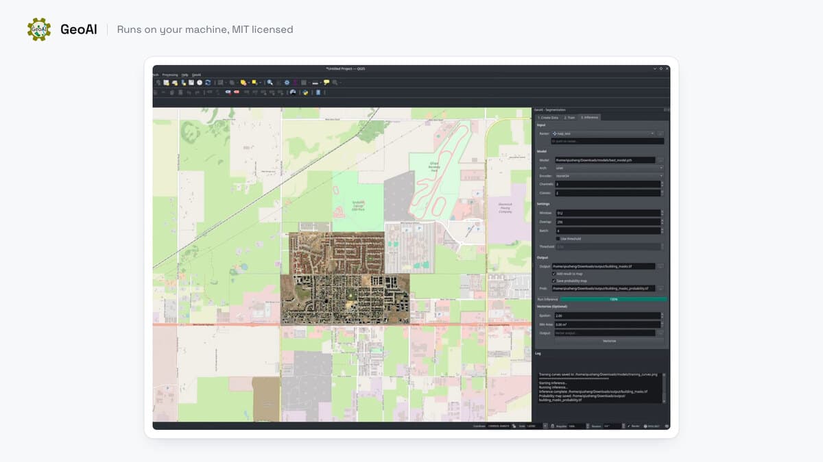
- Best for: someone who would rather train on their own labels than accept a fixed class list.
- Not for: a Mac, or any laptop on integrated graphics.
- Price: free, MIT.
- Runs on: your machine. No account, nothing uploaded, and the outputs land as ordinary vector layers and masks.
- Install: the plugin and a Python stack. An evening, in my case.
Where it wins
- The widest model range here by a distance, and you can add your own.
- Nothing is metered, nothing is uploaded, and the results are plain QGIS layers.
Where it falls short
- The install takes time. SAM 3 needs an NVIDIA card, so it does not run on a Mac.
5. Geo-SAM
Segment Anything inside QGIS, driven by a point or a box you place on the canvas. You encode the raster once as a preprocessing step, then click objects and they land as polygons in a layer you pick.
- Best for: careful manual work over a small area, a shoreline or a quarry edge.
- Not for: sweeping a town, because it is one object per prompt.
- Price: free, MIT.
- Runs on: your machine. You download the SAM checkpoint yourself and no account is involved.
- Install: the plugin, its dependencies and a SAM checkpoint you fetch by hand.
Where it wins
- The click-to-polygon loop is the fastest honest way to trace one awkward feature.
- There is no account, no bill and nothing uploaded.
Where it falls short
- The encoding step has to finish before the first click, and a CPU makes you feel every minute of it.
Side by side
| Tool | What you feed it | Install | GPU | Account | Imagery leaves the machine | A 10 km² buildings job |
|---|---|---|---|---|---|---|
| AI Segmentation (ours) | A zone you draw and a word you type | Plugin manager, QGIS 3.22 and up | No | Yes, email, no card | Yes, for the two cloud modes | Inside Pro's 100 km², so €39 a month |
| Mapflow | An area and a model from a list | Plugin manager | No | Yes | Yes on the public service; on-premise for enterprise | $13 on a zoom 18 basemap |
| Deepness | A raster in your project and an ONNX file | Plugin, then it pip-installs OpenCV and ONNX Runtime | Optional | No | No | Free, and slow on a CPU |
| GeoAI | A raster, plus your own labels if you train | Plugin and a Python stack | Yes in practice | No | No | Free |
| Geo-SAM | A raster you encode, then clicks | Plugin, its dependencies and a SAM checkpoint | Recommended | No | No | Free, one click per object |
How to switch from Mapflow
Export what you have already detected as a GeoPackage or GeoJSON, which is what the Mapflow panel offers, and the layers open in QGIS unchanged. Two things go with it. You lose the per-km² quote before the run, so the four free tools cost you setup time instead of a number you can put in a proposal, and the paid one costs a flat month.
The catalogue goes too. You stop picking buildings, roads and forest from one list, because a word you type and a model file you supply are what the five tools here take instead. What you gain is control over where the work happens. Deepness, GeoAI and Geo-SAM keep the imagery on your disk, and ours keeps a free tier open with no card.
What to remember
A Mapflow area limit caps one job, not the month, so budget from the credits on the plan.
Buildings on Mapflow cost about $1.30 per km² on a zoom 18 basemap, and bringing your own GeoTIFF drops that to $1.
Deepness, GeoAI and Geo-SAM make no network call at inference, so imagery under an upload ban stays on your disk.
This page compares no accuracy. That needs the same imagery, reference data and criteria for every tool, so run one area of your own imagery through the tools you shortlist before you plan a campaign.
How I compared them
I ran each one from the QGIS plugin manager and judged five things: what you feed it, where the model runs, whether the imagery leaves your machine, what one real job costs, and how long the install takes. I did not judge accuracy: a fair accuracy comparison needs the same imagery, the same reference data and the same criteria for every tool, and screenshots cannot stand in for that. Prices and model lists were read on 22 and 23 August 2026, and they move, so check the date before you quote a figure at a client.
Disclosure: I co-founded TerraLab, so the first entry is ours. It gets the same five lines, the same two sections and the same flat limit as the other four. One job I send elsewhere without hesitating is imagery under a contract that forbids upload. Nothing of ours helps you there, and Deepness does.
Questions people ask
Is there a free alternative to Mapflow?
Three of the five run free on your own machine: Deepness, GeoAI and Geo-SAM, all open source. They cost setup time instead of credits, and Deepness was about twenty minutes for me while GeoAI took an evening. AI Segmentation has a free tier of 1.5 km² a month with no card, which is enough to test a method before you pay for anything.
What does Mapflow actually cost per square kilometre?
Buildings are 10 credits per km² and a zoom 18 basemap adds 3, so 13 credits, and a credit is 10 cents. That is about $1.30 per km², or $13 for a 10 km² job. Bring your own GeoTIFF and the imagery half drops to zero, leaving $1 per km². Anything smaller than 1 km² is billed as 1 km².
What does the area limit on a Mapflow plan mean?
It is a ceiling on one job, not a monthly allowance. Starter costs $100 a month, shows an area limit of 250 km², and includes 1,300 credits, which is about 100 km² of buildings on a zoom 18 basemap. Budget from the credits, not from the area figure on the card.
Can I detect objects in QGIS with no internet?
Yes. Deepness, GeoAI and Geo-SAM make no network call at inference, so a machine with no route out still works once the plugin and the weights are in place. Mapflow's public service runs in their cloud, and they offer on-premise deployment to enterprise customers. AI Segmentation keeps only its Semi-Auto model on your machine, and the two other modes send imagery to our servers in Europe.
Do I need a graphics card?
Not for Mapflow or AI Segmentation, which run the model on a server. Deepness runs on a plain CPU, slowly, and only uses CUDA if you set it up yourself. GeoAI needs an NVIDIA card for SAM 3, and Geo-SAM will encode on a CPU but you will feel it.
Are there other QGIS plugins worth a look?
For narrower cases, yes. samgeo suits a notebook pipeline over hundreds of tiles, and GeoOSAM does prompt-driven segmentation with a different interface. Bunting Labs AI Vectorizer is a different job again, since it autocompletes a line while you digitize it by hand.
Which Mapflow models can I use straight away?
Default models are open to every account. Some specialised models are available on request, and custom models can be added, so check their model page for your class before you plan around it.
Does Deepness ship the models listed in its documentation?
The build in the plugin manager is 0.6.5, from December 2024, while the documentation builds from an unreleased branch. The list you read is longer than the list you get.
The full plugin comparison covers eight tools, and the Bunting Labs alternatives post takes the digitizing side of this in the same shape. The QGIS AI hub links every guide we have written.