Deepness Alternatives in QGIS: 5 Free and Paid
Published Updated
The quickest Deepness replacement is AI Segmentation, ours: draw a zone, type building, and the polygons come back with no model file anywhere. Deepness itself runs a deep learning model over a raster inside QGIS, tile by tile, on your own machine, free.
 , tile by tile, on your own machine, free.
Deepness works from an ONNX file you supply: you pick a model from its documentation page, download it, then browse to it in the plugin. If you have no such file, the other tools below start from different inputs. Deepness sits at number two, on the same lines as the rest.
Compared at a glance
| Tool | Best for | Price | Runs on | Free plan |
|---|---|---|---|---|
| AI Segmentation (ours) | Any object you can name, over an area, with nothing to install | 1.5 km² a month free, €39 for 100 km² | Our servers, or your machine in Semi-Auto | 1.5 km² a month, no card |
| Deepness | A model you already have, on imagery that must stay put | Free, Apache 2.0 | Your machine | Everything, no account |
| Geo SAM | A few dozen objects clicked one at a time, offline | Free, MIT | Your machine | Everything, no account |
| GeoAI | Tree crowns, water masks and your own training, on an NVIDIA card | Free, MIT | Your machine | Everything, no account |
| Mapflow | Buildings, roads and fields as finished products over a town | About $1.30 per km² for buildings | Their servers | 250 credits, over at most 25 km² |
1. AI Segmentation
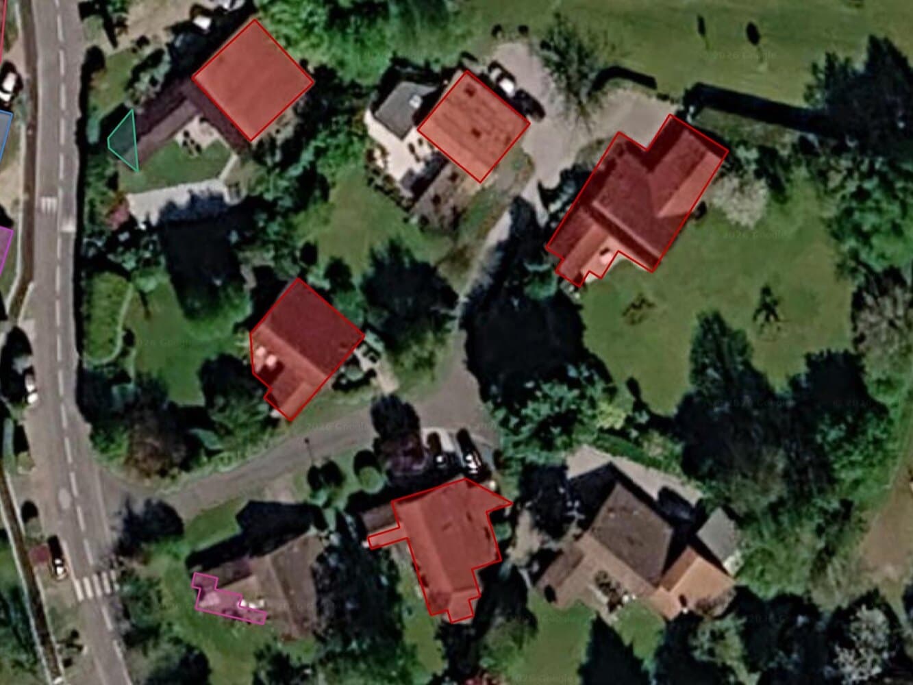
AI Segmentation is ours, so weigh this entry accordingly. Draw a zone over any raster or basemap, type a word such as building or solar panel, and every match comes back as its own polygon. The output is a styled GeoPackage, each polygon carrying a label, a class, a confidence score and an area.
- Best for: a geomatician with no model, no graphics card and no free evening, who needs objects out of an image today.
- Not for: imagery that cannot leave the machine, unless you stay in Semi-Auto, or a class only your own labels know.
- Price: free for 1.5 km² of automatic detection a month, no card. Pro is €39 a month for 100 km². Semi-Auto on your own machine has no counter.
- Runs on: our servers in Europe for the two cloud modes, so the imagery inside your zone does leave your machine. Semi-Auto runs a small model locally and keeps it there.
- Install: the plugin, and nothing after it. No pip command, no CUDA and no weights to fetch.
Where it wins
- The word you type is the class, so
buildingtosolar panelcosts one field, not a retraining run. - Confidence and area sliders filter the result in place, before export.
Limits
- It returns more than you asked for. Vents, skylights, courtyard sheds and shadows come back as correctly outlined polygons that are not buildings, so you drag the sliders until they go. On one Paris run that took 635 polygons to 82, and those 82 still held 84% of the built area.
Product page and the complete guide.
Try it free in QGIS, no card needed
2. Deepness
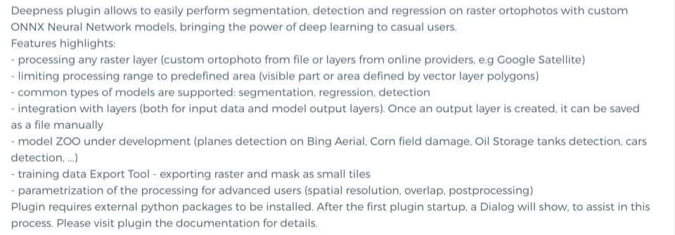
It loads an ONNX network you supply, slides it over a raster in overlapping tiles, and writes the result back as a layer. Segmentation, object detection, regression and super-resolution, and you set the tile size, the overlap and the postprocessing.
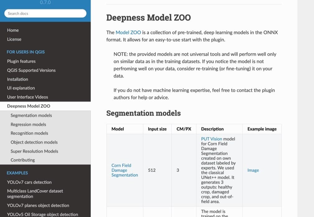
- Best for: someone with a trained ONNX file, or a sensor matching one of the 24 models on the zoo page, whose imagery must stay on the machine.
- Built for: people who bring their own ONNX model.
- Price: free. No account, no API key, no licence check anywhere in the code. The only outbound call is the
pip installon first start. - Runs on: your machine, CPU or CUDA. The installer only fetches the GPU build on Linux, so Windows and macOS get plain
onnxruntime. - Install: the plugin, then OpenCV and ONNX Runtime on first start.
Where it wins
- Your own model runs. Any ONNX matching the documented shape works, trained on your labels, your sensor, your resolution.
- Nothing is metered, so a 10 km² town and a 1,000 km² region cost the same.
- Apache 2.0 and peer reviewed in SoftwareX (DOI 10.1016/j.softx.2023.101495), so a pinned model file gives the same answer in three years.
Limits
- You bring the model and set its resolution in cm per pixel. The zoo page lists 24 models, trained at resolutions from 0.5 to 1000 cm per pixel, and notes that the provided models are not universal tools.
- CPU runs take longer than GPU runs. A user reported on issue #192 one 5000 by 5000 pixel tile at 20 cm: 80 minutes on a Ryzen 7 5800X against 61 seconds on a GTX 1660 Ti. One machine, one model, so read it as his measurement, not a benchmark.
Repository and documentation. As of 23 August 2026 the docs build from a newer unreleased branch, while the marketplace version is 0.6.5, from 10 December 2024.
3. Geo SAM
Segment Anything inside QGIS. Click a point or drag a box on a raster, and that one object comes back as a polygon.
- Best for: a few dozen objects off a local image, with no model file to hunt and no pip command to type.
- Built for: one object per prompt.
- Price: free, MIT.
- Runs on: your machine, with or without a graphics card. No account.
- Install: the plugin. It manages its own dependencies and fetches its checkpoints from inside QGIS.
Where it wins
- The only offline option that asks for no model file at all.
- It takes a raster file or an XYZ, WMS or WMTS layer, so a basemap works.
Limits
- The first prompt on a new image waits while the whole image is encoded, "from a few seconds to several minutes depending on the image size, model, and hardware" by its own FAQ, which also ships a low-memory strategy for when that step exhausts the RAM.
Repository, documentation and plugin listing.
4. GeoAI
A toolbox of ready-made tasks, one dockable panel each: tree segmentation, water segmentation, Segment Anything, semantic and instance segmentation, plus a trainer for your own model. Each panel outputs polygons and masks.
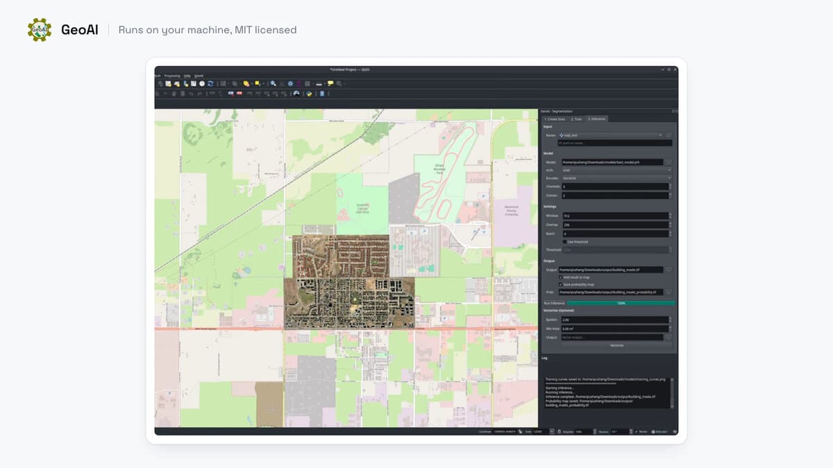
- Best for: someone with an NVIDIA card and an evening, who wants several detection tasks covered with no ONNX file to export.
- Note: SAM 3 needs an NVIDIA card.
- Price: free, MIT.
- Runs on: your machine. CUDA for speed, Apple MPS on Apple Silicon, CPU as a fallback. No account, except that the SAM 3 weights need a Hugging Face access request first.
- Install: the plugin, plus a PyTorch environment. Its own page says this "can be challenging due to the complicated pytorch/cuda dependencies".
Where it wins
- Several tasks in one plugin, each with its own panel, none needing a model file.
- The trainer keeps your own labels inside the same tool.
Limits
- SAM 3 needs an NVIDIA card. Without one it returns
Failed to load model: Torch not compiled with CUDA enabled, and the other models still run.
Plugin documentation and repository.
5. Mapflow, by Geoalert
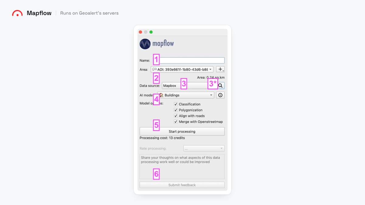
Draw an area over one of their imagery sources, pick a class, and vector layers come back: buildings with optional height, roads, agricultural fields, forest, construction sites.
- Best for: one of those finished classes over a whole town, with nothing to install and no graphics card.
- Not for: a class outside their list.
- Price: credits at $0.10 each. Buildings are 10 credits per km² and the basemap adds 1 to 9 more, so a run on a Mapbox zoom-18 basemap costs 13 credits, about $1.30 per km², and every job rounds up to a whole km². The free plan gives 250 credits over at most 25 km².
- Runs on: their hosted service for the QGIS plugin, with an account. Their site also lists an on-premise option for enterprise customers, which this article does not compare.
- Install: the plugin only.
Where it wins
- The panel prices the run before you start it.
- Building height comes back as an attribute, which no other tool here offers.
Plugin documentation and repository.
Side by side
| Tool | What you feed it | Install | GPU | Account | Imagery leaves the machine | A 10 km² town |
|---|---|---|---|---|---|---|
| AI Segmentation (ours) | A zone you draw, plus a word | Plugin only | No | Yes | Only in the two cloud modes | A tenth of a €39 month |
| Deepness | Any raster layer, plus an ONNX file | Plugin, then OpenCV and ONNX Runtime | Optional, Linux only in practice | No | No | Free, paid in CPU hours |
| Geo SAM | A raster file, or an XYZ, WMS or WMTS layer | Plugin, dependencies handled | Optional | No | No | Free, one click per object |
| GeoAI | A raster layer | Plugin, plus a PyTorch environment | Recommended, NVIDIA for SAM 3 | No | No | Free, paid in install time |
| Mapflow | An area you draw over their imagery | Plugin only | No | Yes | Yes, with the hosted plugin | About $13 |
The install column is the one people underestimate, and the Deepness listing says as much.
How to switch from Deepness
Export your results first. A Deepness run lands in a memory layer that dies with the project, so right-click it and save it as a GeoPackage before you close QGIS.
Your ONNX file has no home in the other four. None of them will load a network you trained. Keep the file, and keep Deepness installed for the day a job needs it.
What you lose is offline inference, but only if you land on Mapflow's hosted plugin or our Automatic mode, since both send the imagery inside your zone to a server. Geo SAM and GeoAI stay local, exactly like Deepness. What you gain is the same in all four cases: no model hunt, no resolution in cm/px to type, no pip install on first start.
What to remember
Deepness is the only tool on this page that runs a network you trained yourself, which is the one thing to weigh before leaving it.
The model zoo is a documentation page, so the ONNX file arrives by hand and you set its resolution yourself.
One user-reported 5000 by 5000 pixel tile at 20 cm took 80 minutes on a CPU, against 61 seconds on a GTX 1660 Ti.
Deepness, Geo SAM and GeoAI make no network call while the model runs, so imagery under an upload ban stays on your disk.
Detecting every building in a 10 km² town costs about $13 on Mapflow, a tenth of a €39 month on Pro, and install time on the three free tools.
How I compared them
Five criteria: what you feed the tool, where it runs, whether your imagery leaves your machine, what a real job costs, and how long the install takes. Prices, versions, licences and open issue numbers were read on 23 August 2026 from each project's own repository or documentation. The screenshots date from the same day.
Disclosure: entry one is ours. If your imagery sits under a policy that forbids any upload and you already have a trained ONNX file, stay on Deepness. Our Automatic mode detects on our servers, so nothing here changes that.
Questions people ask
Is there a Deepness alternative that does not need an ONNX file?
All four of the others. Geo SAM and GeoAI fetch their own weights for you, and Mapflow's hosted plugin and our AI Segmentation keep theirs on a server, so nothing lands on your disk. Deepness asks you to bring your own, which is also what lets it run a model you trained yourself.
Does Deepness work on macOS?
Its GitHub tracker lists macOS install reports, for example #209, open as of 23 August 2026. Check the tracker before you plan around it. Geo SAM handles its own dependencies and the hosted tools need only the plugin, so a Mac stops none of them.
Can I run deep learning in QGIS without a graphics card?
Yes. Deepness, Geo SAM and GeoAI all fall back to the CPU, and Deepness does not even install the GPU build on Windows or macOS. You pay in time: one user-reported tile took 80 minutes on a CPU against 61 seconds on a GTX 1660 Ti. With neither a card nor the patience, Mapflow and our AI Segmentation compute on a server.
Is there a known Deepness issue on QGIS 3.44?
A user reported it on issue #235, open as of 23 August 2026: the plugin's requirements pin numpy<2.0.0 and QGIS 3.44 ships NumPy 2.4.3, so the first start printed A module that was compiled using NumPy 1.x cannot be run in NumPy 2.4.3. Print numpy.__version__ in the QGIS Python console before you install.
Which of these keeps my imagery on my machine?
Deepness, Geo SAM and GeoAI, all three completely: no account, no API key and no network call while the model runs. Our Semi-Auto mode also stays local, while our Automatic mode and Mapflow's hosted plugin send the imagery inside your zone to a server, ours in Europe.
What does it cost to detect every building in a 10 km² town?
About $13 on Mapflow, at 13 credits per km² on a Mapbox zoom-18 basemap. On our Pro plan, €39 a month covers 100 km², so that town is a tenth of a month. On the three free tools the area costs nothing, and you pay in install time and CPU hours.
Do the 24 models in the Deepness zoo cover my imagery?
They are trained at resolutions from 0.5 to 1000 cm per pixel, so check the CM/PX column against your imagery. The page carries its own note that the models are not universal tools.
Does a Deepness result survive closing QGIS?
A Deepness run lands in a memory layer that dies with the project. Right-click it and save it as a GeoPackage before you close anything.
Narrower jobs have their own tools: Bunting Labs AI Vectorizer traces linework ahead of your cursor as you digitize by hand, SamGeo is another local Segment Anything plugin, and SCP classifies land cover from training areas you draw.
The eight AI plugins compared covers the wider field, the SAM guide goes deeper on Segment Anything, and what GeoAI means covers the term all five of these tools get sold under. The QGIS AI hub maps the rest.