5 Best Bunting Labs Alternatives for QGIS (2026)
Published Updated
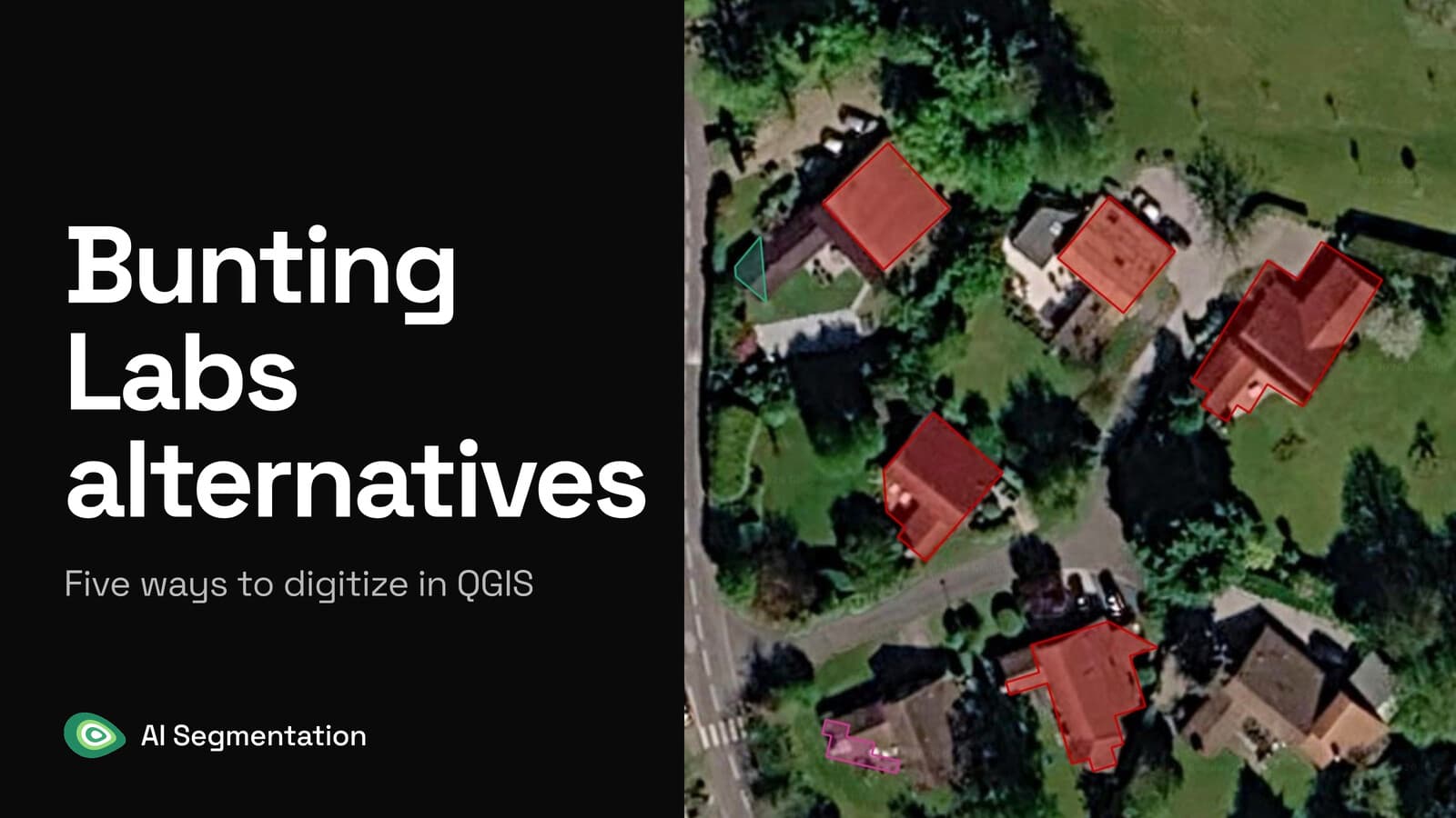
Bunting Labs' AI Vectorizer is a QGIS plugin that continues a line ahead of your cursor while you hand digitize a scanned map. If what you need is every object of one kind across an area, from imagery, the closest fit is AI Segmentation, which we build.
 plugin that continues a line ahead of your cursor while you hand digitize a scanned map. If what you need is every object of one kind across an area, from imagery, the closest fit is
 The tools below differ on what you feed them, where the computation runs and what a seat costs. Which one fits depends almost entirely on what you feed it. Prices and features come from each vendor's own public pages, read on 23 August 2026.
Compared at a glance
| Tool | Best for | Price | Runs on | Free plan |
|---|---|---|---|---|
| AI Segmentation (ours) | Every object of one kind, from imagery | €39 a month | Our servers, in Europe | Yes, 1.5 km² and 20 object detections a month |
| Bunting Labs AI Vectorizer | Tracing lines on scans and PDF plans | $29 or $99 a month per seat | Their servers | 150 map chunks to evaluate with |
| Mapflow | Buildings, roads and forest, billed by area | About $1.30 per km² of rooftops | Their hosted service | Yes, 250 credits capped at 25 km² |
| Deepness | Your own ONNX model, offline | Free, Apache 2.0 | Your machine | Free outright |
| Geo-SAM | Clicking objects out of one raster | Free, MIT | Your machine | Free outright |
1. AI Segmentation
AI Segmentation is ours, so weigh this entry accordingly. It is a QGIS plugin where you draw a zone, type the object in plain words, and get every match back as its own polygon.
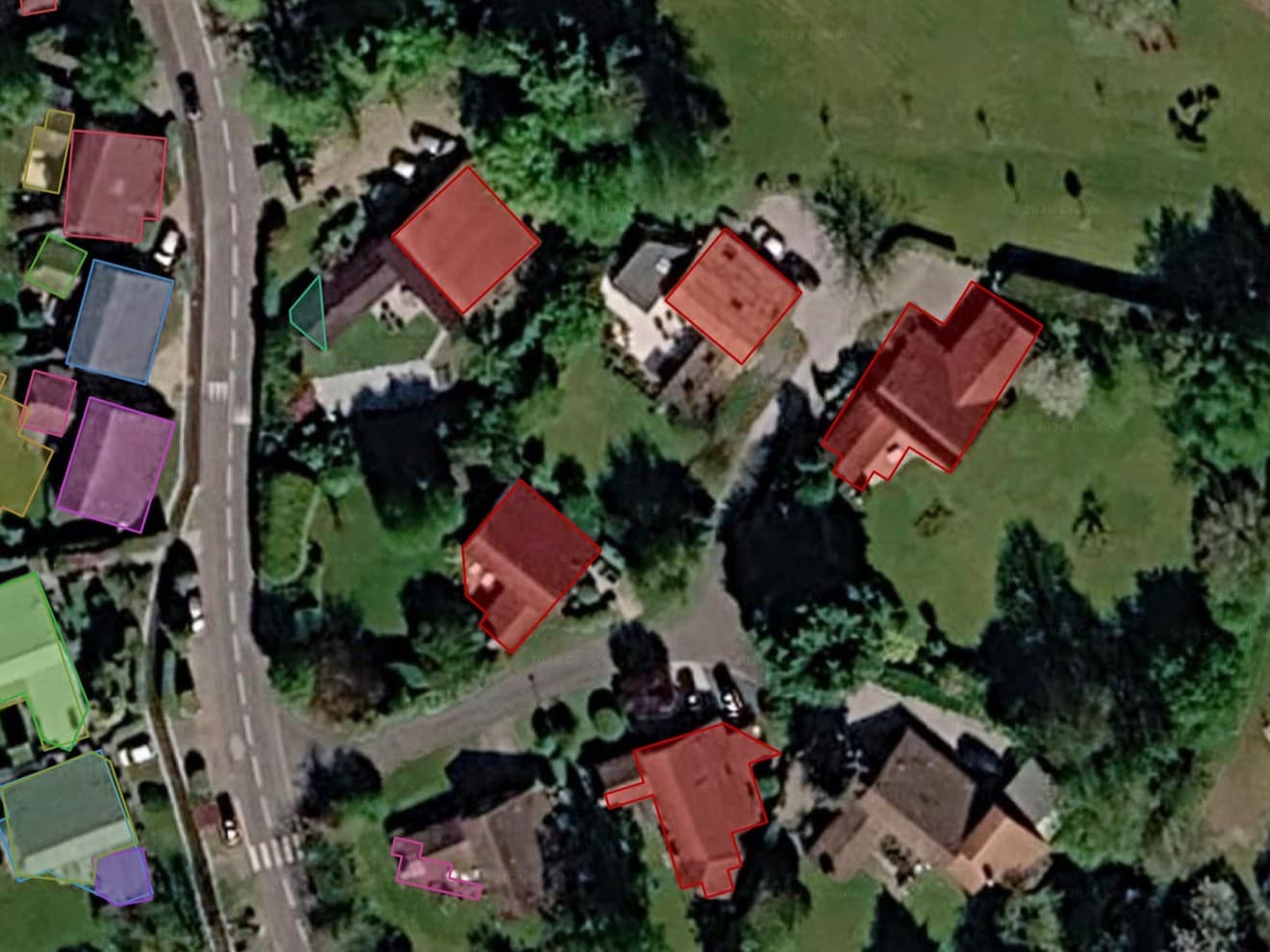
- Best for: a geomatician with orthophotos who needs a whole layer of one object type: the rooftops of a town, the pools of a district, the solar arrays on an industrial park.
- Not for: paper. Point it at a 1955 cadastral sheet and you get nothing usable.
- Price: free for 1.5 km² of automatic detection and 20 object detections a month, no card. Pro is €39 a month for 100 km² and 500 object detections.
- Runs on: our servers, in Europe, for the two cloud modes. Semi-Auto's small local model stays on your machine.
- Install: the plugin manager, nothing else.
Where it wins
- One run returns the whole area, not one feature. On Pro, 100 km² of rooftops is the whole month's envelope, €39.
- Every match arrives as its own editable polygon, with its class, its confidence score and its area filled in.
- Semi-Auto's local model runs on your machine with no counter.
Where it falls short
- It reads imagery and nothing else. Scans, georeferenced PDFs and as-builts are out.
- The two cloud modes send the imagery inside the zone you drew to a server in Europe.
Try it free in QGIS, no card needed
2. Bunting Labs AI Vectorizer
A QGIS plugin that continues a line ahead of your cursor once you have placed two vertices along a road, a contour or a parcel edge. It proposes, you accept or override.
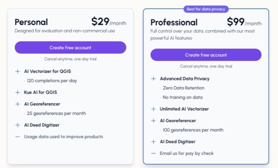
- Best for: anyone with a stack of scanned sheets, georeferenced PDFs or as-builts to trace by hand.
- Built for: tracing the line you are drawing, one feature at a time, rather than whole-area extraction.
- Price: $29 a month per seat, capped at 120 completions a day, or $99 a month uncapped. 150 map chunks free to evaluate with, no card.
- Runs on: their servers. Only the plugin lands on your machine, and it works on an office laptop with no graphics card.
- Install: the plugin manager, nothing else.
Where it wins
- Their own timed test on a USGS geologic quadrangle reports 65 minutes by hand against 31 with the plugin. They publish the source raster and both output GeoPackages, so you can rerun it.
- The vertices go into the layer you already have open, so there is no import step and no second file.
- The $99 card says zero data retention and no training on your data, the line that matters when the scans belong to a client.
Limits
- It continues the line you are drawing, one feature at a time.
- A chunk is a 256-pixel tile of raster your cursor passed over. Their $29 card says usage data is used to improve their products.
3. Mapflow, by Geoalert
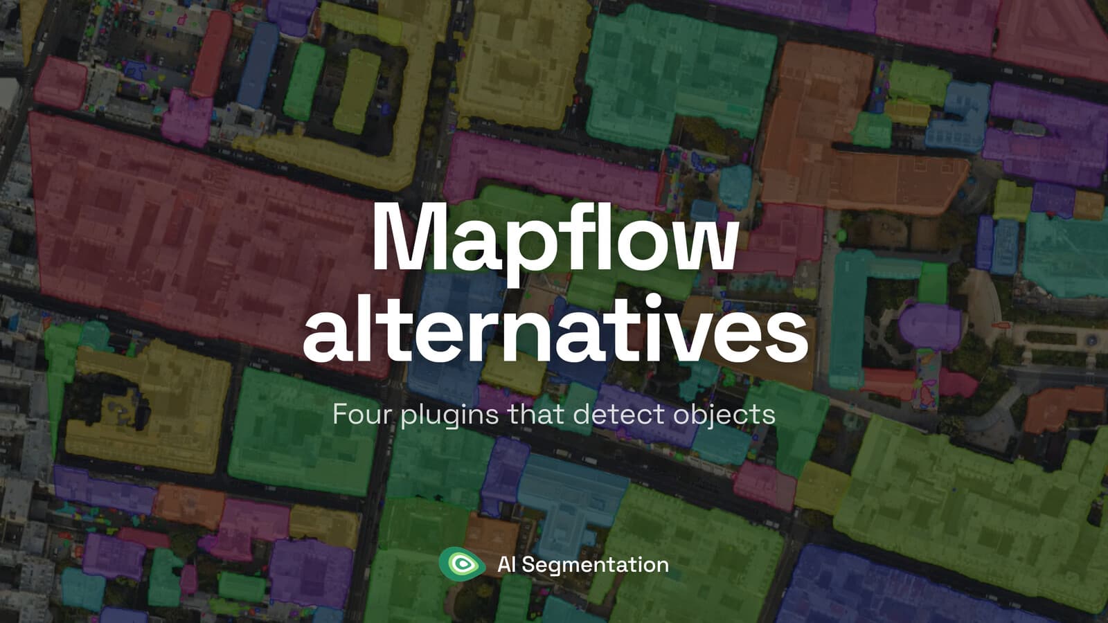
Mapflow runs a fixed catalogue of models over an area you draw: buildings with optional height, roads, agricultural fields, forest, construction sites.
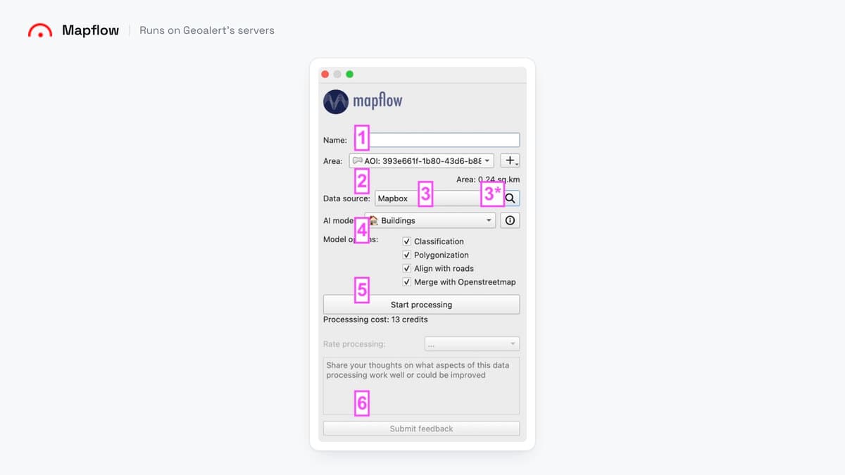
- Best for: someone who wants one named object class over a wide area and wants the bill quoted before the run, not after it.
- Not for: classes outside their model catalogue.
- Price: credits at $0.10 each. Buildings are 10 credits per km², plus 3 for a Mapbox basemap at zoom 18, so about $1.30 per km² and near $130 for a 100 km² town. Every job rounds up to a whole km². Free plan: 250 credits capped at 25 km².
- Runs on: their hosted service for the QGIS plugin. Their site also lists an on-premise option for enterprise customers, which is outside what this article compares.
- Install: the plugin manager, nothing else.
Where it wins
- The cost appears under the start button before you commit.
- The catalogue covers classes most tools make you go and find a model for: buildings with height, roads, agricultural fields, forest, construction sites.
Where it falls short
- Some models in their catalogue are on request only, and Segment Anything is not listed for the QGIS plugin in their docs.
4. Deepness
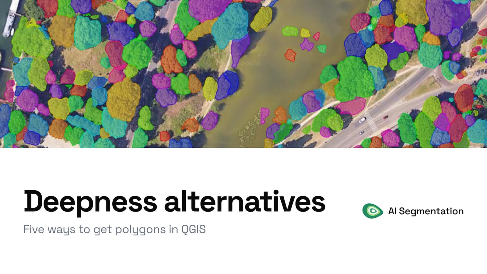
A QGIS plugin that runs an ONNX model over a raster, tile by tile. You supply the ONNX model file, and the documentation links to a model zoo.
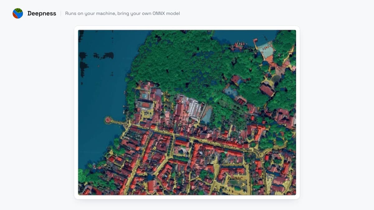
- Best for: someone whose imagery may not leave the building, who already has a model or is willing to fetch one by hand.
- Built for: people who bring their own model and choose it themselves.
- Price: free, Apache 2.0, and peer reviewed in SoftwareX if you have to cite it.
- Runs on: your machine, with no account and no network call at inference.
- Install: the plugin manager, then OpenCV and ONNX Runtime pip-installed on first use.
Where it wins
- Nothing leaves your machine, and there is no account to create.
- CPU works. On one 5,000 by 5,000 pixel tile at 20 cm, a run took 80 minutes on CPU against 61 seconds on a graphics card.
Limits
- As of 23 August 2026 the latest release in the QGIS registry is 0.6.5, from December 2024. The online docs build from a newer, unreleased branch, so their model list can be longer than the one you install.
- Open issues on their GitHub tracker report install failures on macOS (#209) and on QGIS 3.44 with NumPy 2 (#235).
5. Geo-SAM
Geo-SAM runs Segment Anything on a raster you encode first, then hands you the object under each point or box you click.
- Best for: someone offline who needs a few dozen clean outlines out of one scene and would rather click them than find and tune a model.
- Not for: a whole town. You are still clicking objects one at a time.
- Price: free, MIT.
- Runs on: your machine. A graphics card is wanted for the encoding pass, which is the real cost on a large scene. CPU works and is slow.
- Install: the plugin manager, then an encoding pass over your raster.
Where it wins
- You click and it outlines, with no model to find and nothing to tune.
- Fully offline once the raster is encoded, with no account anywhere.
Where it falls short
- You cannot click anything the encoder has not covered yet.
Three more tools cover narrower cases. Polygonize (raster to vector) is already in the GDAL toolbox and costs nothing, if your raster is a clean binary mask. samgeo is the Geo-SAM family for a Python pipeline instead of a panel. GeoAI is a wider toolbox of models, and an evening of install.
Side by side
| Tool | What you feed it | What you install | GPU | Account | Imagery leaves your machine | Cost for a real job |
|---|---|---|---|---|---|---|
| AI Segmentation (ours) | Orthophotos, basemaps | Plugin only | No | Yes, free, no card | Yes, except Semi-Auto | Free to 1.5 km², then €39 a month for 100 km² |
| Bunting Labs AI Vectorizer | Scans, PDFs, as-builts, imagery | Plugin only | No | Yes, 150 free chunks | Yes, the tiles around your cursor | $29 or $99 a month, daily cap on the $29 |
| Mapflow | Orthophotos, basemaps | Plugin only | No | Yes | Yes with the hosted plugin | About $130 per 100 km² of rooftops |
| Deepness | Any raster, plus your ONNX model | Plugin, then OpenCV and ONNX Runtime | Optional | No | No | Free, plus the install time |
| Geo-SAM | Any raster, one object per click | Plugin, then encode the raster | Wanted | No | No | Free, plus the encoding time |
Under fifty features, none of this is worth setting up. Digitize them by hand and you will be done before QGIS has finished restarting.
How to switch from Bunting Labs
There is nothing to export. Bunting Labs writes vertices straight into the layer you already have open in QGIS, so the GeoPackage or the shapefile on your disk is the finished product, with no vendor format in between. Cancel the seat and every feature you traced stays exactly where it is.
What you lose is paper. Scanned sheets, georeferenced PDFs and as-builts have no route through AI Segmentation, Mapflow, Deepness or Geo-SAM, because all four want imagery that already sits on a coordinate system. Keep a seat for that stack, or trace it by hand at the 65 minutes their own USGS test measured.
In exchange you get the whole area in one run instead of one line at a time, no daily cap of 120 completions, and 1.5 km² a month to test on without a card.
What to remember
Bunting Labs' AI Vectorizer is built to continue the line you are drawing, one feature at a time.
Scanned sheets, georeferenced PDFs and as-builts have no route through the other four tools, which all want imagery already on a coordinate system.
Their plan limits are counted in completions per day and in 256-pixel raster chunks.
Deepness and Geo-SAM make no network call at inference, so imagery that may not leave the building points to those two, or to an on-premise offer where a vendor has one.
Under fifty features, digitize by hand. None of these tools pays back the setup at that size.
How I compared them
I judged these five on what decides the job: what you feed it (imagery, a scan, your own model file), where the computation runs, whether your imagery leaves your machine, what a real job costs after the arithmetic, and how much install work stands between you and the first polygon. Prices and version numbers come from each vendor's own pages, read on 23 August 2026.
Disclosure: entry one is ours. It sits first because it answers this article's query, not because I ranked us above the rest. One job here goes to Bunting Labs: scanned paper maps and PDF plans, which none of the other four tools read.
Questions people ask
Is there a free alternative to Bunting Labs?
Three of the five here have one. Deepness and Geo-SAM are free outright, under Apache 2.0 and MIT, and you pay in install time. Our own free tier covers 1.5 km² of automatic detection and 20 object detections a month with no card. Mapflow's free plan gives 250 credits capped at 25 km².
Can any of these digitize a scanned paper map?
Only Bunting Labs AI Vectorizer. The other four read imagery: orthophotos, basemaps and rasters that already sit on a coordinate system. A georeferenced PDF of a 1955 cadastral sheet goes to Bunting Labs, not to us.
Do I need a graphics card?
Not for AI Segmentation, Bunting Labs or Mapflow, because the model runs on a server and only the plugin lands on your laptop. Deepness and Geo-SAM run on your machine and both work on CPU, slowly. Deepness measured 80 minutes on CPU against 61 seconds on a card.
Does my imagery leave my machine?
With Bunting Labs, Mapflow's hosted plugin and our two cloud modes, yes. Bunting Labs sends the tiles around your cursor, Mapflow's hosted plugin sends each detection to their service (they also list an on-premise option for enterprise), and we send the imagery inside your zone to a server in Europe. Deepness and Geo-SAM make no network call at inference, and our Semi-Auto local model sends nothing either.
What does a hundred square kilometres of rooftops cost?
Mapflow charges 10 credits per km² for the buildings model plus 3 for the basemap, so about $130. On our Pro plan at €39 a month for 100 km², the same job takes the whole month's envelope. Bunting Labs' AI Vectorizer is built for tracing lines, not for whole-area extraction, so it is not priced for this job.
How fast can I get the first polygon?
AI Segmentation, Bunting Labs and Mapflow install from the plugin manager and nothing else, so minutes. Deepness pip-installs OpenCV and ONNX Runtime on first use, twenty minutes on a good day. Geo-SAM adds an encoding pass over your raster first.
Do I have to export my work to leave Bunting Labs?
There is nothing to export. It writes vertices straight into the layer you already have open, so the GeoPackage or shapefile on your disk is the finished product.
Which models does Mapflow offer in QGIS?
Some are on request only, and Segment Anything is not listed for the QGIS plugin in their docs. Check their docs that your class is available to your account.
For the wider picture, the eight AI plugins compared covers classification and cloud removal too, and the Segment Anything guide goes deeper on which plugins run which version of SAM. The QGIS AI hub indexes both.