5 Best eCognition Alternatives in 2026
Published Updated
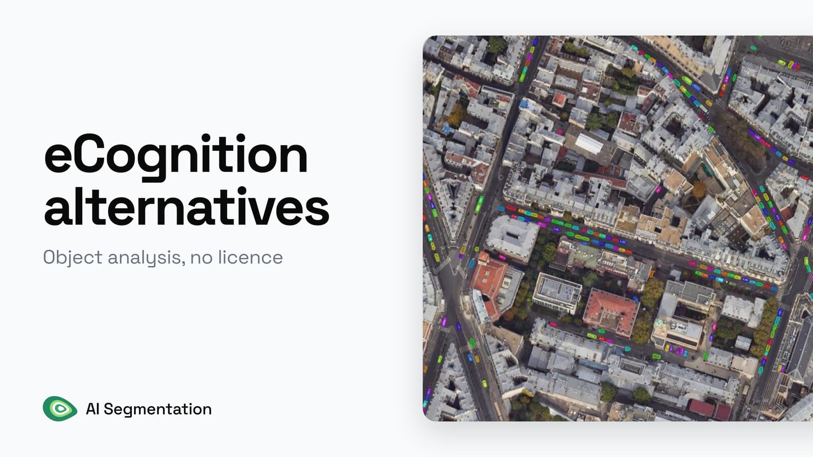
Trimble's own product page says eCognition "is no longer actively sold". If you want objects out of imagery this week, AI Segmentation, which we build, works like this: draw a zone, type the object in plain words, get polygons back. If you want the free route instead, Orfeo ToolBox carries the whole segment-then-classify chain.
On eCognition's own pages, the licence has no published price, and a rule set saved in the trial cannot be opened in a licensed copy. The tools below start from different inputs and run in different places.
Compared at a glance
| Tool | Best for | Price | Runs on | Free plan |
|---|---|---|---|---|
| AI Segmentation (ours) | Objects today, no training set | €39 a month for 100 km² | Our servers in Europe, plus a local mode | Yes, 1.5 km² a month, no card |
| Orfeo ToolBox | Segment then classify, with object statistics | Free, Apache 2.0 | Your machine | Free in full |
| SCP | Training areas, classified raster, accuracy report | Free, GPL v3 | Your machine | Free in full |
| Deepness | Strict no-upload rules, with a model you supply | Free, Apache 2.0 | Your machine | Free in full |
| eCognition | A portable, auditable method | Quote only, no list price published | Your machine, under licence | Trial only, save and export restricted |
1. AI Segmentation
AI Segmentation is ours, so weigh this entry accordingly. It is a QGIS plugin where you draw a zone, type the object you want in plain words, and get every match back as a styled GeoPackage. You get one polygon per object, with no training set and nothing to tune per sensor before the first run.
 plugin where you draw a zone, type the object you want in plain words, and get every match back as a styled GeoPackage. You get one polygon per object, with no training set and nothing to tune per sensor before the first run.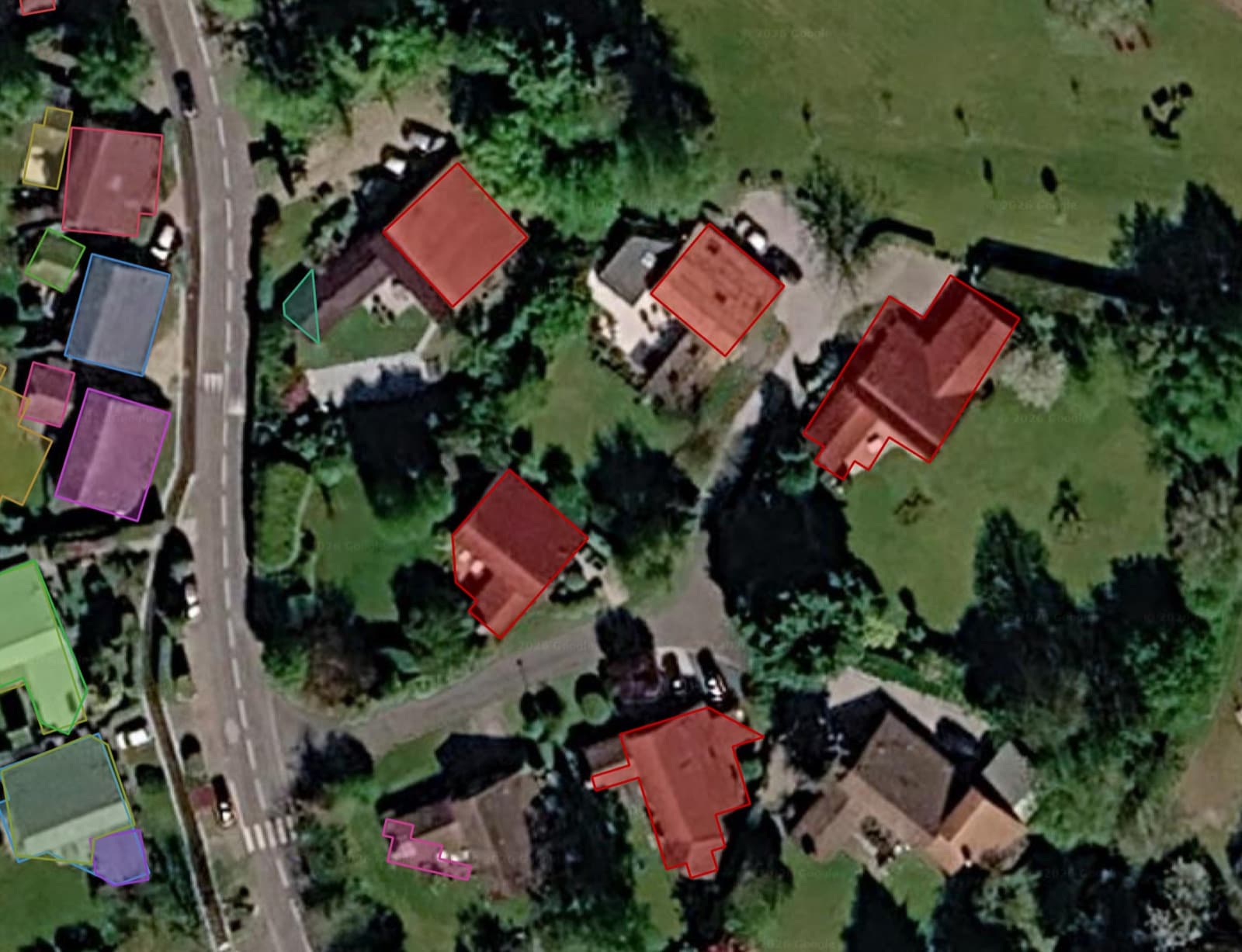
Best for: the geomatician who used eCognition to pull buildings, pools, solar panels or tree crowns out of an orthophoto, and whose client wants the layer rather than the method behind it.
Not for: work under a rule that forbids any upload, unless you stay inside the local Semi-Auto model.
Price: free for 1.5 km² of Automatic detection and 20 Semi-Auto object detections a month, with no card. Pro is €39 a month for 100 km² and 500 object detections. The small local model in Semi-Auto has no counter at all.
Runs on: our servers in Europe for the two cloud modes, and your own machine for the local Semi-Auto model. No graphics card either way.
Install: the plugin from the QGIS repository, then a free account. No weights to download, no Python environment to build.
Where it wins
- Minutes from a lost licence to a working layer. Install, sign in, draw a zone, type
building. - Every polygon comes back editable and already carries a label, a class, a confidence score and an area.
- Nothing to calibrate per sensor, so the first run on a new orthophoto is the same work as the hundredth.
Where it falls short
- The two cloud modes send imagery to a server. If nothing at all may leave the machine, use the local Semi-Auto model, or use Deepness below.
Try AI Segmentation free in QGIS, no card needed
2. Orfeo ToolBox
A remote-sensing library with a QGIS Processing provider. LargeScaleMeanShift cuts a scene into objects, TrainImagesClassifier labels them, and the pair is the closest free thing to what you were doing in eCognition.
Best for: the eCognition user who tuned scale, shape and compactness by hand and wants the same segment-then-classify chain without a licence.
Built for: a tuned, repeatable segment-then-classify chain. Parameters are set per sensor.
Price: free, Apache 2.0.
Runs on: your machine, CPU only, no account. The command line works too.
Install: OTB itself, then the OrfeoToolbox Provider plugin, which left QGIS core at 3.36.
Where it wins
LargeScaleMeanShiftchains smoothing, segmentation, small-region merging and vectorization in one pass.- The vector file it writes already carries the per-band mean and standard deviation for every polygon, and that attribute table is what
TrainImagesClassifierthen learns from.
Limits
- The defaults are spatial radius 5, range radius 15, minimum size 50 pixels and tiles of 500 by 500. Object size is set through those parameters.
CookBook · LargeScaleMeanShift · TrainImagesClassifier
3. Semi-Automatic Classification Plugin
A QGIS workbench where you draw training areas over a multi-band raster, pick an algorithm, and get a classified raster plus an accuracy report. It has been in the QGIS repository since 2013.
Best for: the person whose eCognition work was land cover, crop type or burn scars, and who has to defend the result with numbers rather than with a rule file.
Not for: objects with clean edges. It classifies pixels, not segments.
Price: free, GPL v3.
Runs on: your machine, CPU is fine, no account. An optional tool downloads Landsat and Sentinel-2 scenes, and that is the only time it talks to a server.
Install: the plugin from the QGIS repository, then its dependencies. It sits on Remotior Sensus underneath and fetches scikit-learn and PyTorch on first use.
Where it wins
- Six algorithms ship with it: maximum likelihood, minimum distance, spectral angle mapping, random forest, support vector machine and a multi-layer perceptron.
- The accuracy report comes out of the same run, so the deliverable and its defence arrive together.
- Imagery download, band sets, training areas and classification all sit in one dock.
Limits
- It classifies pixels, not segments.
4. Deepness
A QGIS plugin that runs any ONNX model you supply over a raster, tile by tile, and writes a vector or raster layer. It is the one route here where nothing at all leaves your disk.
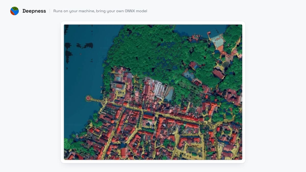
Best for: the geomatician under a rule that forbids any upload, who can find or train a model matching their own ground resolution.
Built for: people who bring their own ONNX model.
Price: free, Apache 2.0. Peer reviewed in SoftwareX, DOI 10.1016/j.softx.2023.101495, if you have to cite it.
Runs on: your machine, and only your machine. No account, no API key, and every URL in the source sits inside a comment.
Install: the plugin, then OpenCV and ONNX Runtime. A graphics card needs your own CUDA setup.
Where it wins
- No network call while it runs, which is the whole reason to pick it.
- CPU works, and a card makes it fast: on one measured machine a 5,000 by 5,000 pixel tile at 20 cm took 80 minutes on CPU and 61 seconds on GPU.
- Any ONNX file works, so a model you trained yourself drops straight in.
Limits
- As of 23 August 2026 the shipped version is 0.6.5 of 10 December 2024. Open issues on its GitHub tracker report install failures on macOS (#209) and on QGIS 3.44 with NumPy 2 (#235).
- The model zoo is a documentation page, and you download the file you pick. Each model is trained for a given ground resolution, so match it to your imagery.
5. eCognition
The object-based environment you already know. Multiresolution segmentation first, then a class hierarchy you write yourself over spectral means, texture, area, neighbours and parent-child relations.
Best for: the person whose deliverable is the method. The rule set saves as a .dcp file or packages as a .dax solution, runs unchanged over a thousand tiles, and shows an auditor why one polygon was called a building. Nothing above replaces that.
Status: Trimble's product page says it is no longer actively sold.
Price: no list price was published on the pages I read on 23 August 2026. A trial still downloads and is not time-limited, but export and save are restricted, and Trimble states that rule sets saved in the trial cannot be opened in a licensed copy.
Runs on: your machine, under licence, CPU with optional GPU acceleration.
Install: the suite, plus a licence you have to be quoted for.
Where it wins
- The rule set is portable and readable, so the method survives a staff change.
- Multiresolution segmentation is still the reference for scale, shape and compactness, and its documentation is free to read.
Limits
- Rule sets are tied to the eCognition format. If you plan to move, you can rebuild the method as a documented QGIS Processing model or a PyQGIS script.
Rule set documentation · Multiresolution segmentation reference
Side by side
| Tool | What you feed it | What you install | GPU | Account | Imagery stays local | What a real job costs | Licence |
|---|---|---|---|---|---|---|---|
| AI Segmentation (ours) | A zone plus a word | The plugin | No | Yes | Only in the local Semi-Auto mode | 1.5 km² a month free, then €39 for 100 km² | GPLv2 plugin, paid service |
| Orfeo ToolBox | Any raster, then training vectors | OTB, plus the QGIS provider | No | No | Yes | Free, plus an afternoon of tuning per sensor | Apache 2.0 |
| SCP | Bands plus training areas you draw | The plugin, then its dependencies | No | No | Yes | Free | GPL v3 |
| Deepness | Any raster, plus your own ONNX file | The plugin, then OpenCV and ONNX Runtime | Optional | No | Yes | Free, plus the hunt for a model at your resolution | Apache 2.0 |
| eCognition | Imagery, plus a rule set you write | The suite | Optional | Licence | Yes | Quote only | Proprietary |
Ten more tools exist for narrower cases, and none of them earned a card here. GRASS i.segment and SAGA give you a segmentation without installing anything. dzetsaka trains a classifier in about a minute.
The rest split by how you like to work. scikit-image and RSGISLib suit people who would rather write it than click it, Geo-SAM and samgeo do Segment Anything one object at a time, and GeoAI does tree crowns and water masks on an NVIDIA card. Mapflow returns buildings from a server at about $1.30 per km², which is the closest paid route to ours.
How to switch from eCognition
We know of no export path. Your .dcp and .dax files are eCognition formats, and we found no free tool that reads them. What carries over is everything that was not the rule set: the imagery itself, the tile boundaries, and the class rules you can read off your own hierarchy.
What does not carry over is multiresolution segmentation, which is Trimble's algorithm. Orfeo's LargeScaleMeanShift is the practical substitute, with range radius and minimum size standing in for scale.
Read the rule set documentation and the segmentation reference while both are still online and free, and treat them as the specification you rebuild from. Keep one licensed machine alive until the rebuild runs, and budget the whole thing as a migration with a deadline.
What to remember
Trimble's own product page says eCognition is no longer actively sold.
A .dcp or .dax rule set is an eCognition format and we found no free tool that reads it, so a migration is a rebuild.
Multiresolution segmentation is Trimble's algorithm. Orfeo's LargeScaleMeanShift is a free segmentation that can stand in for it.
Orfeo, SCP and Deepness make no network call during a run, so imagery under a no-upload rule stays on your disk.
Per Trimble, a rule set saved in the trial will not open in a licensed copy.
How I compared them
Five criteria, the ones that decide whether a tool replaces eCognition on Monday: what you feed it, where it runs, whether your imagery leaves the machine, what a real job costs, and how much install work stands between you and the first result. Every price, licence and version here was read on 23 August 2026 from the project's own pages, and the licences from each repository's LICENSE file.
I co-founded TerraLab, so entry one is ours. It gets the same five lines as everything else and one limit stated flat.
There is one job I send elsewhere. If your contract forbids any upload at all, do not buy our cloud modes. Install Deepness, supply your own ONNX model, and keep every pixel on your own disk.
Questions people ask
What happens to my existing eCognition rule sets?
They stay where they are. Your .dcp and .dax files are eCognition formats and we found no free tool that reads them, so there is nothing to convert. Keep a licensed machine alive while you rebuild the method as a QGIS Processing model or a Python script.
Can I still download eCognition?
Yes. Trimble keeps the page up for existing customers, and the trial still downloads without a time limit. Export and save are restricted in the trial, and Trimble states that rule sets saved in it will not open in a licensed copy.
What does an eCognition licence cost in 2026?
No list price is published. If a reseller is still quoting you, ask one question and write the answer down: what does one seat cost per year, all in with maintenance, and for how many more years is it renewable?
Is there a free multiresolution segmentation?
Not that algorithm, which is Trimble's. In QGIS the practical substitute is Orfeo's LargeScaleMeanShift, which merges neighbouring pixels under a homogeneity rule the same way and gives you a scale-like control through its range radius and minimum size.
Can I keep all my imagery on my own machine?
Yes, and three of the five above qualify. Orfeo, SCP and Deepness never call out during a run. Our two cloud modes send imagery to a server in Europe, and the local Semi-Auto model does not.
How long until I have buildings out of one orthophoto?
With AI Segmentation, minutes: install the plugin, sign in, draw a zone, type building. With Orfeo, an afternoon of tuning for the first sensor, then it repeats. With Deepness, as long as it takes to find an ONNX model trained at your ground resolution, which is where most of the effort goes on that route.
If you want the model-based half of this in more depth, the eight AI plugins compared covers every plugin that runs a network over a raster in QGIS, and the Mapflow article covers the paid server-side route on its own terms. The QGIS AI hub lists the rest.