9 Best AI Plugins for QGIS in 2026 (Free and Paid)
Published Updated
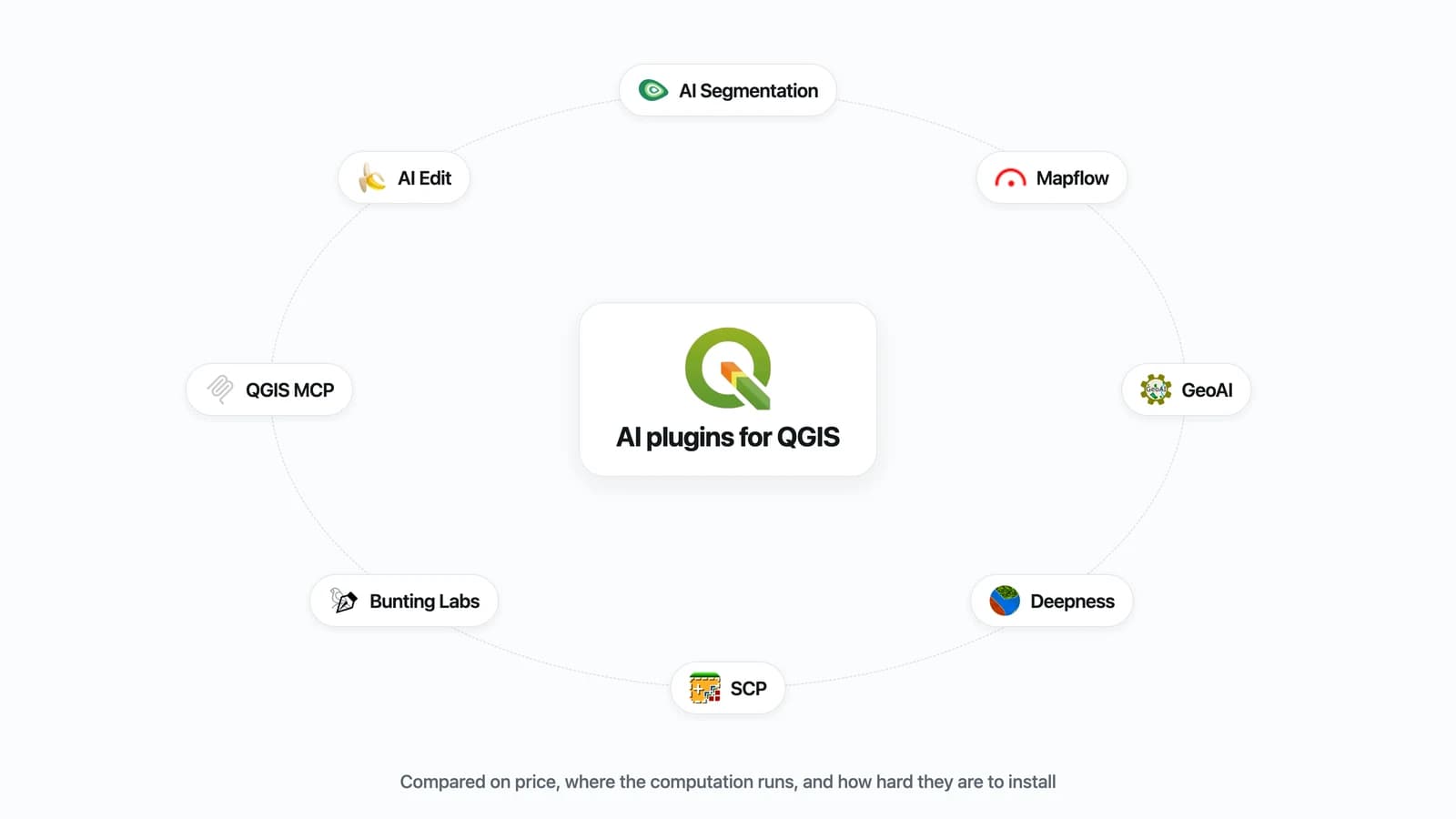
Nine AI plugins install in QGIS today, and between them they do four jobs. To pull every object of one kind out of imagery, start with AI Segmentation, ours, or with Mapflow if you would rather see the cost per km² before the run starts.
 today, and between them they do four jobs. To pull every object of one kind out of imagery, start with AI Segmentation, ours, or with Mapflow if you would rather see the cost per km² before the run starts.
To have a whole QGIS task done from one typed sentence, AI Agent, also ours, has the chat built into QGIS. If nothing may leave your machine, GeoAI and Deepness are free and local. Land cover from your own training areas is still SCP, thirteen years on. Prices, licences and install counts were read from each plugin's own source on 18 August 2026, and AI Agent's on 23 September 2026.
Compared at a glance
| Plugin | Best for | Price | Runs on | Install |
|---|---|---|---|---|
| AI Segmentation (ours) | Every object of one kind, from imagery | Free to 1.5 km² a month, then €39 | Our servers, in Europe | Plugin manager, minutes |
| AI Agent (ours) | A whole QGIS task from one typed sentence | Free for 7 messages a month, then €49 | Our servers in the EU, tools in your QGIS | Plugin manager, then sign in |
| Mapflow | Buildings, roads, fields, forest, priced per km² | $0.10 a credit, paid from $50 | Geoalert's servers | Plugin manager plus an account |
| GeoAI | SAM, tree crowns, water masking, your own trainer | Free, MIT | Your machine | An evening |
| Deepness | Any ONNX model you supply, offline | Free, Apache 2.0 | Your machine | About twenty minutes |
| SCP | Land cover from training areas you draw | Free, GPL v3 | Your machine, CPU | Plugin manager, minutes |
| Bunting Labs AI Vectorizer | Tracing one line at a time while you digitize | $29 or $99 a seat a month | Their servers | Plugin manager plus an account |
| AI Edit (ours) | Rewriting the imagery, then vectorizing it | Free for 3 generations, then €29 | Our servers | Plugin manager, minutes |
| QGIS MCP | Driving QGIS from an LLM client | Free, you pay for your own LLM | Your machine | Plugin manager plus uv |
What counts as an AI plugin for QGIS
An AI plugin runs a learned model over your data instead of a fixed rule. Three shapes turn up here. Some read a raster and hand back vectors or a classified raster, which is what the detection and land-cover plugins do. One rewrites the pixels themselves.
Two let a language model drive QGIS: AI Agent with the chat and the model built in, QGIS MCP through an outside client you set up and pay for. All nine install from the plugin manager. Where the model runs, on your machine or on someone's server, decides most of the rest.
1. AI Segmentation
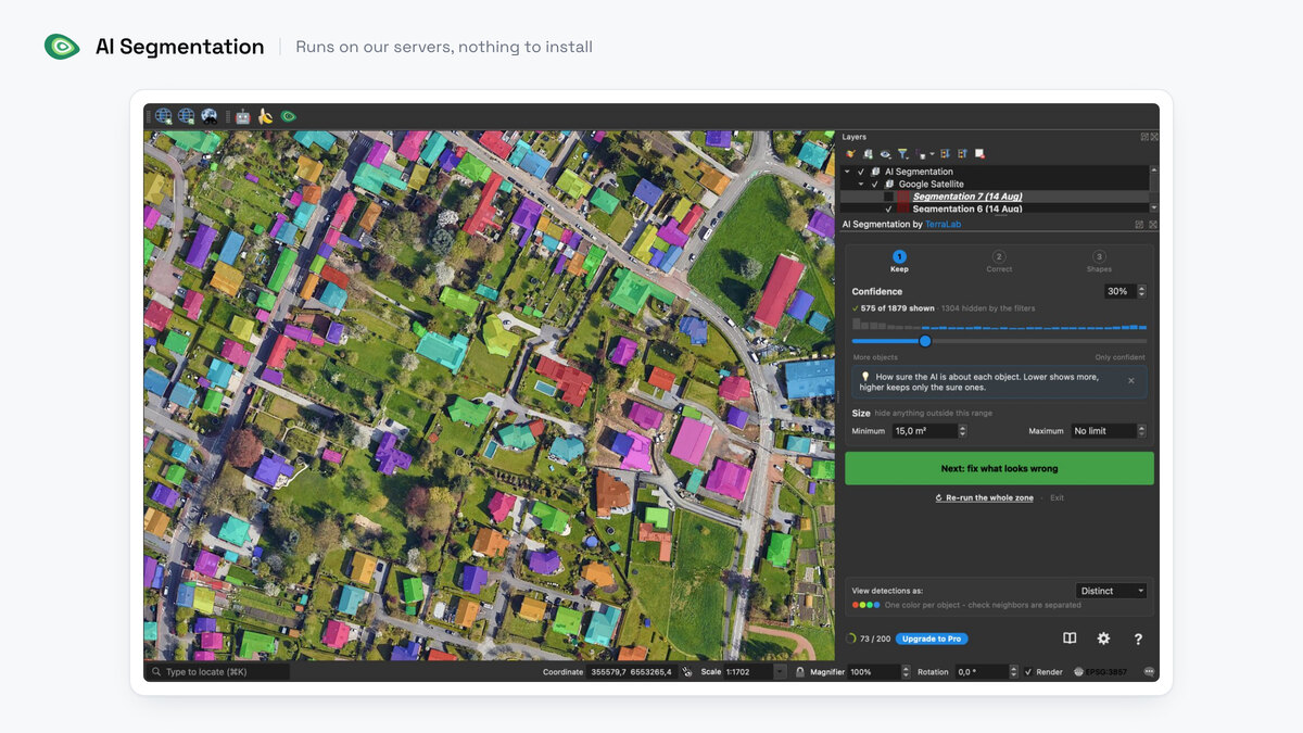
AI Segmentation is ours, so weigh this entry accordingly. Draw a zone, type an object in plain words, and every match comes back as its own polygon. Solar arrays on an industrial roof, the rooftops of a village, the pools of a district.
- Best for: a whole layer of one object type, read straight off orthophotos or a basemap.
- Not for: tracing a single feature by hand, or a raster you are not allowed to send to a server.
- Price: free for 1.5 km² of automatic detection and 20 object detections a month, no card. Pro is €39 a month for 200 km² of automatic detection, counted on the map whatever the imagery, plus 500 object detections and no limit on the zone you draw.
- Runs on: our servers, in Europe. The Semi-Auto mode runs on your own machine and has no counter.
- Install: plugin manager, QGIS 3.22 and up. No weights download, no graphics-card setup, no Python environment.
Where it wins
- Filtering happens in the panel, not the attribute table. On one Paris run, dragging confidence and area took 635 polygons down to 82, and those 82 still held 84% of the built area.
- Output is a styled GeoPackage with a label, a class, a confidence score and an area per feature.
- Any laptop will do, because the model never touches your hardware.
Where it falls short
- We process the imagery on a server in Europe. If nothing may leave your machine, use Semi-Auto or one of the local plugins below.
- The free tier stops at 1.5 km² of automatic detection a month.
Try it free in QGIS, no card needed
2. AI Agent
AI Agent is ours as well, so weigh this entry accordingly. It is a chat panel docked in QGIS: you type the task in plain words, and it finds the data, runs the Processing tools, styles the layers and builds the print layout in the project you have open. It is the same idea as QGIS MCP, at the end of this list, with the difference that the chat and the model come with the plugin: no separate LLM client to install, no API key of your own, no model bill.
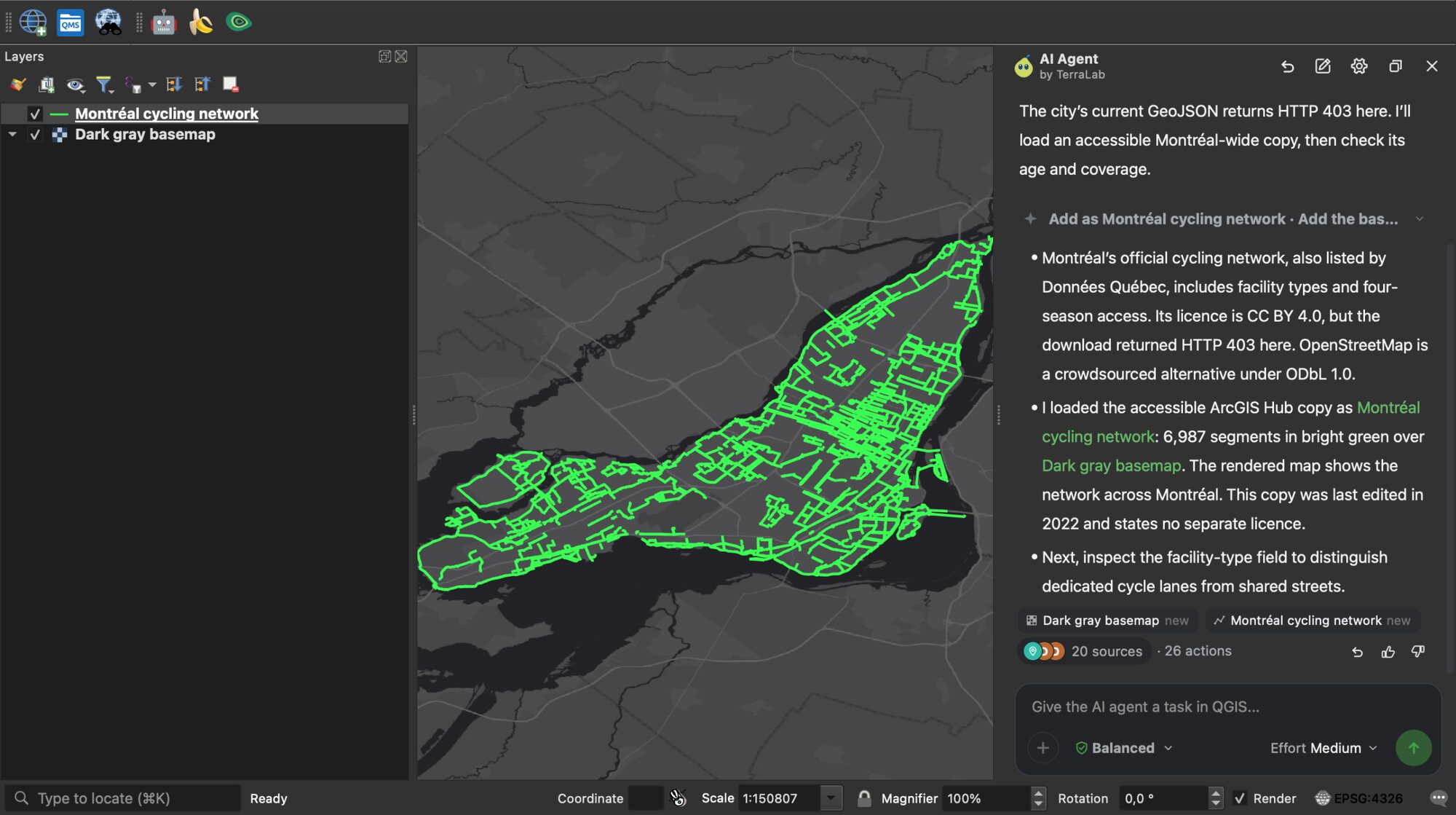
- Best for: the QGIS work you would otherwise click through: finding and loading open data, geoprocessing, styling, a print layout.
- Not for: a project whose description may not leave your machine. Your message and a summary of the open project go to our servers, never your data files.
- Price: free for 7 messages a month, no card. Pro is €49 a month for 300 messages, with the Medium and High effort levels.
- Runs on: our servers in the EU for the model. The tools run in your own QGIS.
- Install: plugin manager, QGIS 3.28 and up, on Windows, macOS and Linux, then sign in from the panel.
Where it wins
- It finds the data itself, from 700+ open datasets across 55 sources, national mapping agencies included.
- It asks before anything destructive, and one click undoes everything a message changed.
- It drives AI Segmentation and AI Edit when they are installed, which keep their own credits.
Where it falls short
- Ten free messages a month go fast on real work.
- It drives the plugins on its own list, not every plugin on this page: it does not call Mapflow, GeoAI or Bunting Labs.
3. Mapflow
Pick an area, pick a model, get vector layers back. Buildings with optional height, roads, agricultural fields, forest with optional crown, construction sites.
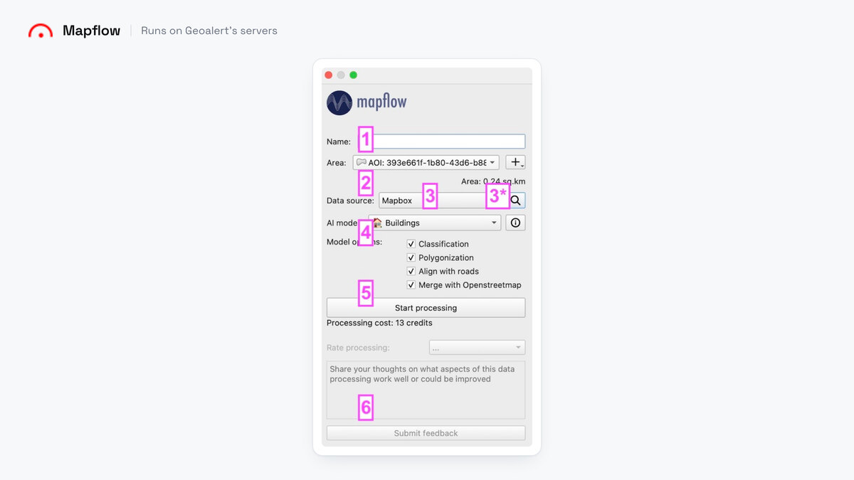
- Best for: buildings, roads or forest over a wide area, with the bill known in advance.
- Not for: an object type outside their list. You choose from the models they ship.
- Price: $0.10 a credit. Buildings cost 10 credits per km², rounded up to a whole km². Paid plans start at $50 for 500 credits, then $100 and $300 a month.
- Runs on: Geoalert's servers. No graphics card, nothing to install beyond the plugin.
- Install: plugin manager, then an account. Minutes.
Where it wins
- The cost of the run appears in the panel before you start it, which no other paid plugin here does.
- 250 free credits at signup, enough to try a real neighbourhood.
- The widest model list of any server-side plugin on this page.
Where it falls short
- The free tier is capped at 25 km² and download is disabled.
- The licence file says GPL v3 while the README says GPL v2 or later. Read the file.
Docs · Video walkthrough of a building run
4. GeoAI
The deepest toolbox here, from Qiusheng Wu. SAM, DeepForest for tree crowns, OmniWaterMask, Mask R-CNN, and a trainer for your own model.
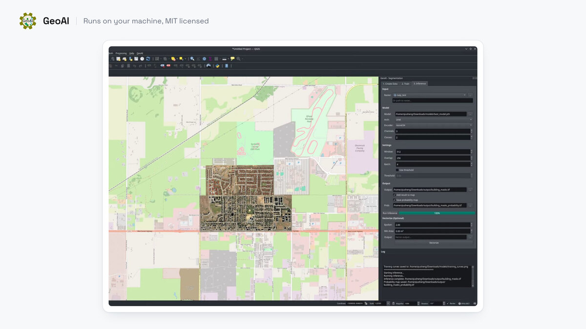
- Best for: trying several model families on your own machine, with the imagery never leaving it.
- Not for: a first install the afternoon before a deadline.
- Price: free, MIT.
- Runs on: your machine. CUDA recommended, Apple MPS supported, CPU fallback. SAM 3 needs an NVIDIA card.
- Install: budget an evening. I failed on both my Mac and my Windows machine, and my hardware was not enough for the runs I wanted.
Where it wins
- Nothing else free covers this much ground: segmentation, tree crowns, water masking and detection under one dock.
- It trains on your own labels, so the classes are yours.
- The version is pinned to the QGIS 3.44 series, to avoid a regression in 3.42.2.
Where it falls short
- Reported install failures are overwhelmingly Windows. The maintainer closes them fast: #827, #519, #414, all closed.
- The good models want a graphics card, and SAM 3 wants an NVIDIA one specifically.
Docs · Step-by-step setup video
5. Deepness
Hand it an ONNX file, point it at a raster, and it runs the model tile by tile. It also ships a small library of ready-made models.
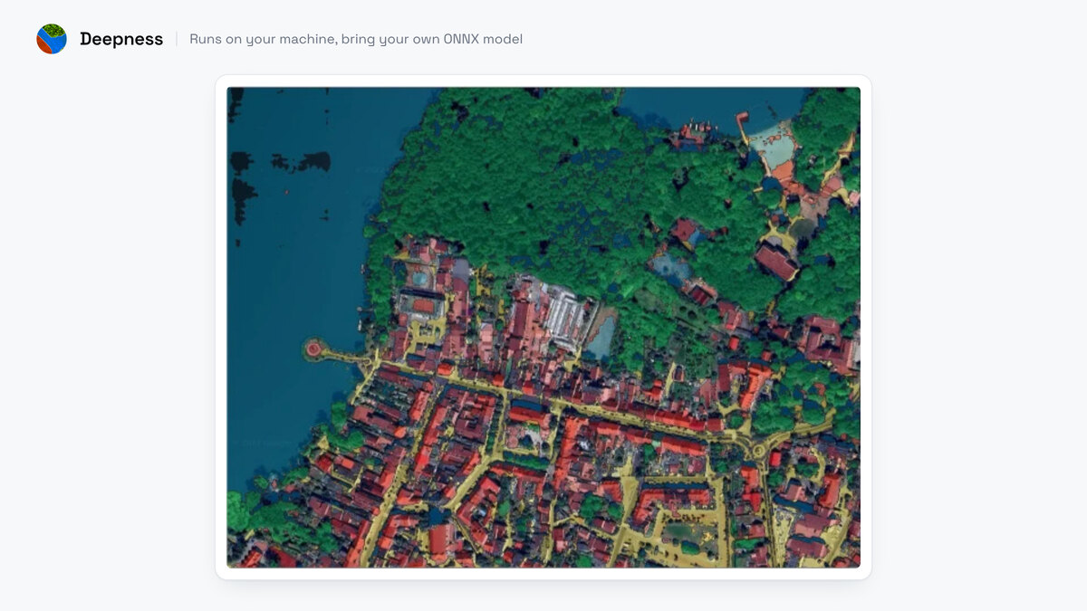
- Best for: running a model you already have, or one from their library, with nothing leaving your machine.
- Not for: macOS. The maintainers have no Mac to test on (#209) and the install page still reads "MacOS - SOON".
- Price: free, Apache 2.0. Published in SoftwareX in 2023 if you have to cite it.
- Runs on: your machine. It works on CPU, and a GPU needs your own CUDA setup.
- Install: about twenty minutes for me, and worth it.
Where it wins
- The shipped library covers land cover, buildings, roads, solar panels, tree tops and cars.
- It tiles a raster natively, so a large scene is one job rather than a script.
Where it falls short
- Each shipped model is only reliable on data resembling its training set.
- The plugin pip-installs OpenCV and ONNX Runtime on first use, and that is what breaks: #197 and #235 are still open, #193 is the same story.
Docs · Model loading and inference video
6. SCP
Luca Congedo's Semi-Automatic Classification Plugin has been in the repository since 2013 and installed 2,634,130 times, more than everything else on this page put together. You draw training areas, pick a classifier, and get a classified raster.
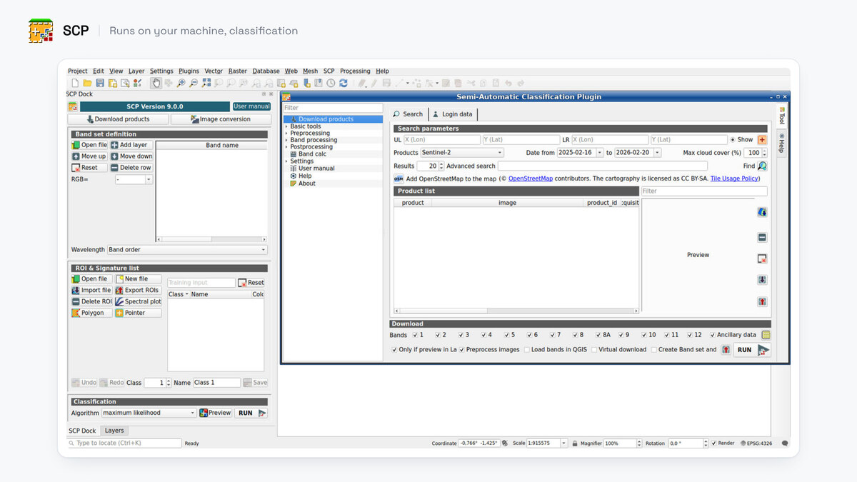
- Best for: land cover, land use and change detection from training areas you draw yourself.
- Not for: object outlines. It labels pixels, not things.
- Price: free, GPL v3.
- Runs on: your machine, CPU.
- Install: plugin manager, minutes, but check the version first.
Where it wins
- Version 9 added random forest, a neural-net classifier and pretrained models, alongside minimum distance, maximum likelihood and spectral angle mapping.
- It downloads Landsat and Sentinel-2 for you, so the imagery and the classification live in one place.
Where it falls short
- The 9.x line needs QGIS 4, so on QGIS 3 you get 8.5.0 from November 2024 and none of the newer classifiers.
- Apple Silicon has an open crash report.
Manual · Supervised classification walkthrough
7. Bunting Labs AI Vectorizer
Autocomplete for hand digitizing. Start editing a layer, place two vertices along a road or a river, and it traces ahead of your cursor.
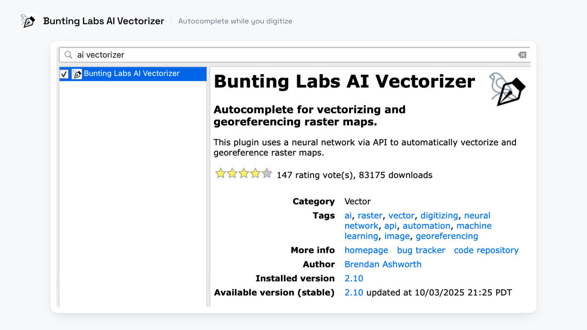
- Best for: following a line you can see but do not want to click a hundred times.
- Not for: returning every match in an area. It draws one feature at a time and never sweeps a zone.
- Price: 150 map chunks free to evaluate with, then a first day at $1, then a plan. Personal is $29 per seat per month, capped at 120 completions a day. Professional is $99, uncapped, with no data retention.
- Runs on: their servers. The imagery around your cursor goes out, the geometry comes back.
- Install: plugin manager, then an account. Licence GPL 2.0.
Where it wins
- Two vertices are enough to start a trace, which is the fastest thing here for a long linear feature.
- The $99 tier is uncapped and retains none of your data.
Where it falls short
- The free evaluation stops at 150 map chunks, and a dense scan can spend that in one session.
- Their listing advertises georeferencing too, but the pricing page meters AI Georeferencer separately, at 25 or 100 a month.
Docs · Their own demo of the autocomplete
8. AI Edit
AI Edit is ours, so weigh this entry accordingly. It changes the pixels rather than reading them. Clouds off a scene, a summer field turned winter, an orthophoto rendered as a clean land-cover map, then vectorized into a layer.
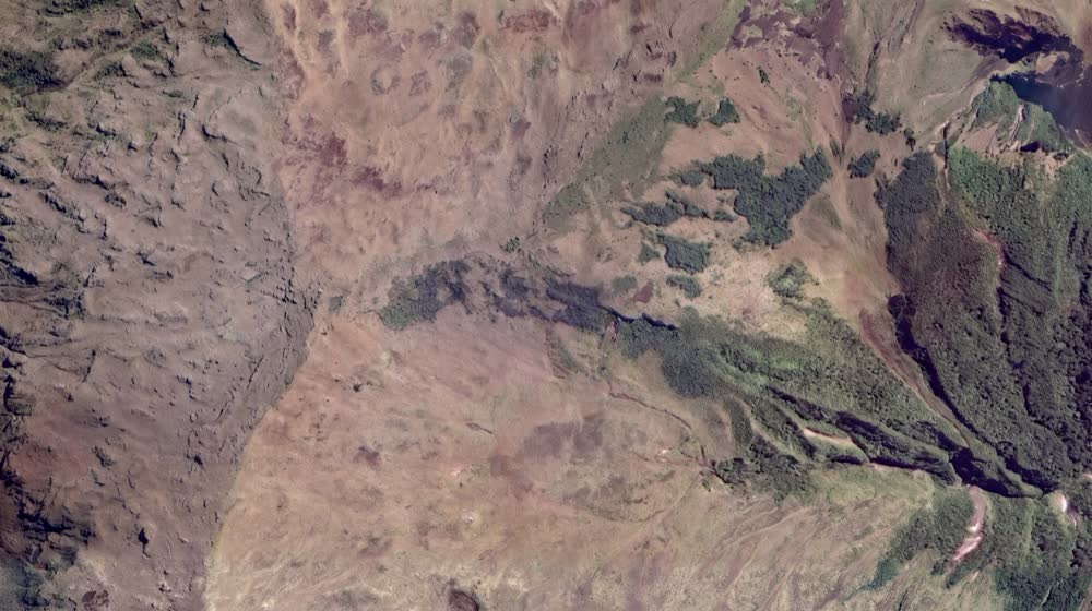
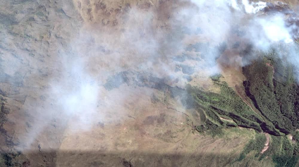
- Best for: making a scene usable before you map from it, or turning imagery into a cartographic render.
- Not for: counting or outlining objects. That is the segmentation plugin's job, not this one.
- Price: three free generations, then €29 a month.
- Runs on: our servers. No graphics card.
- Install: plugin manager, QGIS 3.22 and up.
Where it wins
- The output stays georeferenced on the same extent, so it drops back into the project as a layer.
- It vectorizes the result, so a rendered land-cover map becomes polygons in one pass.
Where it falls short
- It rewrites the imagery. What comes back is a new scene, not a measurement of the old one.
- Three free generations go fast, and after that it is €29 a month.
9. QGIS MCP
Nicolas Karasiak's plugin opens a socket inside QGIS, and a companion server exposes 118 operations to any Model Context Protocol client. Layers, features, editing, styling, processing, rendering, layouts, atlas, SQL.
- Best for: running QGIS operations by asking for them, from Claude Code, Claude Desktop, Codex, Cursor or VS Code.
- Not for: detection of any kind. It ships no model.
- Price: free. Plugin GPL 2.0, server MIT. You pay for your own LLM.
- Runs on: your machine. The model runs wherever your client points.
- Install: QGIS 3.28 or later, plus
uv.
Where it wins
- 118 operations is most of what a QGIS session does, and none of them need you to remember the menu path.
- It is the only tool here that could call the other eight.
Where it falls short
- It ships no detection model, so it does not replace the detection plugins on this page.
- You install, set up and pay for the LLM client yourself. AI Agent, #2, does the same job with the chat and the model included.
Setup and agent integration guide
Installing them
The plugins that run locally are free. The price is your afternoon. QGIS ships its own Python on Windows, dependencies land in the other one, and a numpy 1 against numpy 2 mismatch takes the whole plugin down. I failed to install GeoAI, Deepness and GeoOSAM on both my Mac and my Windows machine on the first attempt. Deepness eventually worked and was worth it.
| Plugin | Install path | Watch for |
|---|---|---|
| AI Segmentation (ours) | Plugin manager, QGIS 3.22 and up | Nothing to download beyond the plugin |
| AI Agent (ours) | Plugin manager, QGIS 3.28 and up, then sign in | Nothing to download beyond the plugin |
| Mapflow | Plugin manager, then an account | Free tier capped at 25 km², download disabled |
| GeoAI | Plugin manager, then its Python dependencies | Windows failures dominate the issue tracker |
| Deepness | Plugin manager. It pip-installs OpenCV and ONNX Runtime on first use | macOS untested, install page reads "MacOS - SOON" |
| SCP | Plugin manager | 9.x needs QGIS 4, QGIS 3 gets 8.5.0 |
| Bunting Labs AI Vectorizer | Plugin manager, then an account | No free tier, so budget the $1 first day |
| AI Edit (ours) | Plugin manager, QGIS 3.22 and up | Nothing to download beyond the plugin |
| QGIS MCP | Plugin manager plus uv, QGIS 3.28 and up | You supply and pay for the LLM client |
Two habits save the evening. Install one at a time and restart QGIS between each, because a failed dependency install often leaves the environment worse than it found it. And read the requirements page before the plugin manager: GeoOSAM states in bold that both of its install methods still need a manual pip install of nine packages.
Also worth knowing. Smaller or newer, all alive as of August 2026, and all free:
- SamGeo, Qiusheng Wu again, SAM segmentation from text, point or box prompts.
- Geo SAM, SAM 1 through 3 for landforms, one object at a time.
- GeoSeg Studio, a full semantic segmentation pipeline for raster.
- Aerial LiDAR Classifier, deep learning semantic segmentation for aerial LiDAR.
- AgenticGIS, an in-QGIS chat assistant that runs QGIS operations through an LLM.
How I chose
Five questions, asked of every plugin in the same order: what you feed it, where the computation runs, whether your imagery leaves the machine, what one real job costs, and how long the install took me. I read every price, licence and issue thread on 18 August 2026, off the vendor's own page or repo. Three of the nine are ours, AI Segmentation, AI Agent and AI Edit, and they get the same five lines as the rest.
One case sends you away from every paid tool here. If your imagery sits under a confidentiality clause and may not leave the building, no cloud plugin on this page is the right answer, ours included: use Deepness with your own ONNX model, or GeoAI, both free and both local. Same for a small job. Under fifty features, digitize them by hand, because setting any of this up costs more than the drawing does.
Install counts come from the official QGIS plugin index, the same field for every row, read the same day: SCP 2,634,130, Mapflow 202,501, Bunting Labs 95,566, Deepness 84,288, GeoAI 58,992, AI Segmentation 51,497, QGIS MCP 33,950, AI Edit 21,581. AI Agent reached the index on 11 September 2026, after that count. They say what people already run, and I did not use them as a ranking.
Questions people ask
What is the best free AI plugin for QGIS?
For extracting objects from imagery on your own machine, GeoAI. It is MIT licensed, it covers SAM plus tree crowns, water masking and Mask R-CNN, and among the free options here only SCP has more installs. Budget an evening. For land cover from your own training areas, SCP, which has been doing it since 2013.
Is there an AI plugin for QGIS that works without a GPU?
Yes, five of them. Mapflow and our AI Segmentation run the model on a server, so any laptop works, and Bunting Labs runs remotely too. Our AI Agent runs its language model on our servers, and QGIS MCP needs no model at all. Everything that runs locally wants a graphics card once you move past small areas, and this class of model specifically needs an NVIDIA card with CUDA.
What is a cheaper alternative to Mapflow?
It depends on the area. Mapflow charges 10 credits per square kilometre for buildings, and a credit is $0.10, so a hundred square kilometres of buildings is about $100. Our AI Segmentation is a flat €39 a month for 200 km² of automatic detection, counted on the map whatever the imagery, with no per-zone cap, and free for 1.5 km² a month. If you want no bill at all, GeoAI and Deepness are free and run on your machine.
Does QGIS have Segment Anything?
Not in core QGIS. Several plugins bring it: GeoAI and SamGeo from Qiusheng Wu, and Geo SAM. The SAM guide compares them properly.
Which of these can I use on client work without a licence problem?
GeoAI is MIT and Deepness is Apache 2.0, both permissive. SCP is GPL v3. Bunting Labs is GPL 2.0 and QGIS MCP is GPL 2.0 with an MIT server. Mapflow ships a GPL v3 licence file while its README says GPL v2 or later, so read the file if it matters to you. None of that covers the imagery you feed them, which stays your responsibility.
Can I run any of this on a batch of 400 tiles?
Deepness tiles a raster natively. Mapflow processes an area server-side. For a real pipeline you want Python rather than a plugin, and segment-geospatial is the package to start from.
If you are still deciding, the SAM guide goes deeper on which plugins run which version of Segment Anything, and the building footprints guide walks one job end to end on real data. For what the term "GeoAI" actually covers before you pick a plugin sold under that name, what GeoAI means sorts vendor talk from the five things these models actually do. The QGIS AI hub lists everything we build for QGIS in one place.