Google Earth AI Alternative for QGIS
Published Updated
The closest alternative to the image generator Google Earth ran for one day is AI Edit, ours: it runs the same model inside QGIS, on the aerial photography you already have open, and gives the answer back as a map layer that knows where it belongs, not a screenshot. The day was 30 to 31 July 2026. Google Earth on the web had a button marked create image: you typed a sentence into the box under the map, and Nano Banana drew a photorealistic version of that exact spot. Then Google took it away.
 , on the aerial photography you already have open, and gives the answer back as a map layer that knows where it belongs, not a screenshot. The day was 30 to 31 July 2026. Google Earth on the web had a button marked create image: you typed a sentence into the box under the map, and Nano Banana drew a photorealistic version of that exact spot. Then Google took it away.
What the button did
Image generation in Google Earth was a create image button in Earth on the web, live from 30 to 31 July 2026, that turned a typed sentence into a photorealistic view of the place on screen, drawn by Nano Banana from Google's own satellite, aerial and 3D imagery of that spot. The result stayed inside Earth as a picture, never as a file a map could place.
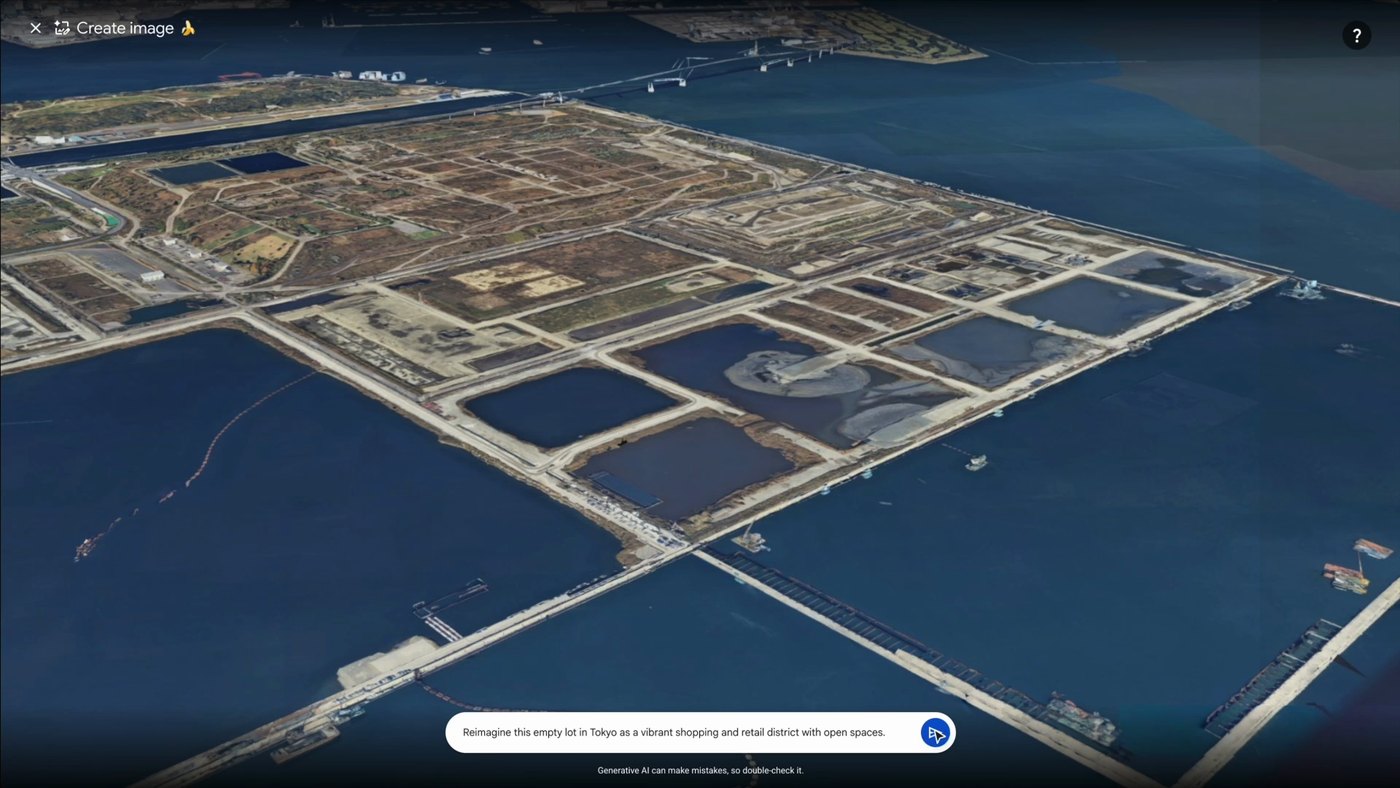
What came back had arrows to page between attempts, a Refine image button, and a Save to project button that kept it inside Earth. There was no way to get it out as a file a map could place.
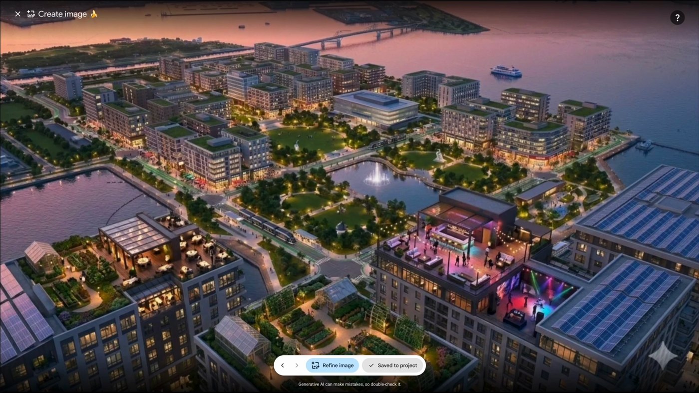
Google rolled it back on 31 July, saying it had seen shared screenshots of generated imagery that appeared to violate its policies (full statement under the questions below).
The two side by side
| AI Edit (ours) | Google Earth, create image | |
|---|---|---|
| Status | Live | Removed on 31 July 2026 |
| Where it runs | A QGIS plugin | A button in Earth on the web |
| What it draws on | The imagery in your own project | Google's imagery of that spot |
| What comes back | A map layer, placed on the ground | A picture inside Earth |
| Point of view | Straight down, 2D. 3D in progress | Any angle, photorealistic 3D |
| Setup | Plugin manager, one install | None |
Which you want depends on one thing. If the picture has to go back on a map next to your own data, use AI Edit. If it is going on a slide and nothing after it cares where the place is, you do not need a plugin. If you need a tilted, street-level view, neither one replaces Earth: it looks straight down, in 2D, and a 3D view is something we are building rather than something you can use today.
1. AI Edit
AI Edit is ours, so weigh this entry accordingly. It gets the same card, the same lines and the same stated limits as the entry below.
It is a QGIS plugin that redraws the aerial photography on your screen from a written instruction. Outline an area, describe the change, and the answer comes back as a map layer sitting exactly on the photograph it was built from, so everything else in your project still lines up with it.
- Best for: a town planner, landscape architect or flood engineer showing a jury what a real site could become.
- Not for: counting or measuring.
- Runs on: our servers. Your imagery leaves your machine on every run.
- Install: the QGIS plugin manager, version 3.22 and up. No graphics card needed.
- Price: a free tier with an email and no card, then a subscription.
Where it wins
- The result lands on the exact rectangle you outlined, so two runs side by side meet cleanly and a long corridor can be done in pieces.
- It works on your imagery, not Google's: your drone flight, your 2019 survey, your national mapping agency's feed.
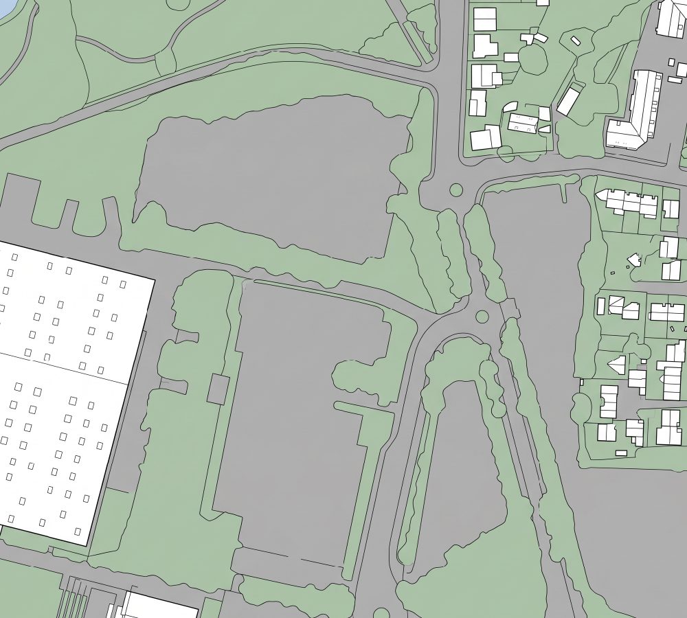
- It reads the site. In the park example below the car parks go, while the exhibition hall, both roundabouts and every mature tree stay.
Where it falls short
- It works in 2D, and Earth worked in 3D. This is the real gap. If what you have to hand a client is a view from the pavement, this tool does not produce it today. We are working on a 3D output. It is not shipped, and I am not going to pretend otherwise.
- Coverage is whatever you brought. Earth had the whole planet indexed.
- Expect two or three attempts on an area before one is worth showing.
2. Google Earth, create image
The button described above. Live from 30 to 31 July 2026.
- Status: paused by Google on 31 July 2026.
- Runs on: Google's servers.
- Install: none, it was a browser button.
- Price: see Google's Earth plans page (read 31 August 2026).
Where it won
- Every place on the planet was one search away, with photorealistic 3D on top.
Where it fell short
- In the launch video, the result was saved to a project inside Earth as a picture.
- It is gone, with no published return date.
What you can give it besides a sentence
That is the comparison. The rest of this page is about the one of the two that still works, and about what decides your results more than the wording of your prompt: what else you put in. In the launch video, Earth took a sentence. Inside QGIS, two other kinds of input reach the model.
Any layer already open in your project
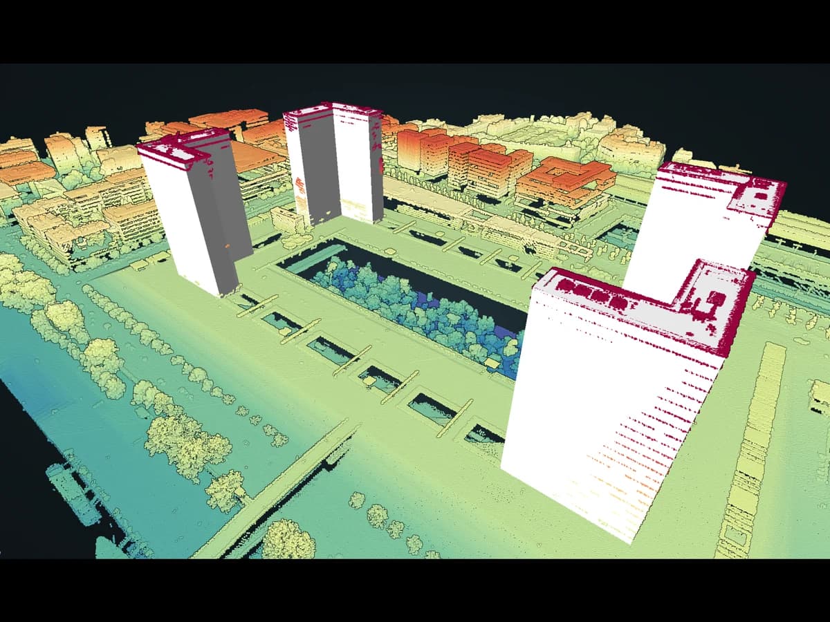
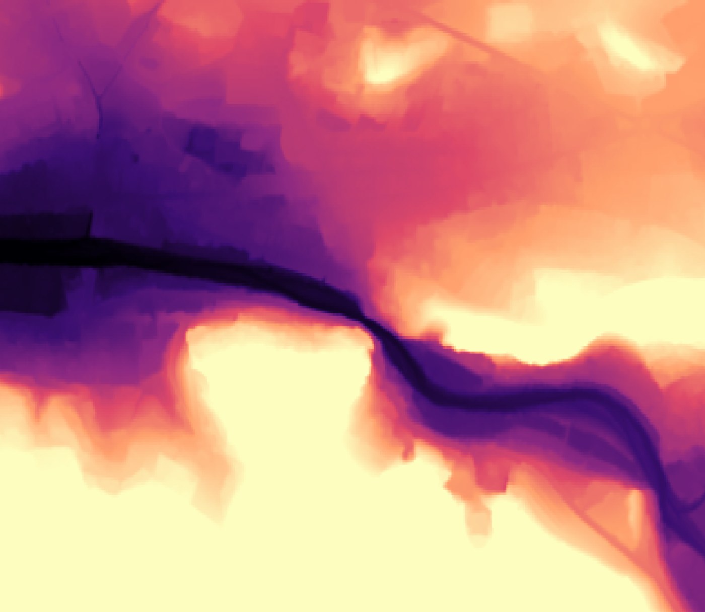
You can hand the model one of your own map layers as guidance: an elevation model, a cadastral plan, a flood map, a land-use map with its legend. It is cropped to the area you outlined and never drawn on your canvas.
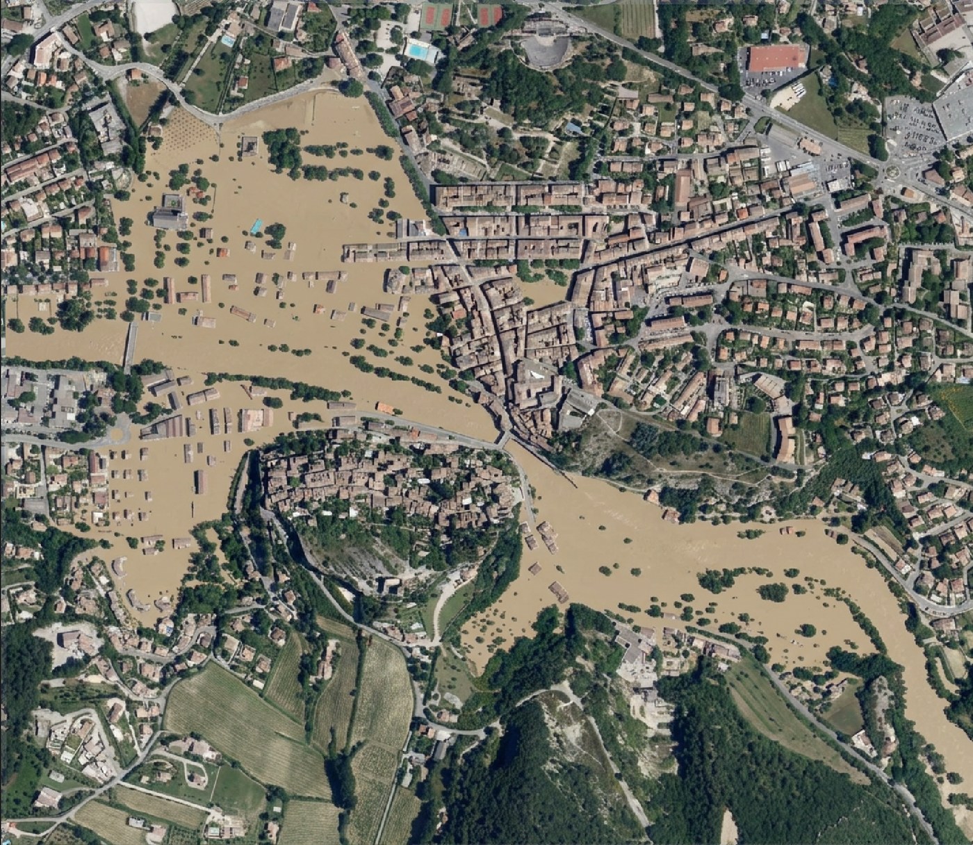
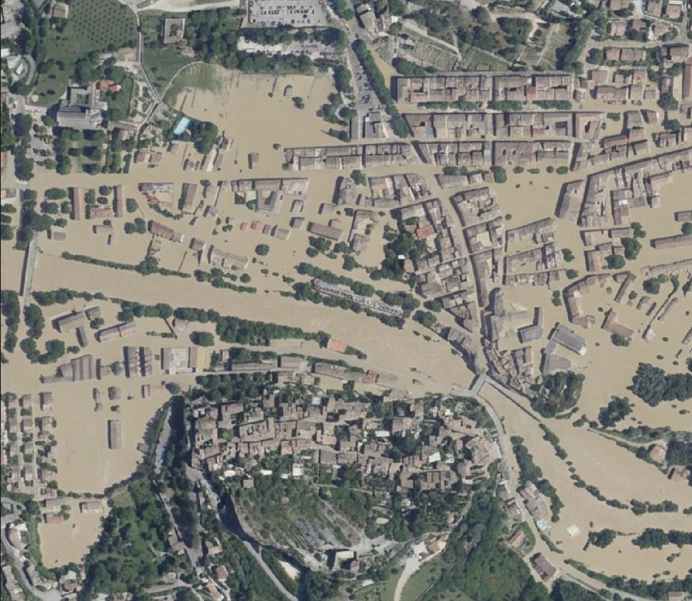
Below is an elevation model of Vaison-la-Romaine, a map where the colour of each pixel is the height of the ground at that point.
Marks you draw on the map itself
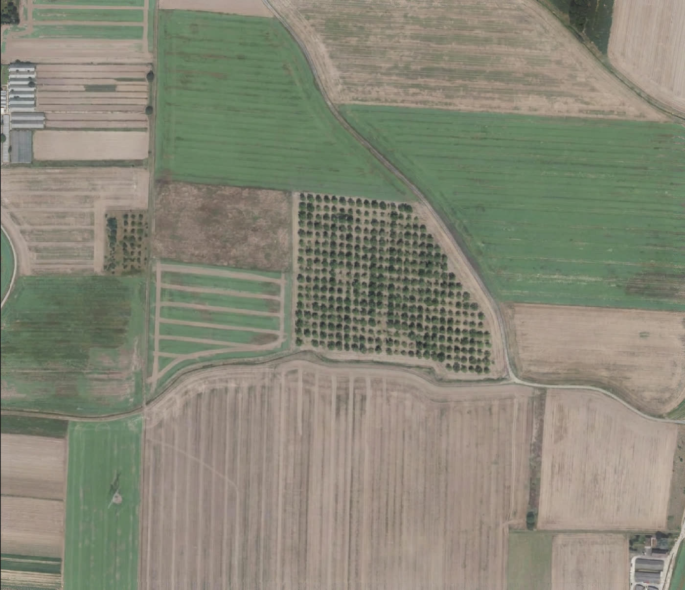
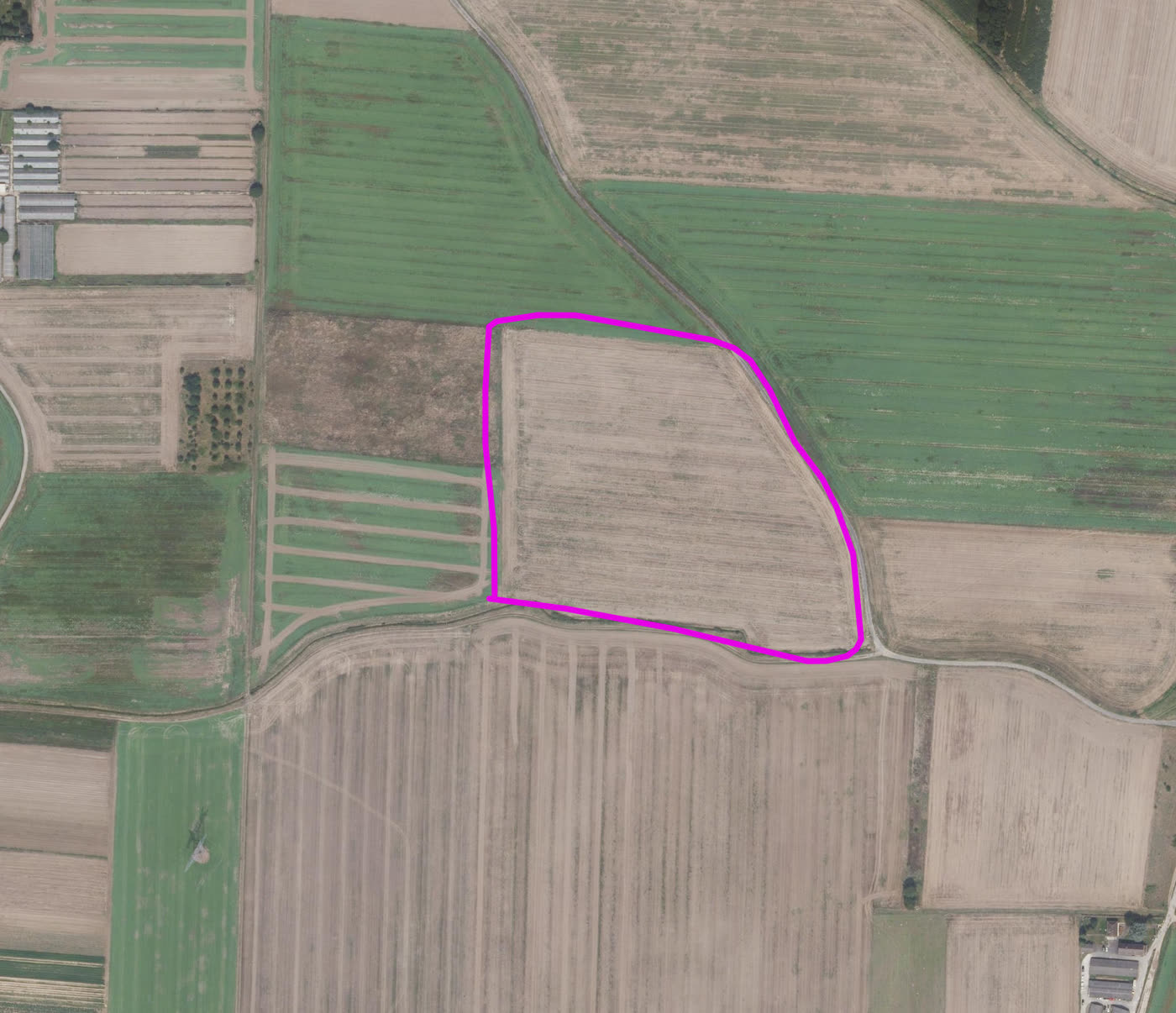
The second input is simpler: stop describing a spot in words and point at it. Draw on the map with a pencil, a line, an arrow or a circle, in a colour you then name in the prompt. The marks travel with the request and are taken back out of the result.
Examples
Four runs on the same 339 m square over Nantes. One photograph, four different questions.
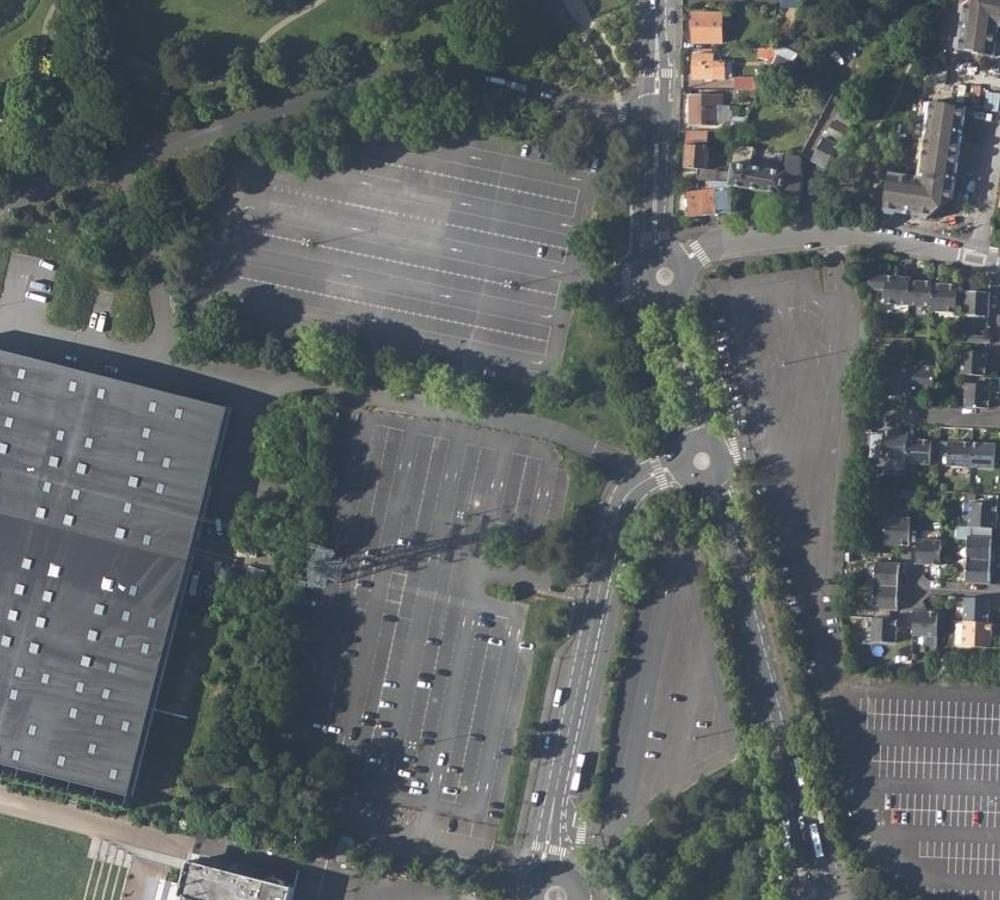
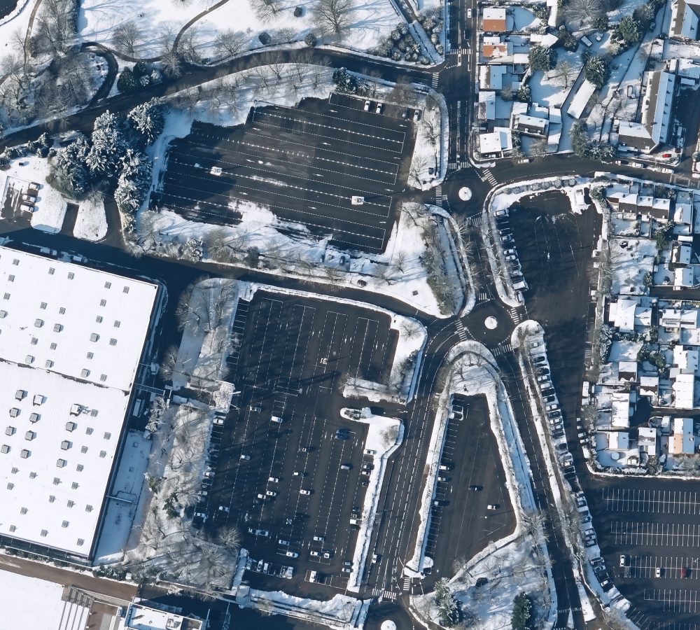
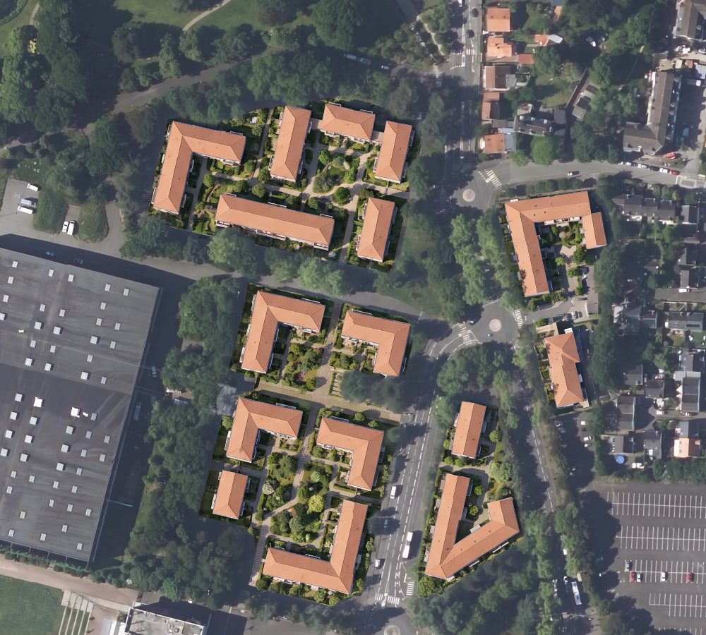
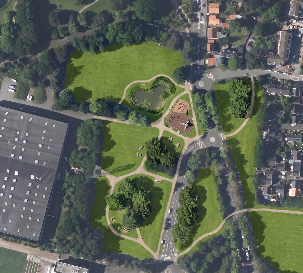
Two habits decide whether your own first result is usable. Name what must not move: "keep every building, road, roundabout and existing tree exactly where they are". And say the classes, not the mood: the site plan above came from "buildings as white footprints with a thin black outline, roads and parking as mid grey, vegetation as pale sage green".
How I checked this
One of these two I could test and the other I could not, so it is worth saying which is which before the cards below.
I ran AI Edit myself, over a 339 m by 339 m square in Nantes, on public aerial photography from IGN. Earth's button no longer exists, so everything I say about it comes from Google's launch post, rollback statement and plan pages, all read on 31 August 2026.
Questions people ask
Why did Google remove AI image generation from Google Earth?
Google rolled it back on 31 July 2026, one day after launch: "We've seen geospatial professionals using this feature for a range of useful purposes, however we've also seen people sharing screenshots of generated imagery that appear to violate our policies. So we're rolling back this feature in Google Earth while we work on implementing stronger guardrails."
Is it coming back?
Google called it a pause and has published no date.
Does the generated image line up with my map?
In QGIS, yes. AI Edit writes a GeoTIFF, an image file that carries its own coordinates, covering the exact rectangle you outlined. A plain picture has no coordinates.
Can I put a generated aerial image in a planning application?
Treat it as an illustration of intent, labelled as generated, never as a survey or a record of what exists. Our output is marked as AI-generated for that reason.
Sources
- Google, Transform any place with Nano Banana in Google Earth, 30 July 2026. The two Earth screenshots are frames from the demo video in that post.
- Google's rollback statement, 31 July 2026, quoted from the reproductions in NDTV Profit and unite.ai, the post itself being unreachable.
- Google, Learn about Google Earth plans, read 31 August 2026.
- Nantes figures generated in QGIS on 31 August 2026 over IGN BD ORTHO, Licence Ouverte. Flood and mark-up figures from the AI Edit guide.
The complete AI Edit guide covers the plugin end to end, and how to redesign a street in QGIS puts it to work on one job. The QGIS AI hub links every guide we have.