Greenfield vs Brownfield Sites: Meaning, Costs, How to Spot Them
Published Updated
A greenfield site is land that has never been developed: a field, a wood, a meadow at the edge of town. A brownfield site is land that was developed before and now sits vacant or underused, often with the slabs, sheds or contamination of its previous life still on it. The same two words also mean something else in software and in foreign investment, as the next section shows. The rest of this page is about land.
Three meanings of greenfield and brownfield
The metaphor is the same everywhere: a greenfield starts clean, a brownfield has a past to work around. What changes is the thing being built.
| Land and planning | Software projects | Foreign investment | |
|---|---|---|---|
| Greenfield | Land never built on | A new system, built with no legacy to carry | A company builds new facilities abroad |
| Brownfield | Land built on before, now vacant or underused | A change to a system that already runs, with its constraints | A company buys or leases existing facilities abroad |
| Who says it | Planners, councils, developers | Developers, ERP consultants | Economists, investors |
| Usual trade-off | Cheap to build on vs hard to get permitted | Clean design vs slower, costlier rollout | Control and design freedom vs faster market entry |
Engineers use the words for industrial plants too. A greenfield project goes on unused land with nothing to work around. A brownfield project expands, upgrades or repurposes an existing facility, which often means less capital spending and a shorter timeline than building new.
The difference in one line
Greenfield has no past to deal with. Brownfield has one, and the cost of building there is the cost of dealing with it.
| Greenfield | Brownfield | |
|---|---|---|
| Built on before | No | Yes, and the use has ended |
| What is there now | Crops, grass, trees | Empty buildings, slabs, sealed ground |
| Cost before building | Roads, pipes, a planning fight | Demolition, ground investigation, clean-up |
| What planning policy says | Protect it | Reuse it first |
How each looks from the air
Greenfield reads as texture with no straight lines inside it: the stripes of a ploughed field, the mottled top of a wood, a hedge as the only edge.
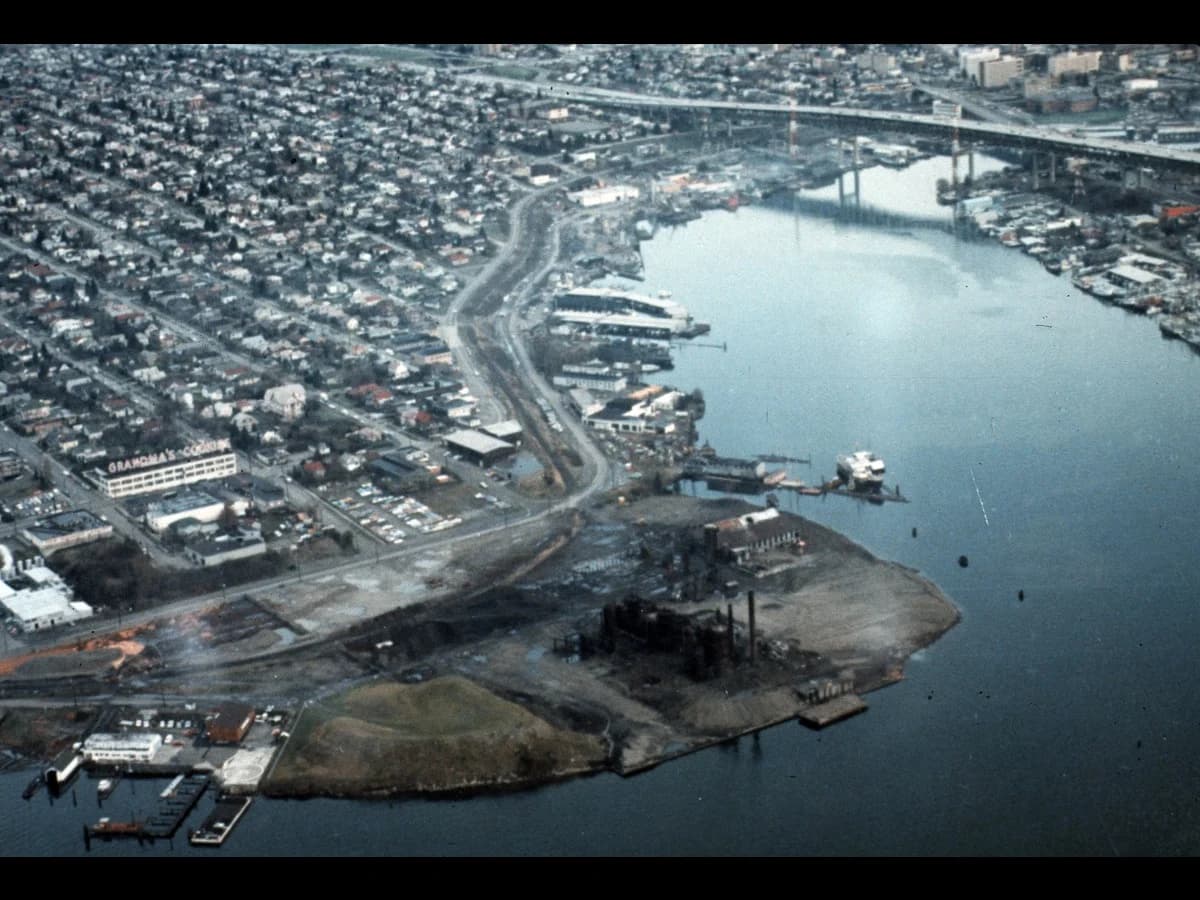
Brownfield reads as geometry that has lost its purpose: rectangular slabs with weeds in the joints, a roof with holes, rail sidings that stop at nothing, fences around nothing.
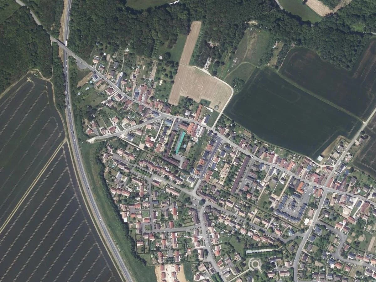
The one that catches people out is mown grass. A gasworks capped and grassed twenty years ago looks like a park from the air. It is still brownfield, and the register says so.
What counts, and what does not
Not every built-on site is brownfield. In England, planning guidance defines it as previously developed land, but land that is or was occupied by agricultural buildings, mineral workings or landfill, residential gardens, and parks or recreation grounds does not qualify. A site whose old structures have blended back into the landscape may no longer count either. Residential gardens, the "backland" plots inside towns, therefore fall on the greenfield side.
Greenfield is the looser word. The planning framework gives no official definition of it: it describes how a site looks, as land that appears never to have been developed. It is also not the same as Green Belt, which is a statutory designation that protects rural land from urban sprawl. A brownfield site can sit inside the Green Belt, and a greenfield one can sit outside it.
How to tell them apart in QGIS
- Look at the imagery. Your national orthophoto or a satellite basemap, at about 1:2,000. Apply the two cues above.
- Look at the past. A historical imagery slider (IGN's Remonter le temps in France, USGS EarthExplorer in the United States). A parcel that had buildings in 1990 and none today is brownfield, whatever the grass says.
- Check the register. Cartofriches in France, the council's Brownfield Land Register in England, the EPA's Cleanups in My Community map in the United States. If the parcel is listed, the question is settled.
What the registers hold: Rouen and Birmingham, counted
Around Rouen, the brownfield land France's national inventory confirms covers more ground than the metropolis built over on farmland, woods and natural land in the ten years to 2021: 784 ha on 222 sites, against 665 ha. We counted it on 23 September 2026 from Cartofriches (export of 15 June 2026) and Cerema's land-take figures for the 71 communes of the Métropole Rouen Normandie.
| Métropole Rouen Normandie, 71 communes | Sites | Hectares |
|---|---|---|
| Friches with no project | 110 | 228 |
| Friches with a project under way | 112 | 556 |
| Friches already reused | 92 | 218 |
| Greenfield built on, 2011 to 2021 | 665 | |
| Greenfield built on, 2021 to 2025 | 185 |
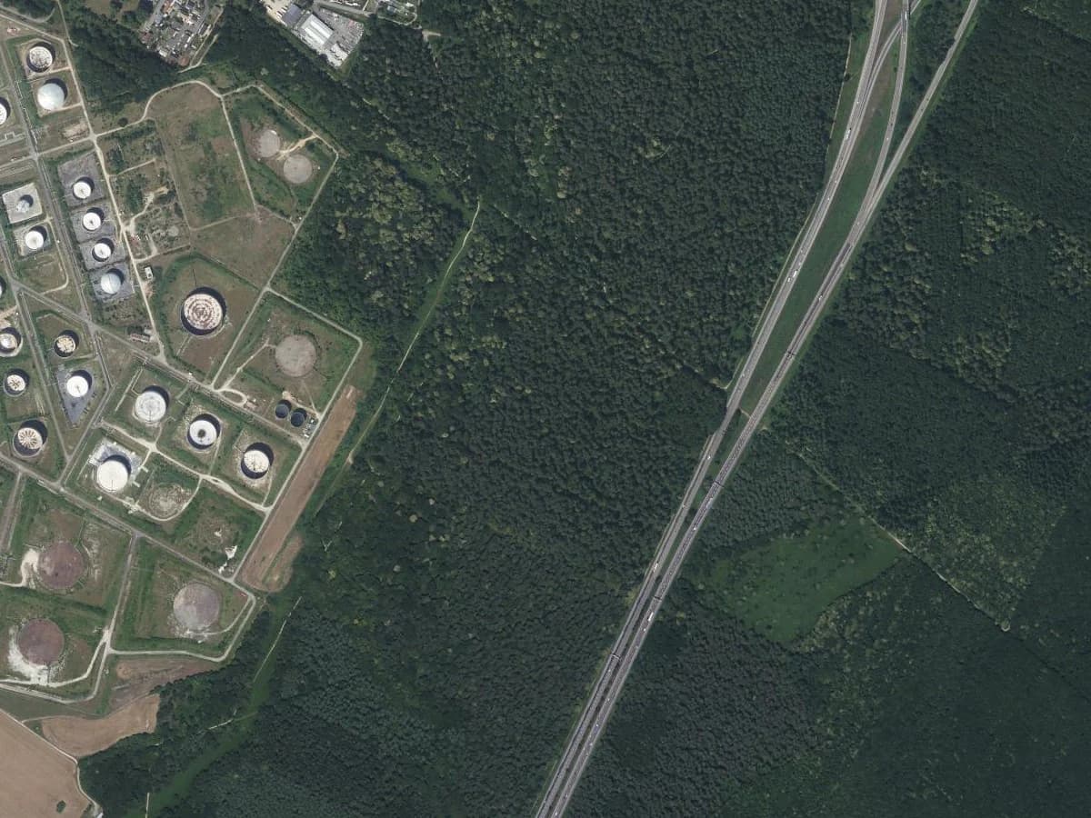
Only the no-project friches are land nobody has claimed yet. At 228 ha they equal about 3.4 years of greenfield take at the 2011 to 2021 pace, or 4.9 years at the slower pace since. The Petit-Couronne refinery in the aerial above is three entries: 59 ha already reused, then 103 ha and 19 ha with a logistics project.

An English register lists housing sites, not all brownfield
England's registers answer a narrower question: which previously developed sites the council thinks suit housing. Birmingham's, last updated on 5 December 2025, lists 703 current sites on 603 ha. Three sites in four (76%) already have planning permission, yet they cover only 40% of the area. The small plots are agreed; 9 of the 17 sites over 5 ha are not.
What you get when you load them in QGIS
Every one of Cartofriches' 36,241 sites comes with an outline, so you can measure it, intersect it with your parcels or clip imagery to it. England's national file on planning.data.gov.uk gives a point for 28,133 of its 29,941 entries with no end date, and an outline for none: the shape sits in a plan linked from each row, and the area is a number typed by the council.
Neither register settles contamination. Cartofriches records soil pollution as unknown on 31,315 sites (86%) and as confirmed on 516. The English registers have no pollution field at all: their "hazardous substances" column is about hazardous substances consent, and 183 entries fill it.
How we measured this
We kept the Cartofriches sites marked "friche sans projet" or "friche avec projet" and summed the area of their outlines, which do not overlap. The 124 "potential" friches stay out: they are unverified, and one is a 365 ha commune holding. Greenfield take is Cerema's consumption of natural, agricultural and forest land for every use, built from land tax files, so it is not measured the way a friche outline is. Birmingham's figures come from the council's own workbook. Licences, as the providers state them: Licence Ouverte 2.0 for both Cerema datasets, Open Government Licence v3.0 for planning.data.gov.uk. One metropolis and one city are two places, not a national rate.
Questions people ask
Is a brownfield site always contaminated?
No. In British usage brownfield means previously developed, and a clean former car park qualifies: the National Planning Policy Framework defines previously developed land as "land which has been lawfully developed and is or was occupied by a permanent structure", and its glossary entry for brownfield land reads "See Previously developed land". In American usage the word implies possible contamination: the US EPA defines a brownfield as "a property where expansion, redevelopment or reuse may be complicated by the presence or potential presence of a hazardous substance, pollutant or contaminant". The registers will not tell you either: Cartofriches marks soil pollution as unknown on 86% of its sites, and England's registers carry no pollution field. For a specific site, only a ground investigation answers.
What is a friche?
The French word for a brownfield site. Since 25 August 2021 the planning code defines it, in article L111-26, as any property "unused, and whose state, layout or occupation does not allow reuse without prior development or works" (our translation). The national inventory is Cartofriches, run by Cerema: on 15 June 2026 it listed 36,241 sites: 20,487 confirmed friches, 14,020 potential ones still to check, and 1,734 already reused.
What do greenfield and brownfield mean in software?
A greenfield project starts from nothing: a new product or system with no legacy code or data to carry. A brownfield project changes a system that is already running, with all its constraints. Same metaphor: one is a clean site, the other has a past to work around.
In SAP projects the words name the two routes from an older ERP to S/4HANA. Greenfield installs a new system with no legacy process obligations. Brownfield converts the existing system and brings its data, configuration and customisations along. Brownfield is usually faster and cheaper, at the risk of carrying old processes and technical debt over. Greenfield costs more and takes longer, but removes that debt.
What is bluefield?
An SAP term for a hybrid. SAP's own support pages call the approach Selective Data Transition and note that partners market it under names such as "Bluefield". You migrate only the data and processes you choose into a new S/4HANA system, instead of converting everything (brownfield) or starting empty (greenfield). It has nothing to do with land.
What is a greenfield investment?
A form of foreign direct investment where a company builds new facilities abroad from the ground up. A brownfield investment is the opposite: the company buys or leases facilities that already exist. Investopedia's example is BASF buying Engelhard for $5 billion in 2006, which gave it facilities, a workforce and a market presence in the United States at once. The usual choice is time against control: brownfield enters the market faster, greenfield gives full control of the design.
The QGIS AI hub collects what AI can and cannot do inside QGIS.