AI Agent for QGIS: The Complete Guide
Published Updated
AI Agent is a QGIS plugin that adds an AI chat panel to QGIS. You write what you need in plain words, and it does the work in your open project: it finds the data, runs the QGIS tools, styles the layers and checks the map before it answers.
 . You write what you need in plain words, and it does the work in your open project: it finds the data, runs the QGIS tools, styles the layers and checks the map before it answers.
 Watch Hans van der Kwast's video review
Install and sign in
Install the plugin
In QGIS, open Plugins > Manage and Install Plugins, search for AI Agent by TerraLab and click Install Plugin. It works on QGIS 3.28 and later, QGIS 4 included.
Open the panel
Click the AI Agent icon in the toolbar, or press Ctrl+Shift+K. The panel docks next to the map.
Sign in
Click Sign in / Sign up to start. Your browser opens, you create a free account, and the plugin connects by itself. No API key, no card.
Write your first message
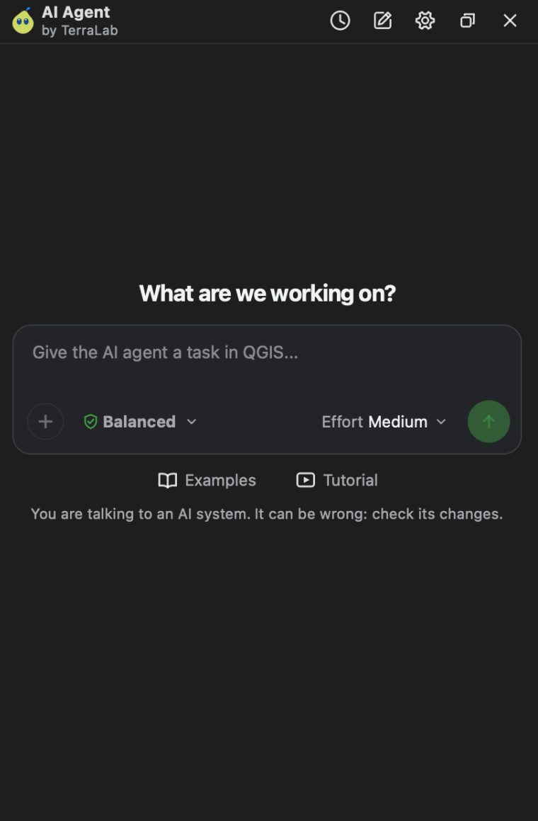
Type in the box and press Send. The agent shows its steps as it works, then answers with what it did. Under the answer you see the layers it added and the sources it used.
A good request names three things:
- The place: “central Lyon”, or “my selected parcels”.
- The result: a map, a PDF, a shapefile, a number.
- The look, if it matters: colours, basemap, opacity.
Follow-ups work in the same chat. “Make it lighter” or “add a legend” apply to what it just did.
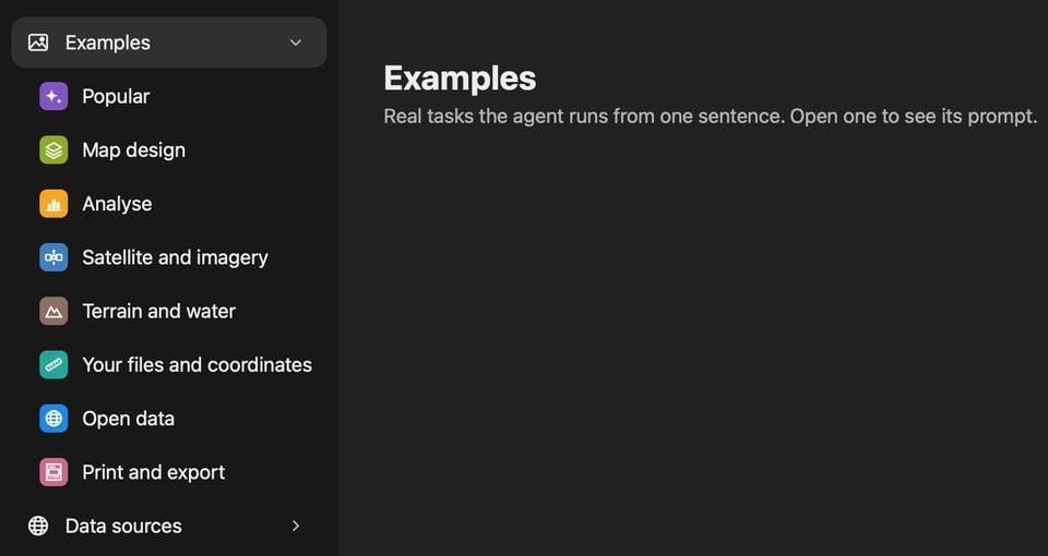
Not sure what to ask? Click Examples under the box. The library holds tested tasks in 8 groups, from Map design to Open data and Print and export. Open one, change the place, send it.
Stay in control
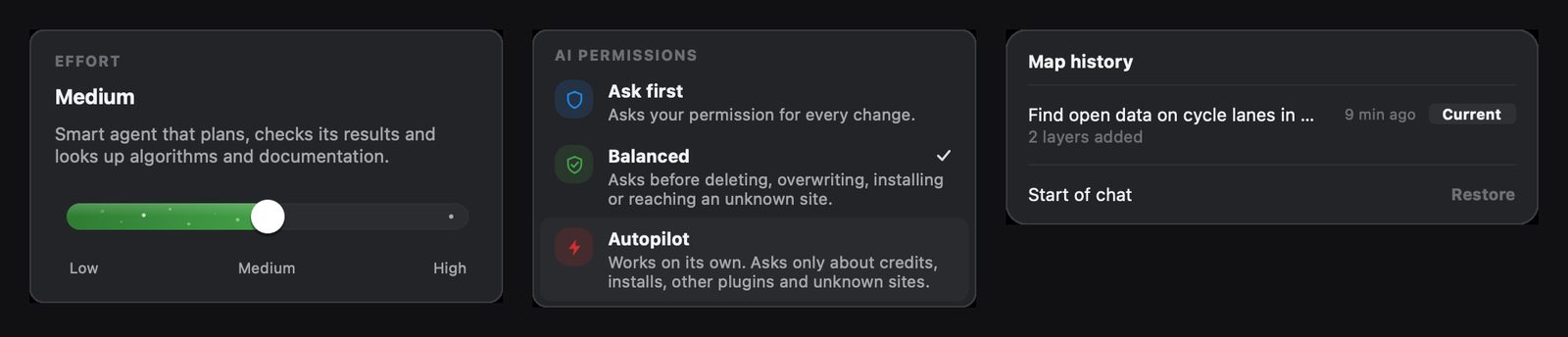
Effort sets how much it thinks. Low is fast and is on every plan. Medium plans and checks its results, and suits most tasks. High plans deeper for long analyses. Medium and High are on Pro.
Permissions set when it stops to ask. Ask first asks before every change. Balanced, the default, asks before deleting, overwriting, installing or reaching an unknown site. Autopilot works on its own and still asks about credits, installs and other plugins.
Undo: every answer has an Undo changes link. Map history (Ctrl+Shift+X) lists each request of the chat, and Restore takes the project back to that point.
5 real tasks
Each task is one message in an empty project, on Medium effort. Copy the prompt, change the place, try it.
1. Find open data and check the licence
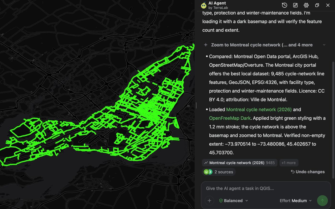
Find open data on cycle lanes in Montreal, Canada. Compare what the portals offer, tell me the licence, and load the best one in bright green over a dark basemap.
It compared the city's open data portal with other copies and with OpenStreetMap, picked the official dataset and loaded 9,485 cycle network lines under CC BY 4.0, credited to the Ville de Montréal. About 40 seconds.
2. Map a wildfire's burn severity from Sentinel-2
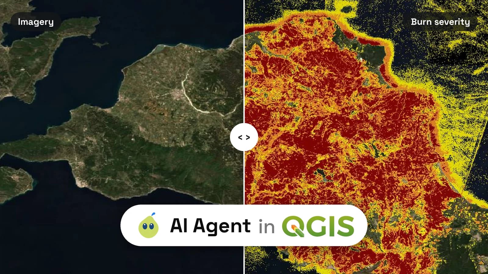
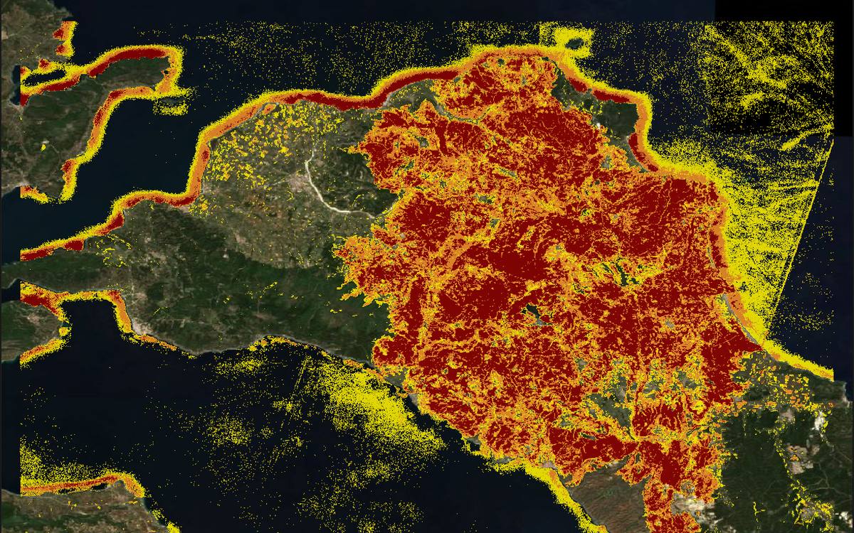
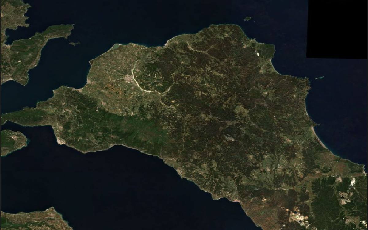
Map the burn severity of the August 2021 wildfire in northern Evia, Greece, from Sentinel-2 images before and after the fire. Show low, moderate and high severity in yellow, orange and dark red over a satellite basemap, and give the hectares per class.
It found the official Copernicus emergency footprint, compared Sentinel-2 images from July 2021 and from late August to September, and classed the burn index: 20,121 ha low, 22,890 ha moderate, 27,359 ha high. About 6 minutes. To pick scenes yourself, see how to download Sentinel-2 images in QGIS.
3. Georeference a scanned map
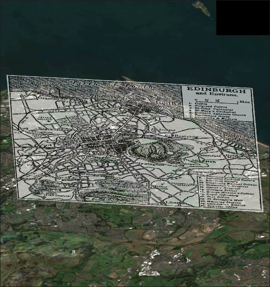
Georeference this old map automatically and lay it over a satellite basemap at 60% opacity. Tell me how accurate it is.
Drop the scan into the chat. With a 1911 map of Edinburgh, it matched six landmarks and placed the map with a 112 m error, and said the edges are less reliable. About 2 minutes. For the manual way, see how to georeference a map in QGIS.
4. Drive-time areas and who lives inside
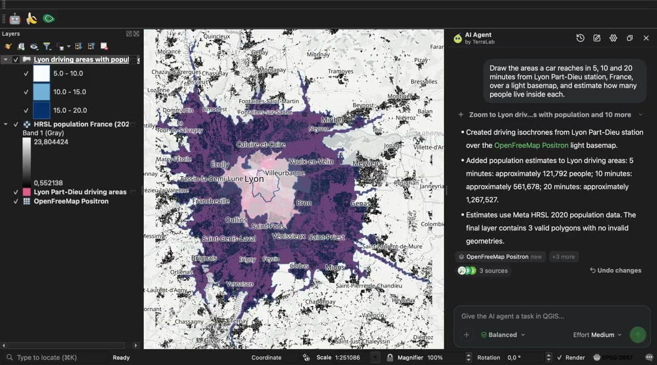
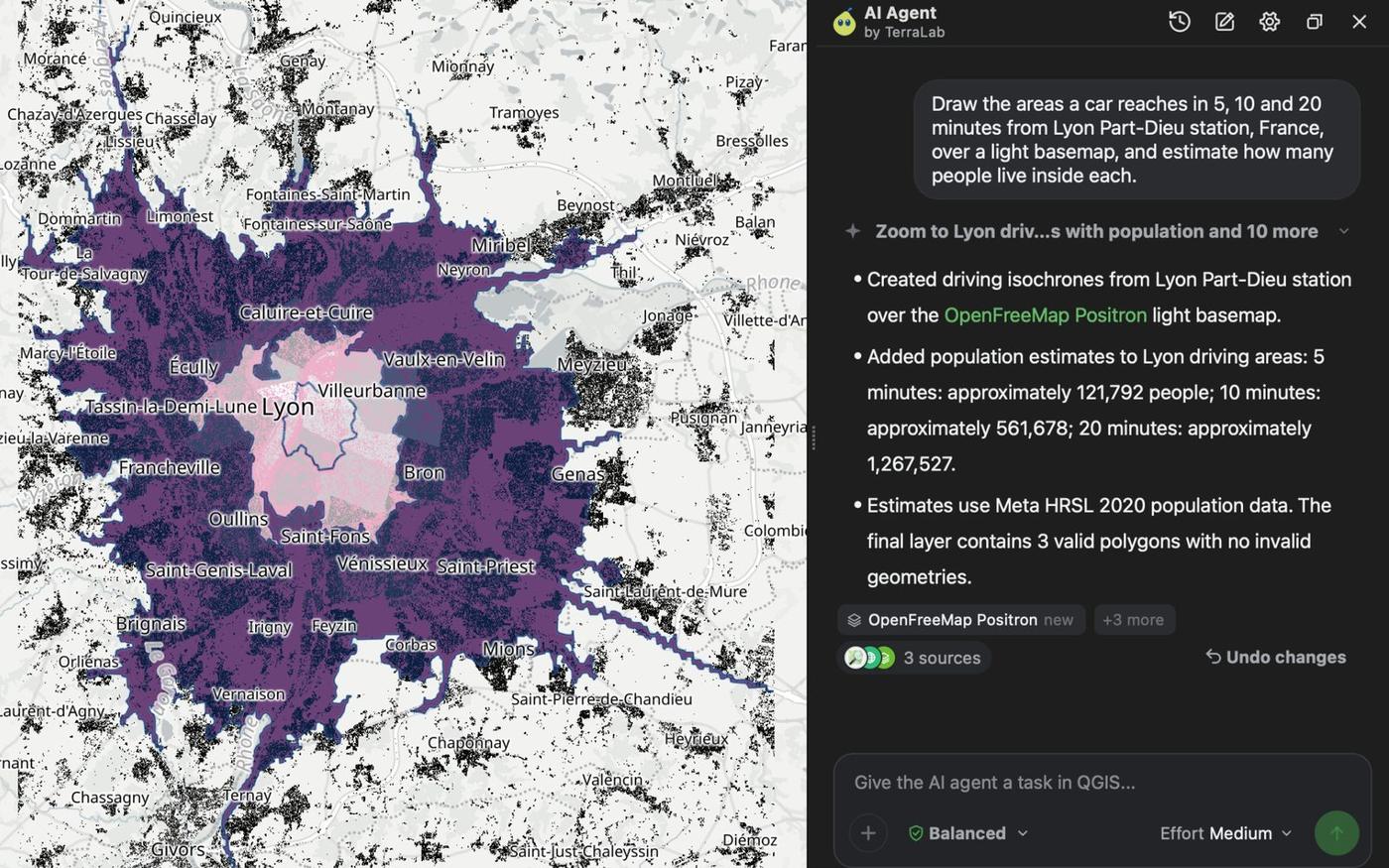
Draw the areas a car reaches in 5, 10 and 20 minutes from Lyon Part-Dieu station, France, over a light basemap, and estimate how many people live inside each.
It routed on OpenStreetMap roads and summed a 2020 population grid (CC BY 4.0) inside each area: about 121,792 people within 5 minutes, 561,678 within 10 and 1,267,527 within 20. About 90 seconds.
5. Write an HTML report
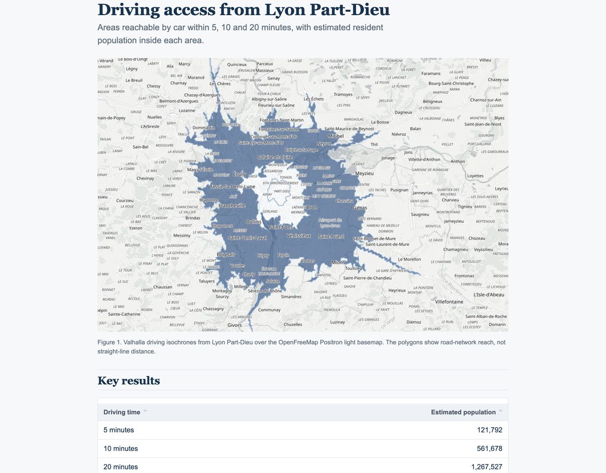
Write a short HTML report of this analysis, with a picture of the map, the key numbers and the data sources.
A follow-up to task 4, in the same chat. In about 30 seconds it wrote one HTML file with the map, a table of results, the method and every source with its licence. Show in QGIS buttons select the matching layer.
What else to know
The agent finds data in its built-in catalogue, then in open data portals, then on the web. It can also drive other plugins you have, like AI Segmentation. It can be wrong, so read the steps under each answer. On Google's GeoKTools and GeoExpertQueries benchmarks it scored 43.8 out of 100 on 41 held-out questions at Low effort, against 24.9 for Claude Sonnet 5.5 with the nkarasiak QGIS MCP server in Claude Code, the highest of the agents we tested (benchmark results). On a CSV of 6,041 bike crashes it built a heat map, a hexagon count and an A4 PDF in 2 min 34 s, and flagged 7 crashes its first grid had missed (heat map guide). It sends your message and a short description of the project, never your data files, and the service runs in the EU. For how agents differ from chatbots and copilots, and the 38 agent plugins we counted for QGIS, see what an AI agent in QGIS is. For other tools, see the best AI plugins for QGIS.
Pricing
| Free | Pro | |
|---|---|---|
| Price | 0 EUR | €49 / month |
| Tasks | 5 every month | 300 a month |
| Effort | Low | Low, Medium, High |
| Autopilot | No | Yes |
One task is one thing you ask for, however many steps it takes to finish. A year of Pro costs ten months, and you can try Pro free for 7 days: add a card, cancel before the end and nothing is charged. Teams can ask for an Organization plan. Prices exclude VAT. See all plans or the AI Agent page.
FAQ
Is there a free AI agent for QGIS?
Yes. AI Agent has a free plan with 5 free tasks every month on Low effort, data sources and web search included.
Can it georeference a scanned map?
Yes. Drop the scan into the chat and ask. It matches the scan to reference maps, loads it as a layer and gives the error in metres.
Can I use ChatGPT or Claude inside QGIS?
Not directly. A browser chatbot can write PyQGIS code for you to paste. AI Agent runs inside QGIS and does the steps itself, with undo.
Can it break my project?
On the default setting it asks before deleting or overwriting, and every answer can be undone. Save your project before a long session anyway.