What Is QGIS? The Free GIS, Explained for 2026
Published
QGIS is free, open-source software for making maps and working with geographic data. GIS means geographic information system: software that stores, shows and analyses data tied to places. QGIS runs on Windows, macOS and Linux, opens almost every map file format, and costs nothing, even for commercial work. The name comes from Quantum GIS, which it was called until 2013.
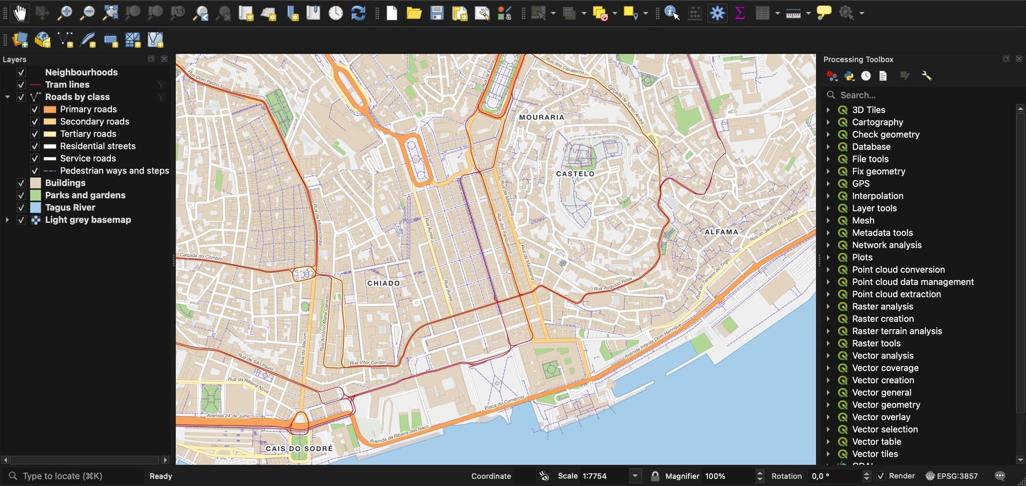
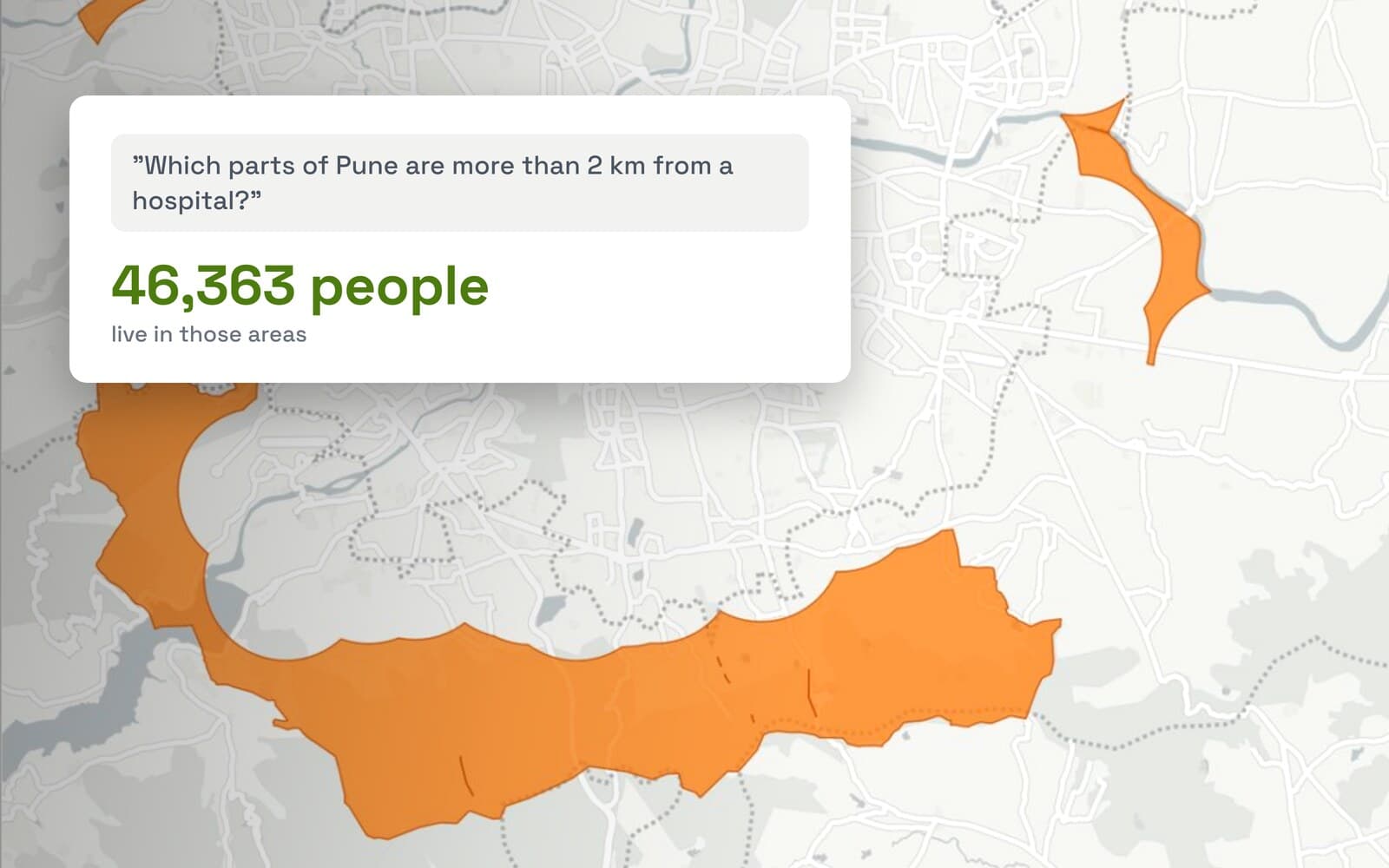
People use QGIS for the same jobs as ArcGIS: map a flood zone, measure land parcels, find every school more than 2 km from a clinic, or print a map for a planning file. Gary Sherman started it in 2002. Today it's run by a community of volunteers and paid developers, and funded by the organisations that use it.
 for the same jobs as ArcGIS: map a flood zone, measure land parcels, find every school more than 2 km from a clinic, or print a map for a planning file. Gary Sherman started it in 2002. Today it's run by a community of volunteers and paid developers, and funded by the organisations that use it.
I've built QGIS plugins full time for over a year, and I still find features I didn't know about. This page is the overview I'd give a colleague on day one. We also build AI Agent, a plugin that does QGIS tasks for you from a plain-language request, so I cover AI near the end.
What QGIS is used for
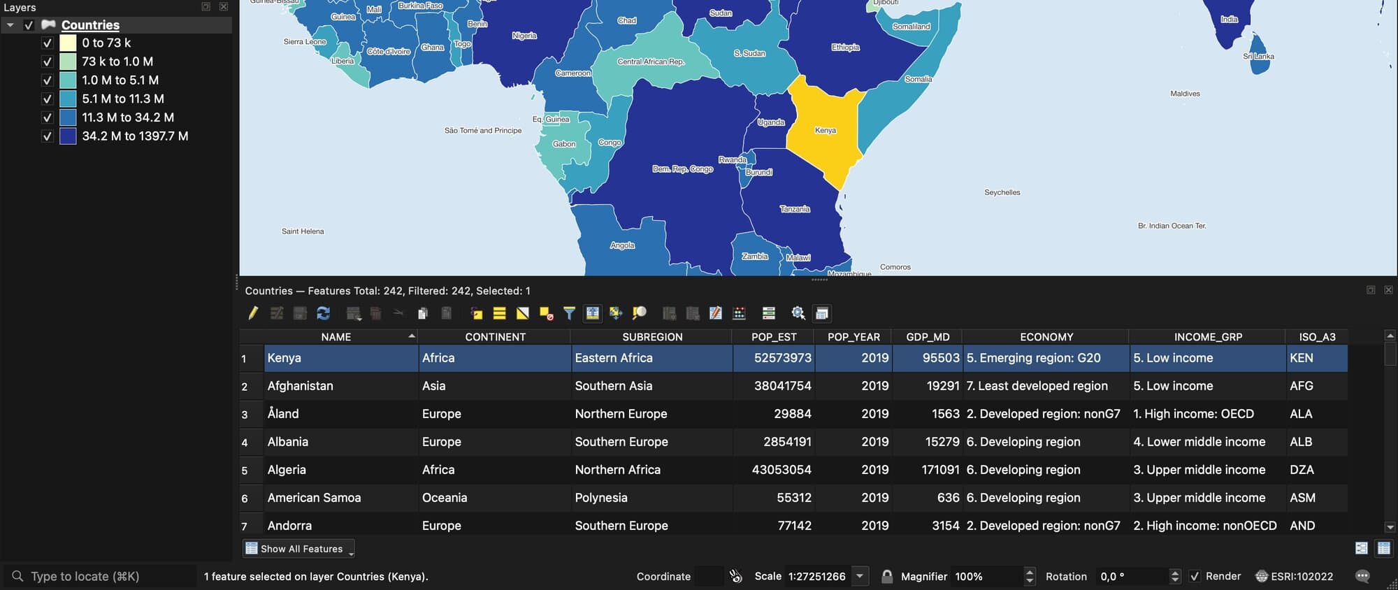
QGIS answers questions that depend on where things are. It covers the whole job, from loading data to printing the final map.
| Job | What you do in QGIS | Who does it |
|---|---|---|
| Make a map | Style layers, add labels, lay out a page with a legend and scale bar, export a PDF | Planners, consultants, NGOs, journalists |
| Edit data | Draw and fix points, lines and shapes on the map | Surveyors, land registry and utility teams |
| Analyse | Measure distances and areas, overlay layers, count what falls in each zone | Environmental and city analysts |
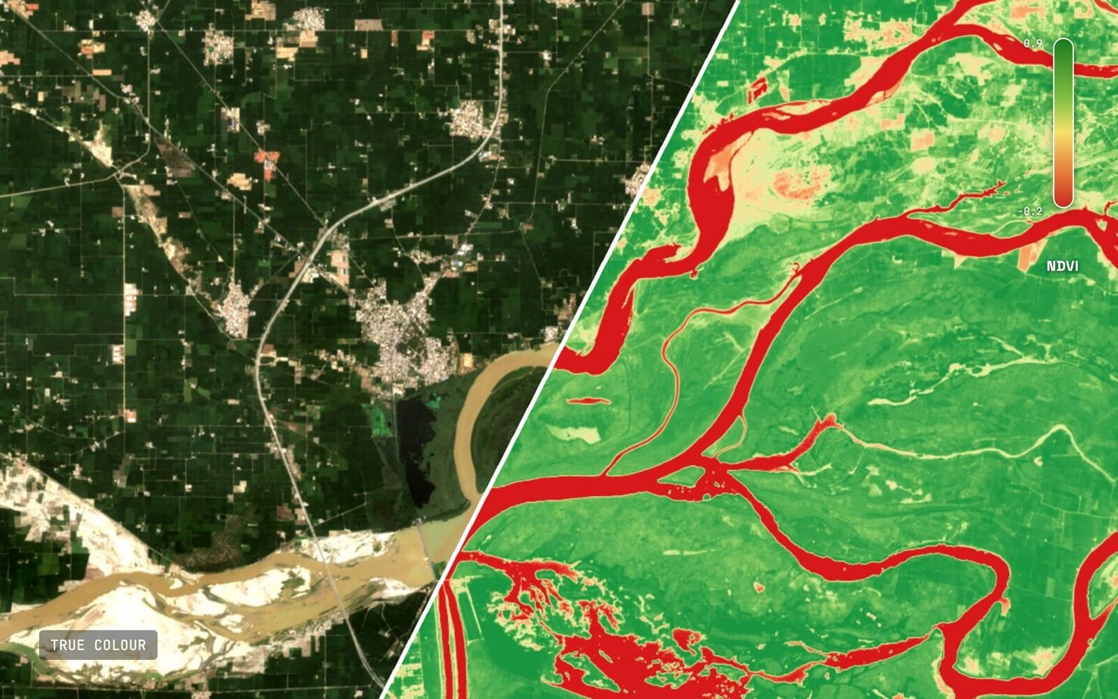
| Work with images | Load satellite, aerial and drone images, compute indices such as NDVI | Farming, forestry, remote sensing |
| Convert and clean | Change file formats and coordinate systems, fix broken shapes | Anyone who receives data from others |
| Publish | Put maps online, or send projects to phones for field work | GIS teams in cities and agencies |
All of this rests on two kinds of data. Vector data is shapes with information attached, like a country with its population. Raster data is a grid of pixels, like a satellite photo or an elevation map.
What's inside QGIS
QGIS is a family of tools rather than one program. They share free libraries that most of the GIS world also uses.
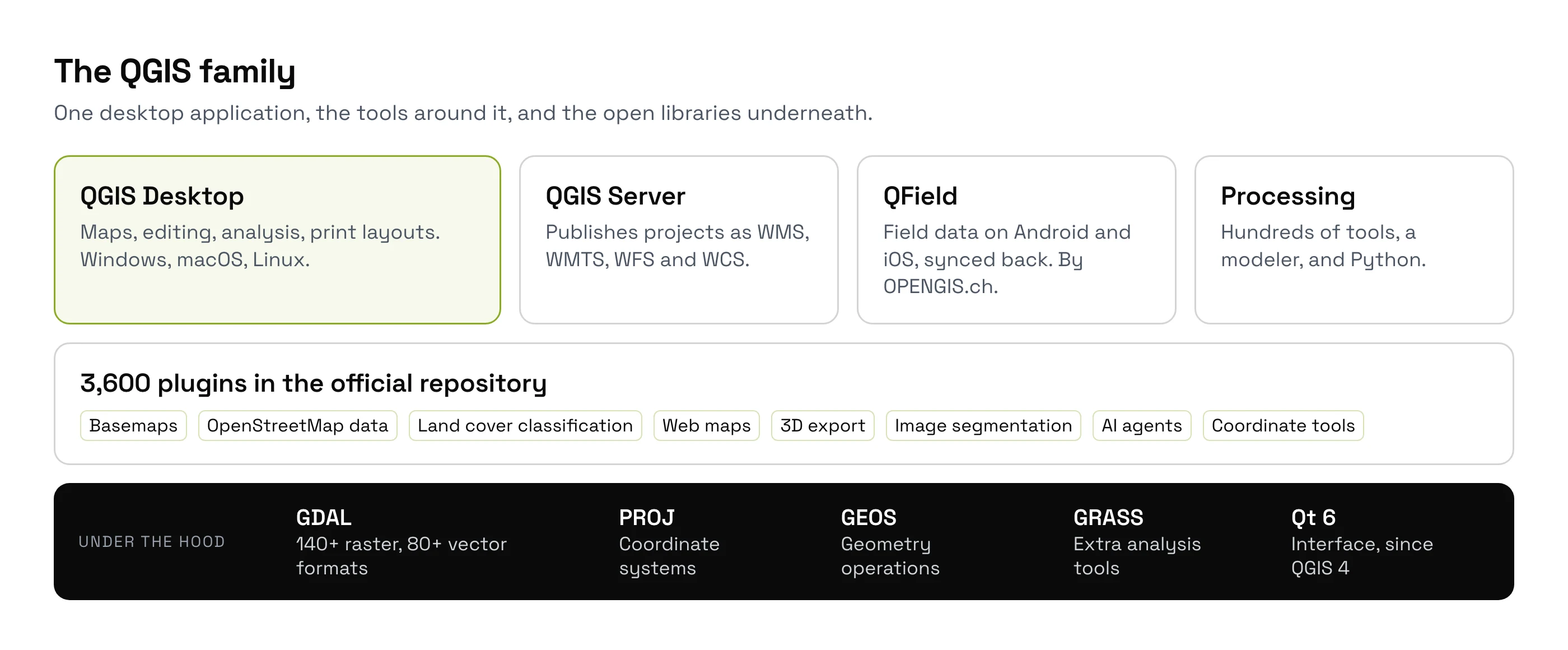
- QGIS Desktop is the app most people mean when they say QGIS.
- QGIS Server puts the same maps online as standard web map services.
- QField, made by OPENGIS.ch, takes QGIS projects to Android and iOS phones for field work.
- Processing is the toolbox. QGIS 4.0 ships with 462 analysis tools ready to use, and 307 more from GRASS, a companion GIS, when GRASS is installed.
- Under the hood, GDAL reads the file formats (over 140 image and 80 vector formats), PROJ handles coordinate systems and GEOS does the geometry. ArcGIS and Google Earth Engine use the same libraries.
How we measured this. On 26 September 2026 we counted the tools registered in QGIS 4.0.0 on macOS, provider by provider: 339 native, 59 GDAL, 39 QGIS, 24 PDAL (point clouds) and 1 3D, for 462. The GRASS provider lists 307 more, but the macOS package we tested didn't include GRASS itself, so those need a separate install. Tools added by third-party plugins are not counted.
Is QGIS really free?
Yes, for everyone and for any use. QGIS uses the GNU GPL licence, version 2 or later. You can install it on as many computers as you like, use it for paid client work, and change the code. The only rule: if you share a modified QGIS, you share your changes too.
The money comes from users. In 2025, QGIS.org had 128 sustaining members from 30 countries and €455,628 of income, according to its public financial report. It pays for bug fixes, packaging and servers. Your real costs are learning time, and a support contract if you want one: several companies sell them.
QGIS 4: what changed in 2026
QGIS 4.0, named Norrköping, came out on 6 March 2026. Most of the change is under the surface: QGIS moved to Qt6, a newer version of the toolkit that draws its windows. For users, it looks and works like QGIS 3, with over a hundred new features.
The catch is plugins. Each plugin's author has to update it and mark it ready for QGIS 4. On 26 September 2026, 1,377 of the 3,600 plugins in the official repository, 38%, were marked ready. Several of the ten most downloaded were not yet.
QGIS releases a new version every four months. Some versions become long-term releases (LTR), which get fixes for longer. On 26 September 2026, the download page offers QGIS 4.2.2 as the latest version and QGIS 3.44 as the long-term release. My advice: keep 3.44 for important work, install 4.2 next to it, and switch once your plugins are ready.
The plugin ecosystem, counted
Plugins are add-ons that give QGIS new features. Anyone can publish one in the official repository. You install them from inside QGIS, in Plugins > Manage and Install Plugins.
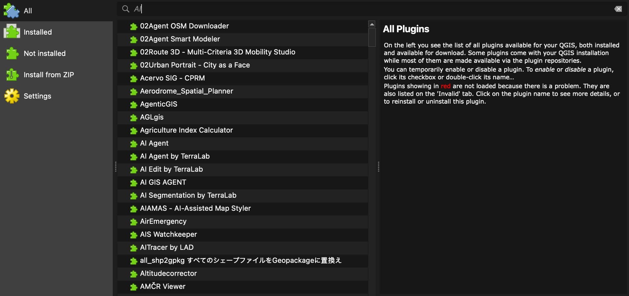
We counted the whole repository on 26 September 2026:
3,600
plugins in the official repository
99.6M
downloads, all plugins together
38%
marked ready for QGIS 4
174
mention AI or machine learning
The most downloaded plugins show what people add first: background maps, OpenStreetMap data and land cover tools.
| Rank | Plugin | Downloads | What it does |
|---|---|---|---|
| 1 | QuickMapServices | 12,540,473 | Adds background maps: OpenStreetMap, satellite and more |
| 2 | OpenLayers Plugin | 3,837,109 | The older background map plugin, now replaced |
| 3 | QuickOSM | 3,320,617 | Downloads OpenStreetMap data for an area |
| 4 | Semi-Automatic Classification | 2,663,097 | Maps land cover from satellite images |
| 5 | HCMGIS | 2,264,396 | Background maps, address search and conversion tools |
| 6 | Lat Lon Tools | 1,858,486 | Captures and converts coordinates |
| 7 | mmqgis | 1,738,598 | Address search, merging and animation tools |
| 8 | Profile tool | 1,727,535 | Draws the terrain profile along a line |
| 9 | qgis2web | 1,654,715 | Turns a project into a web map |
| 10 | Qgis2threejs | 1,499,281 | Shows a project in 3D in the browser |
How we counted. We downloaded the repository's plugin lists for QGIS 3.44 and QGIS 4.0 from plugins.qgis.org and kept one row per plugin, 3,600 in all. "Ready for QGIS 4" is the repository's own list for 4.0. Inside QGIS 4.0 itself, the Plugin Manager offered 1,372 plugins the same day, close to that list. The AI count is a keyword search over names, tags and descriptions, and it counts a few too many.
QGIS vs ArcGIS in one paragraph
ArcGIS Pro, from Esri, is the best-known paid GIS. It runs on Windows only and costs $700 to $4,200 per user per year in the US. QGIS is free, runs on every desktop system, and does most daily mapping and analysis just as well. ArcGIS is ahead on some specialist tools, large company setups and official support. The full QGIS vs ArcGIS comparison has a three-year cost table.
How to start with QGIS
Install QGIS
Download it from qgis.org: 3.44 for stability, 4.2 for the newest features. Both can be installed side by side.
Add a background map
In the Browser panel, open XYZ Tiles and double-click OpenStreetMap. For satellite images, see how to add a basemap in QGIS.
Load your data
Drag a file onto the map: a shapefile, a GeoPackage, a GeoJSON, a CSV with coordinates or a GeoTIFF. If it lands in the wrong place, the cause is almost always its coordinate reference system.
Style it and print it
Double-click a layer to change its colours. When the map looks right, Project > New Print Layout gives you a page with a legend, a scale bar and a title.
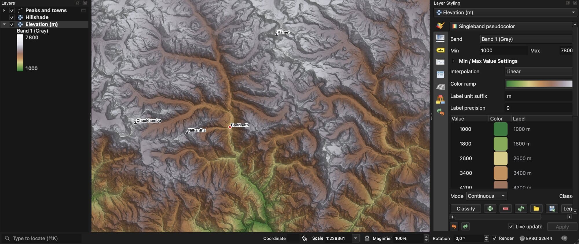
Raster layers get the same treatment. Here an elevation map of the Indian Himalaya gets a colour ramp from green valleys to white peaks, and a shaded relief on top so the mountains stand out.
AI in QGIS
Two kinds of AI now run inside QGIS. The first reads images: models that find buildings, roads or trees in a satellite or drone photo and draw them as shapes. The second does the work for you: you describe a task in plain words, and an agent runs the steps in your project. What is GeoAI covers the first. AI agents in QGIS covers the second.
Doing a QGIS task from one message
We build AI Agent, so this section is about our own plugin. It adds a chat panel to QGIS. You type what you need, such as "map the parks within 500 m of this river and give me their total area", and it finds the data, runs the QGIS tools, styles the result and tells you what it did.
It's made for people who know what they want on the map but don't want to click through ten dialogs to get there. It asks before deleting anything, lists every step it took, and one click undoes a whole message. Everything in this guide still works by hand, for free. The agent saves the clicks.
It installs from the Plugin Manager like any plugin, with a free plan and no card needed.
Try AI Agent free in QGIS, no card needed
What to remember
QGIS is free, open-source software for making maps and analysing geographic data. It costs nothing, even for commercial use.
QGIS 4.0 came out on 6 March 2026. The latest version is 4.2.2 and the long-term release is still 3.44. On 26 September 2026, 38% of the 3,600 plugins in the official repository were marked ready for QGIS 4.
It does the same daily work as ArcGIS Pro, on Windows, macOS and Linux, and it opens Esri files such as shapefiles and file geodatabases.
To go faster, an AI agent plugin such as AI Agent runs QGIS tasks from a plain-language request.
Questions people ask
What is QGIS used for?
Making maps and working with geographic data: drawing and editing shapes, measuring distances and areas, processing satellite and drone images, converting file formats, and publishing maps online or to phones. Planners, surveyors, environmental analysts, utilities and NGOs use it every day.
Is QGIS free for commercial use?
Yes. Its GPL licence lets you use QGIS for paid client work, in a company or a government agency, on as many computers as you like, at no cost. The only rule applies if you share a modified version of QGIS itself: you then share your changes under the same licence.
What does QGIS stand for?
It started as Quantum GIS. The project dropped the long name in 2013, and the software is now just called QGIS. GIS stands for geographic information system.
Is QGIS as good as ArcGIS?
For most daily mapping, editing and analysis, yes, and it runs on macOS and Linux, where ArcGIS Pro doesn't. ArcGIS is ahead on some specialist tools, large company setups and official support. Many teams use both. The full comparison goes point by point.
Is QGIS 4 out?
Yes. QGIS 4.0 came out on 6 March 2026, and the latest version is 4.2.2, from 28 August 2026. The long-term release is still QGIS 3.44. Plugins have to be updated for QGIS 4: 38% of the official repository was marked ready on 26 September 2026.
Is QGIS hard to learn?
The basics take an afternoon: add a background map, load a file, change its colours, print a page. Analysis takes longer, because each tool has its own settings. AI agent plugins shorten that part: with AI Agent, you describe the result in plain words and it runs the tools for you, showing each step so you learn along the way.
Can QGIS open Esri files?
Yes. QGIS opens and saves shapefiles and file geodatabases, and connects to ArcGIS online map services. Esri style files (.lyr, .lyrx) need a free conversion plugin.
Three pages go further from here. QGIS vs ArcGIS Pro compares price, features and AI, what a CRS is explains the most common reason a layer lands in the wrong place, and PyQGIS shows how to automate QGIS with Python. To run QGIS tasks from a plain-language request, try AI Agent. The QGIS AI hub and the best AI plugins for QGIS compare the wider field.